


- Brief description
-
Idyllic forest path to the Schartenmauer, to the Bertl Madonna and to the Haingrabeneck with a magnificent view
- Difficulty
-
medium
- Rating
-
- Starting point
-
Großraming/Church Square
- Route
-
Pfarrkirche Großraming0.0 kmLandgasthof Kirchenwirt0.1 kmGroßraming0.1 kmBertl Kapelle3.5 kmHubertuskapelle6.0 kmPfarrkirche Großraming8.1 kmLandgasthof Kirchenwirt8.1 kmGroßraming8.3 kmHaingrabeneck (841 m)11.1 km
- Best season
-
JanFebMarAprMayJunJulAugSepOctNovDec
- Description
-
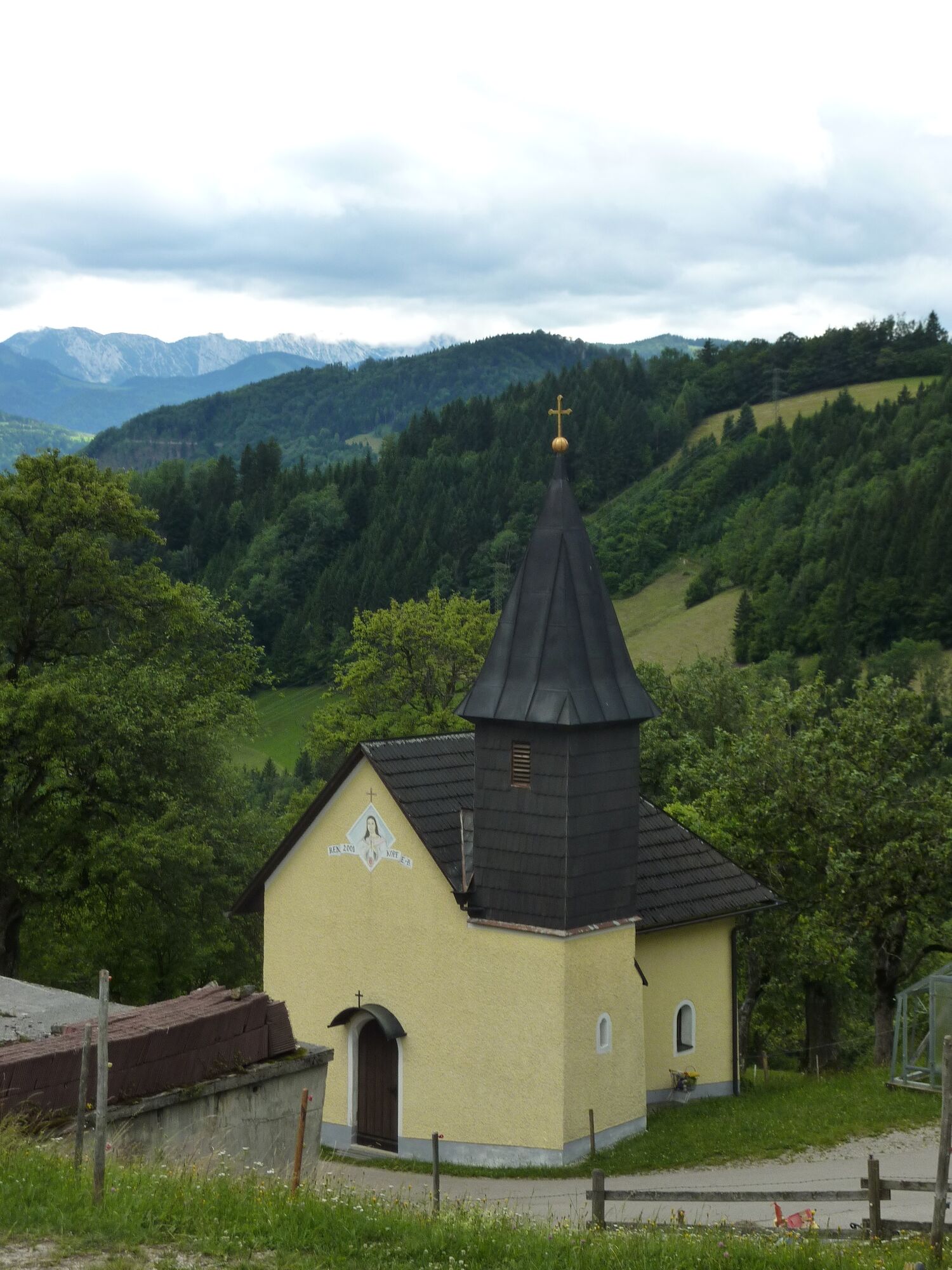
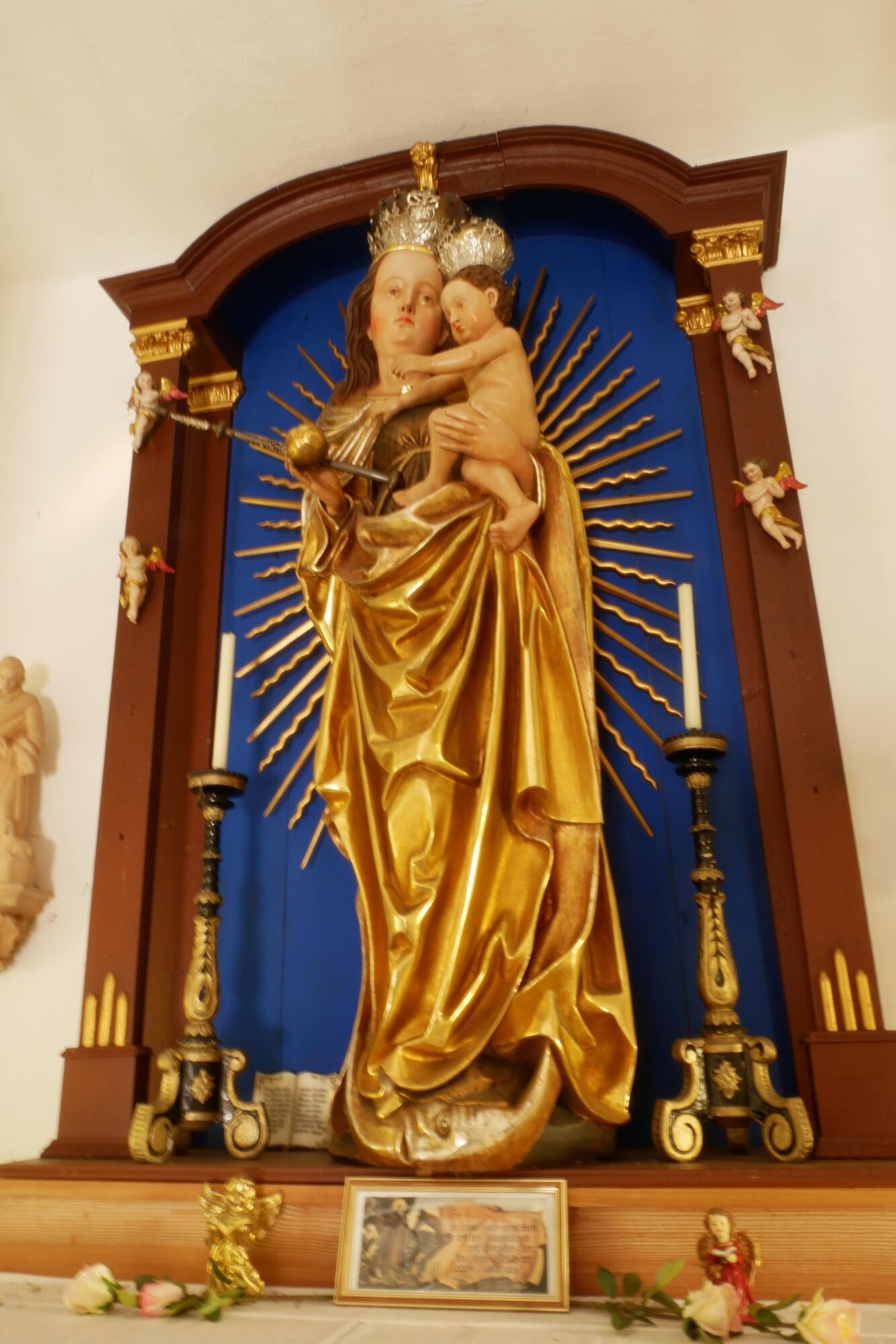
This hike directly from the center of Großraming leads a short distance on the asphalted road towards Fuchsberg farmhouse. At the bend, turn right to the Scharten wall, along carved Stations of the Cross to the Bertl Madonna from 1470 and continue to the Haingrabeneck (841 m).
The way back leads via the Hubertus Chapel and the Fuchsberg farmhouse.
Trail number: E42
- Directions
-
This trail leads us from the center of Großraming about 200 m eastward to the turnoff on the left in front of the former Salzwimmer inn. The idyllic forest hiking trail leads to the Schartenmauer, from where you can enjoy an extraordinary view of Großraming.
Continue on gravel road past the carved stations of a Way of the Cross, to Bertl-Gut. In the chapel you can admire the "Bertl-Madonna" from 1470 and follow her path of suffering.
Continue to the Haingrabeneck and from there via the Hubertus Chapel and the Fuchsberg farmhouse back to the starting point.
- Highest point
- 832 m
- Endpoint
-
Großraming/Church Square
- Height profile
-

- Tips
-
Climate-friendly to the National Park Region - railway station Großraming: By train you can reach the starting point for this hike in about 2 hours from Linz and in about 2.5 hours from Vienna.
- Directions
-
From Salzburg/Linz: A1 motorway exit Enns-Steyr > B115 into the Enns Valley
From Vienna: A1 motorway exit Haag > B42 > B122 > B115 into the Enns Valley
From Passau: A8 Passau > Wels > A1 motorway exit Enns-Steyr > B115 into the Enns Valley
From Graz: A9 Pyhrnautobahn > motorway exit Klaus > Grünburg > into the Ennstal Valley
- Public transportation
-
The Ennstalbahn runs between Linz and Weißenbach-St. Gallen.
Details at www.ooevv.at
Railway Stations are located in Steyr, Garsten, Lahrndorf, Dürnbach, Ternberg, Trattenbach, Losenstein, Reichraming, Großraming, Gaflenz, Weyer, Küpfern, Kastenreith, Kleinreifling and Weißenbach-St. Gallen.
- Parking
-
Großraming/parking in the center of the village
- Author
-
The tour Bertl Madonna is used by outdooractive.com provided.


General info
-
Traunviertel
1940
-
Steyr und die Nationalpark Region
1371
-
Großraming
334


