
- Brief description
-
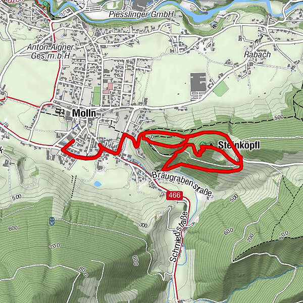
Family hike Steinköpfl with different possibilities for extended rounds
- Difficulty
-
easy
- Rating
-
- Starting point
-
Molln/center of the village
- Route
-
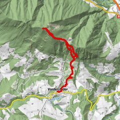
Wirt im Dorf0.0 kmSteinköpfl3.0 kmWirt im Dorf5.1 kmMolln (442 m)5.6 km
- Best season
-
JanFebMarAprMayJunJulAugSepOctNovDec
- Description
-
From the National Park Center, walk in the direction of Parkstraße, past the inn Wirt im Dorf (Museum in the Village), in the direction of Breitenau. The Denk Güterweg leads you over the Hochsteinergut to the Steinköpfl. Return on the same path or from the Hochsteinergut upwards and then continue on path no. 2 to the Denk vacation farm (Reitern). From there the trail leads you back to Molln.
- Directions
-
From the National Park Center, walk in the direction of Parkstraße, past the inn Wirt im Dorf (Museum in the Village), in the direction of Breitenau. The Denk Güterweg leads you over the Hochsteinergut to the Steinköpfl. Return on the same path or from the Hochsteinergut upwards and then continue on path no. 2 to the Denk vacation farm (Reitern). From there the trail leads you back to Molln.
- Highest point
- 599 m
- Endpoint
-
Molln/center of the village
- Height profile
-

- Tips
-
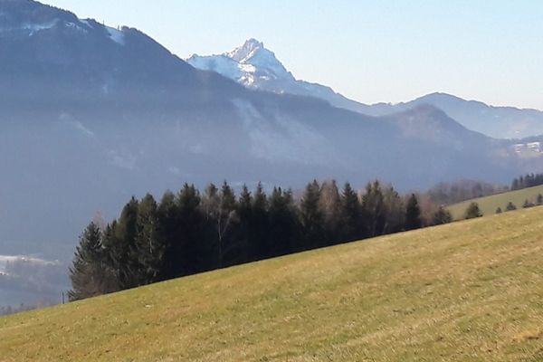
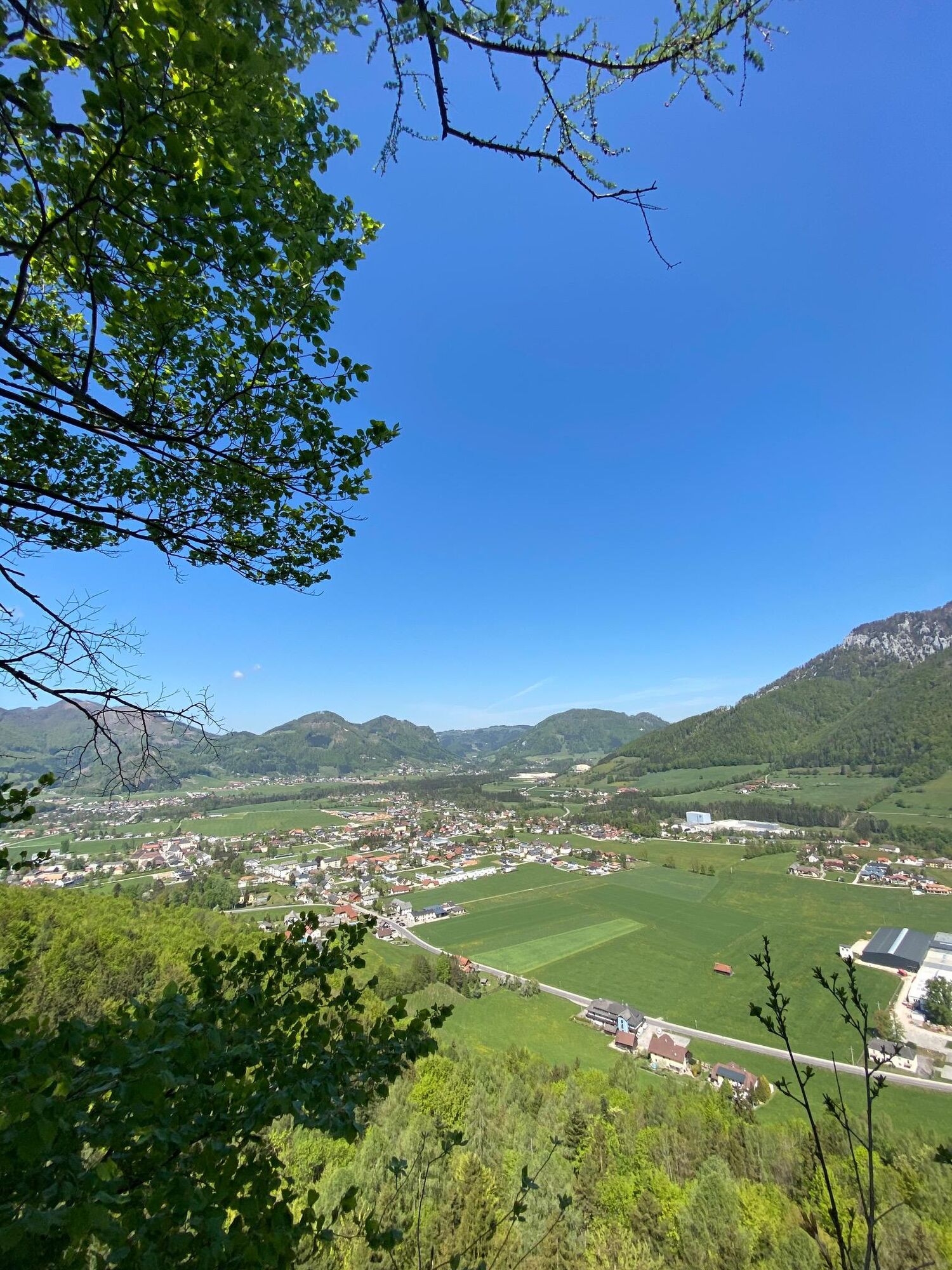
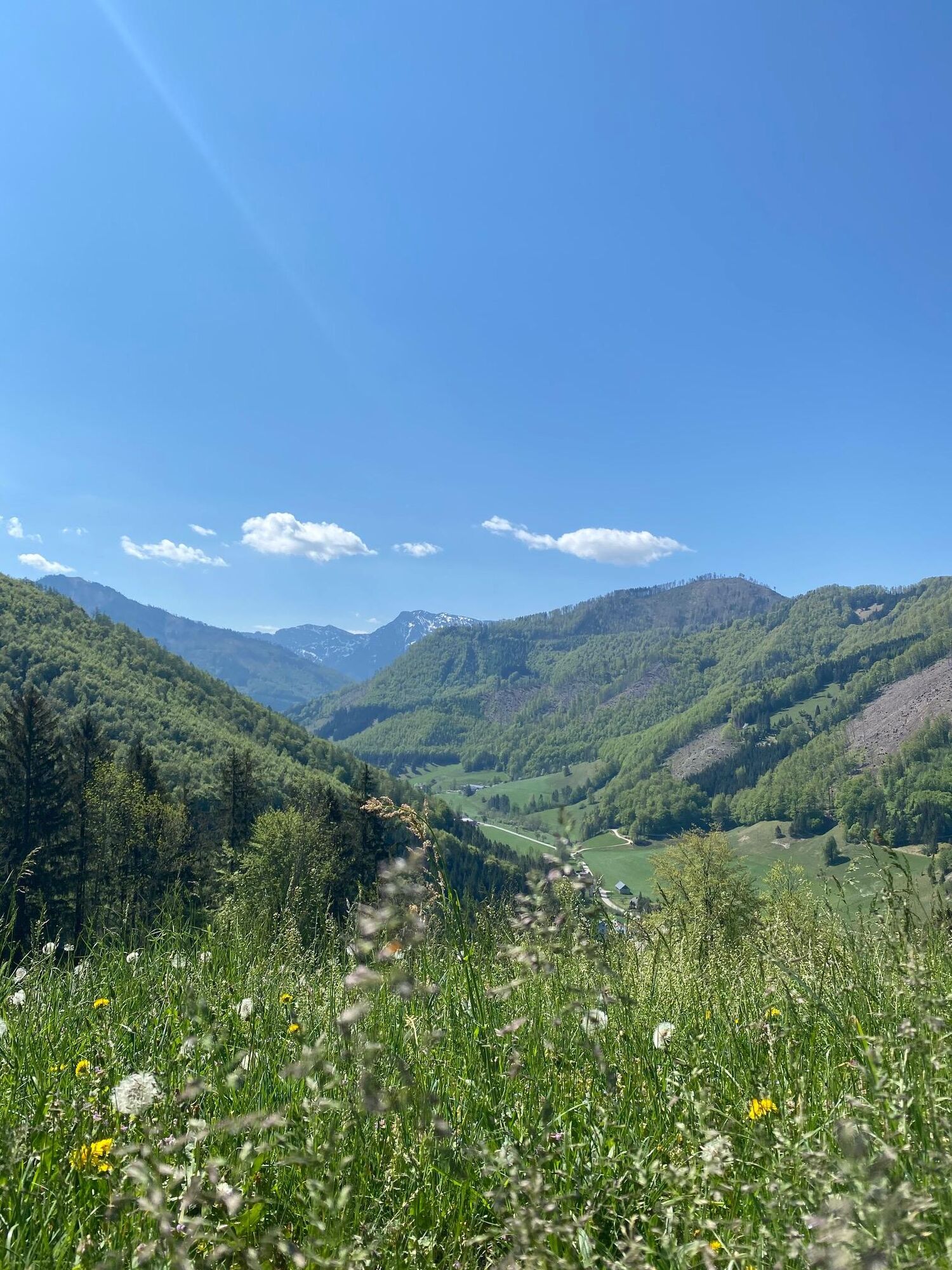
Legendary hike to one of the most beautiful lookout mountains in Molln.
Views of the Tote Gebirge mountains round off the experience.
As the story goes, it led many "men and women" to the famous Kiss-Mountain.
- Directions
-
From the west: A1 exit Sattledt > via Kremsmünster > Bad Hall > Steinbach an der Steyr
From the east: A1 exit Haag > Steyr > B140 into the Steyr valley
From the north: A3 Passau > Wels > A9 exit Sattledt > Kremsmünster > Bad Hall > Steinbach
From the south: A9 exit Klaus > into the Steyr valley
- Public transportation
- Author
-
The tour Steinköpfl is used by outdooractive.com provided.
Süß!


-
Traunviertel
1940
-
Steyr und die Nationalpark Region
1371
-
Molln
374