

© Gmd. Hinterstoder
Tour data
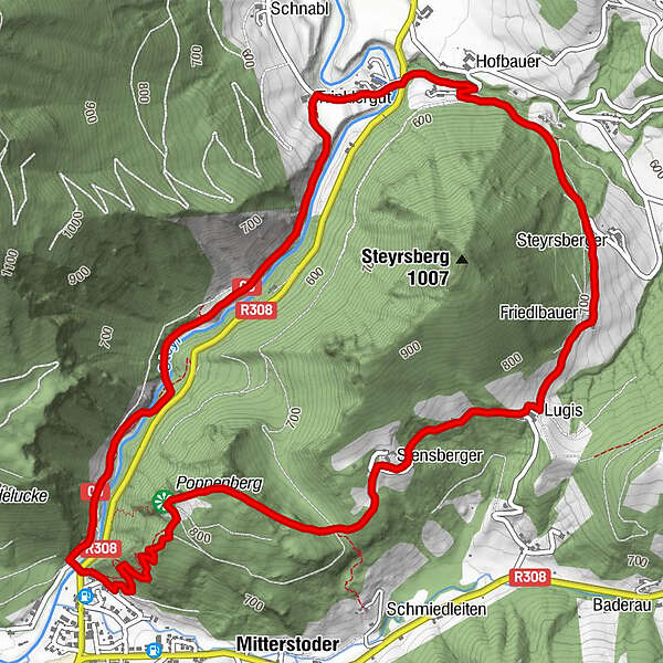
7.52km
538
- 834m
305hm
04:00h
- Rating
-
- Starting point
-
Dorfbrunnen Hinterstoder
- Route
-
Poppenberg (860 m)1.1 kmSchönau1.6 kmStromboding Wasserfall6.6 kmKreidelucke7.1 km
- Highest point
- 834 m
- Rest/Retreat
-
Mostschenke Flötzerstub´n, Jaidhaus, Sportbuffet, Pizzeria Mamamia, Café Annemarie, GH zur Post, Dorfstub´n, Café Gollner, Landgasthof Schmalzerhof
- Ticket material
-
Wanderkarte Pyhrn-Priel erhältlich in allen Pyhrn-Priel Tourismusbüros!

GPS Downloads


Other tours in the regions
-
Traunviertel
1940
-
Urlaubsregion Pyhrn - Priel
1440
-
Hinterstoder
395


