

© Viorel Munteanu

© Viorel Munteanu

- Brief description
-
The beautiful karst nature trail is located on the Dachstein Krippenstein in Obertraun.
- Difficulty
-
medium
- Rating
-
- Route
-
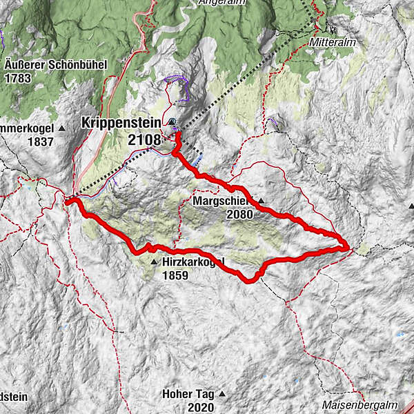
Bergrestaurant Dachstein KrippensteinLodge0.2 kmMargschierf (2,080 m)1.7 km
- Best season
-
JanFebMarAprMayJunJulAugSepOctNovDec
- Description
-
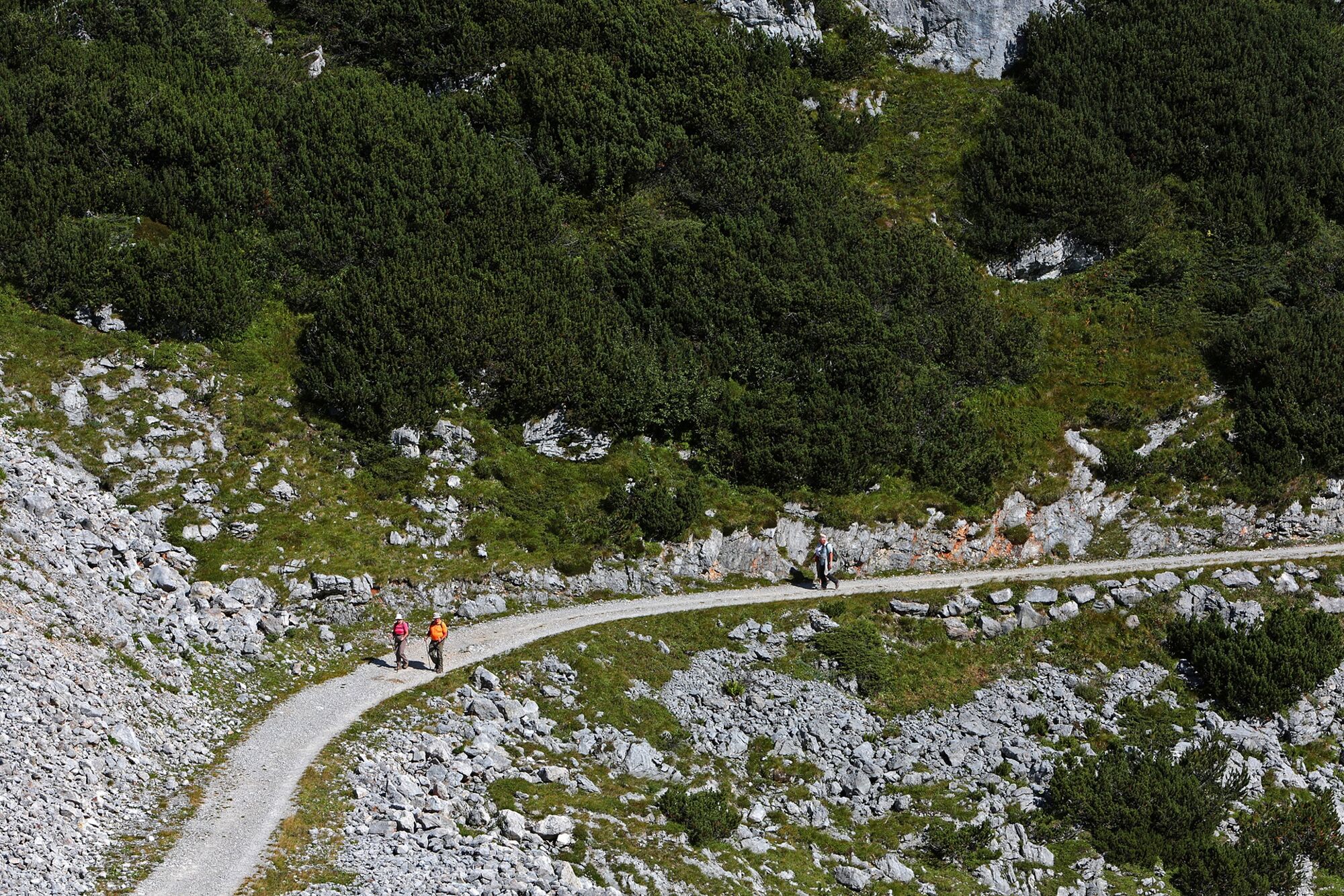
Karst nature trail leads through true "moon landscape"The paths over the Margschierf Ridge and to the Hirzkar Lakes are narrow and lead over rugged rocks - in any case, only walk in safe weather!
To the east of the High Dachstein, the 280 km² large, rugged and impassable karst plateau "Auf dem Stein" expands. Right in the middle of this area is the Heilbronner Cross, which reminds you of the Dachstein tragedy in 1954: Ten students and three teachers from Heilbronn in Württemberg died here in a snowstorm. Today a broadly laid out nature teaching trail on the subject of "Karst" leads over from the Dachstein Krippenstein - between rocks with strange fossils, razor-sharp carts and mysterious "Karst tables" where the dissolution of the limestone by rainwater is particularly evident.
The hiking tour in detail
From Obertraun you conquer approx. 1 600 metres in altitude with the Dachstein Krippenstein cable car. At the mountain station you should first visit the pioneer cross under the Krippenstein summit - the view of Lake Hallstatt is breathtaking 1 500 metres deep!
Walk back to the Lodge at the Krippenstein and down over the ski slope to the lift station. From there the karst nature trail leads to the Krippenstein ice cellar (cave) and to the place where it turns left, while two paths branch off to the right.
Choose the straight path No. 661, which climbs over the rocky Margschierf ridge (view of the Dachstein). The descent leads to the Heilbronner Cross, visible from far away. Shortly before you reach the wide karst nature trail again, which you now follow to the right. It leads past a hut and then steeply down into a hollow - past the entrance of path No. 666 at Loskoppen.
The path continues downhill between mountain pines and rocks. After the turnoff of the path to the three little Hirzkar lakes (a worthwhile detour) there is a short ascent, then hike down in serpentines to the ruined mountain pasture Hirzkaralm. Below the walls of the lower Gjaidstein, the path leads to the cable car station Gjaid (the short detour to the Schilcherhaus on the Gjaid Alm is worthwhile).
Shorter variant: From Margschierf back into the hollow at the Krippenstein ice cellar, there turn left on trail No. 662 to the Hirzkar lakes and down to the Karst nature trail.
Order hiking maps of the Dachstein Salzkammergut Region ...
Experience a 360° panorama tour of the Dachstein Krippenstein…
Mountain rescue: 140 - Highest point
- 2,061 m
- Height profile
-

- Additional information
- Directions
-
by car
from Salzburg:
Federal road B158 direction Bad Ischl
in Bad Ischl driveway onto Salzkammergut Straße B145 in direction to Bad Goisern, Hallstatt and Obertraun, in Obertraun turn right direction Dachstein Krippenstein cable car
from Linz:
A1 motorway exit Regau on Salzkammergut Straße B145 direction Gmunden, Bad Goisern, Hallstatt and Obertraun, in Obertraun turn right direction Dachstein Krippenstein cable car
from Graz:
A9 motorway exit Liezen on B320
in Trautenfels turn onto Salzkammergut Straße B145 via Bad Aussee to Obertraun, in Obertraun turn left direction Dachstein Krippenstein cable car
from Villach:
A10 Tauernautobahn to exit "Eben im Pongau", from there via Annaberg, Gosau and Hallstatt to Obertraun, in Obertraun turn right direction Dachstein Krippenstein cable car
by bus:
get off at the bus station “Obertraun Dachsteinseilbahn”
by train:
from Linz/Salzburg to Attnang-Puchheim, change to train to Stainach-Irdning
or from Stainach-Irdning Zug direction Attnang-Puchheim
get off at train station "Obertraun-Dachsteinhöhlen", from there about 45 minutes to walk or change to the bus
Detailed information on the respective train and bus times can be found at https://www.oebb.at/en/ (train) and https://www.postbus.at/en (bus).

- Author
-
The tour Margschierf is used by outdooractive.com provided.
GPS Downloads


General info
Refreshment stop
Other tours in the regions


