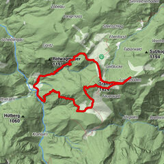
Tour data
6.48km
698
- 902m
225hm
224hm
02:30h
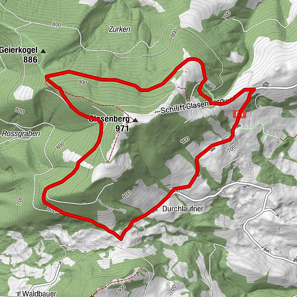
- Difficulty
-
easy
- Rating
-
- Starting point
-
Parkplatz Schilift Glasenberg
- Route
-
Glasnerhütte0.1 km
- Best season
-
JanFebMarAprMayJunJulAugSepOctNovDec
- Highest point
- 902 m
- Endpoint
-
Parkplatz Schilift Glasenberg
- Rest/Retreat
-
Glasner Hütte
- Ticket material
-
Gemeinde
GPS Downloads


Trail conditions
Asphalt
Gravel
Meadow
Forest
Rock
Exposed
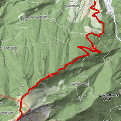
Other tours in the regions
-
Traunviertel
1940
-
Moststraße
754
-
Maria Neustift
333