


- Brief description
-
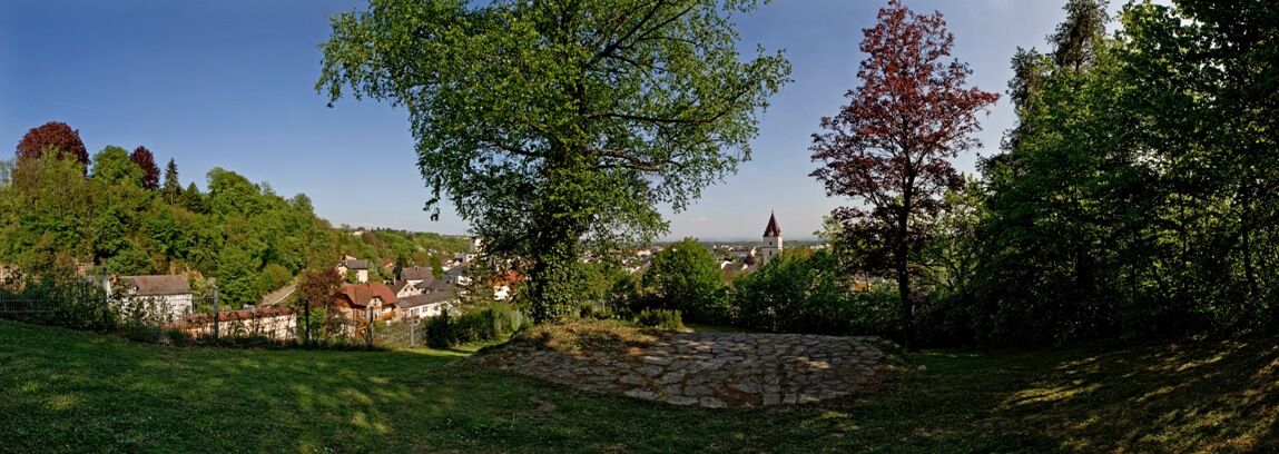
Neuhof – Neuhofer Bridge – Hauswiesbrücke Bridge - Perg - Lanzenberg - Aisthofen - Altenhof - Au - Naarn
- Difficulty
-
medium
- Rating
-
- Route
-
Gasthof Lettner zur Post0.2 kmPfarrkirche Naarn0.2 kmNaarn im Machlande0.2 kmFlorian0.3 kmPratztrum1.7 kmBaumgarten4.8 kmNeuhof5.7 kmGasthaus Redl Wirt z´Neuhof5.8 kmKickenau10.7 kmPerg13.1 kmStadtpfarrkirche Perg13.2 kmKalvarienbergkirche13.7 kmZeitling14.7 kmLanzenberg15.2 kmWeinzierl16.7 kmAisthofen18.1 kmHart20.6 kmAu an der Donau24.5 kmPfarrkirche Naarn27.6 kmNaarn im Machlande27.8 km
- Best season
-
JanFebMarAprMayJunJulAugSepOctNovDec
- Description
-
From the starting place in Naarn we cross the village and follow Perger Straße road. We cross the road, turn into Pratztrumer Straße road and keep the direction. We continue on the road past several farm houses and take a right turn at the next T-crossing. We follow this road and at a farm house we keep to the right and hike southwards. Near Baumgarten we keep to the left and walk to Neuhof and then to Neuhofer Bridge. We cross the bridge and follow Donausteig Trail against the signposting direction to Perg. We take a left turn at the cemetary (Kerngraben) and hike out of Perg to Weinzierl. There we follow again Donausteig Trail against the signposting direction and take a left turn in Heuhart to get back to Naarn.
- Highest point
- 331 m
- Endpoint
-
Infopoint im Zentrum
- Height profile
-

- Additional information
- Arrival
-
By car: A1 autobahn to “Enns-Steyr” exit or “St. Valentin” to Mauthausen respectively (Danube bridge) – federal road no. 3 to Perg – Naarn junction.
By train: The next train station is in Perg, 4km from Naarn.
By boat: Au/Danube landing stage
- Public transportation
- Parking
-
At Marktplatz square, at the guesthouses, public car park of the municipality of Naarn i. M.


- Author
-
The tour Naarn: Fuchtelmanderlweg Trail is used by outdooractive.com provided.


General info
-
Mühlviertel
1784
-
Moststraße
754
-
Naarn im Machlande
129