
- Brief description
-
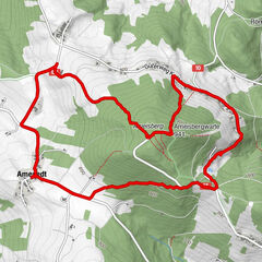
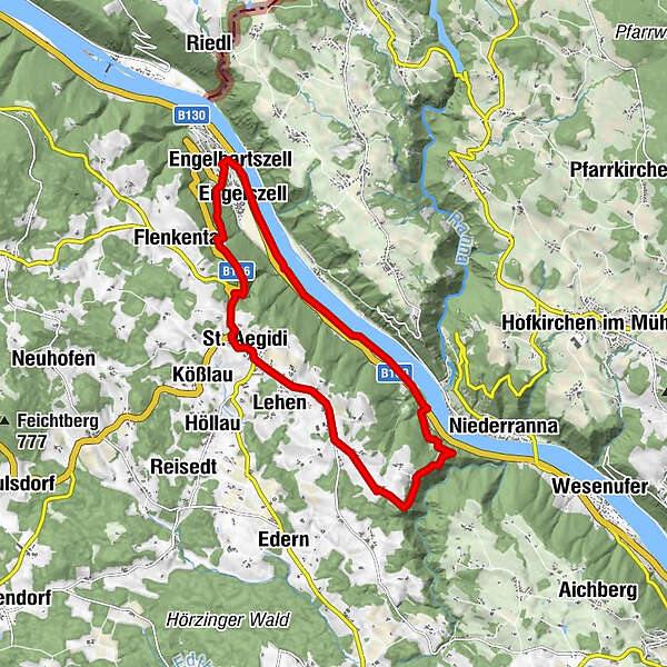
From the town hall walk along Nibelungenstraße Road to the Blacksmith Museum, about 4 km along the Danube to the soon-to-be UNESCO World Cultural Heritage "Römerburgus Oberranna" unhill past the "Lady Chapel" to St. Pankrazkapelle Chapel, Stop at "Sauwald Erdäpfeln" and "Burgstall-Blick" on Sauwaldpanoramastraße, via St. Aegidi back to Engelhartszell.
- Difficulty
-
medium
- Rating
-
- Starting point
-
town hall Engelhartszell
- Route
-
Pfarrkirche Maria Himmelfahrt0.0 kmEngelhartszell0.1 kmGasthof zum Goldenen Schiff0.4 kmSchiffsanlegestelle0.4 kmEngelszell0.5 kmSaag1.4 kmRonthal2.8 kmOberranna4.8 kmMittelbach7.6 kmTullern8.5 kmSchauern9.1 kmLehen9.7 kmKapelle9.8 kmOberleiten9.8 kmAu10.2 kmKirchenwirt10.2 kmPfarrkirche St. Aegidi10.3 kmSt. Aegidi (599 m)10.7 kmKellerwirt11.1 kmEngelszell14.0 kmPfarrkirche Maria Himmelfahrt14.4 kmEngelhartszell14.5 km
- Best season
-
JanFebMarAprMayJunJulAugSepOctNovDec
- Description
-
Past the town hall walk along Nibelungenstraße Road to the 400-year-old, heritage-protected, blacksmith museum. After the road-crossing at the "Golden ship" and the "Art by the Danube-path sculptures" continue along the Danube for 4 km to the 1700-year-old excavations in "Römerburgus Oberranna", the best preserved and antique building in Upper Austria. After your visit, cross the road and the hiking trail leads past the Lady Chapel "Magna Mater Austriae" on the left uphill to the plateau, where a meadow path turns off to St. Pankrazkapelle Chapel. A blue and yellow marking leads to the right in direction of Schauern to the "Sauwald potatoes" on the left and further on to the "Castle view" of the Sauwald scenic road. Continue to St. Aegidi and along the road in direction of Engelhartszell. Just after the bridge across the rushing stream, the hiking trail turns off through the forest, past the Gothic-style market church back to the town hall.
- Highest point
- 596 m
- Endpoint
-
town hall Engelhartszell
- Height profile
-

- Equipment
-
Hiking backpack (incl. rain cover), sturdy shoes
- Tips
-
The "Römerburgus Oberanna"-likely called "Stanacum" by the Romans - as an excavation site by the Roman Donaulimes will soon be designated a UNESCO World Cultural Heritage. The St. Pankraz Chapel allegedly houses a spring, which was once said to have healing powers.
- Additional information
- Directions
-
on B 130 Nibelungenstraße coming from Linz and Passau,
from Schärding on the B 136 Sauwaldstraße
- Public transportation
- Parking
-
parking possibility available
- Author
-
The tour World Cultural Heritage-Walking Tour is used by outdooractive.com provided.


General info
-
Innviertel
797
-
Ferienregion Böhmerwald
480
-
St. Aegidi
164