
- Brief description
-
Nature Active Trail on the banks of the Enns
- Difficulty
-
easy
- Rating
-
- Starting point
-
Ternberg railway station
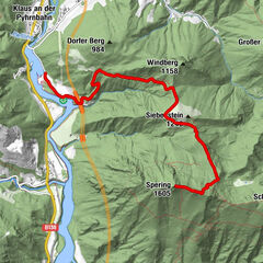
- Route
-
TernbergFaller Wasserfall2.9 kmWirtshaus zur Gerti4.5 km
- Best season
-
JanFebMarAprMayJunJulAugSepOctNovDec
- Description
-
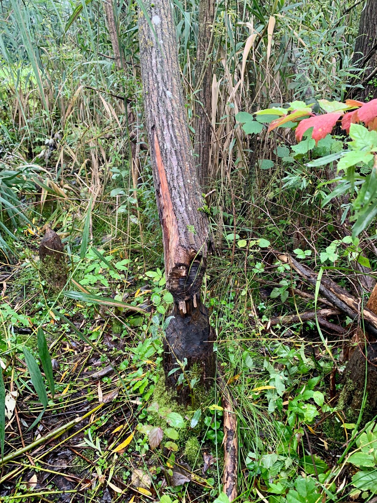
Hiking trail close to the riverbed where beavers and water birds have their habitat.
- Directions
-
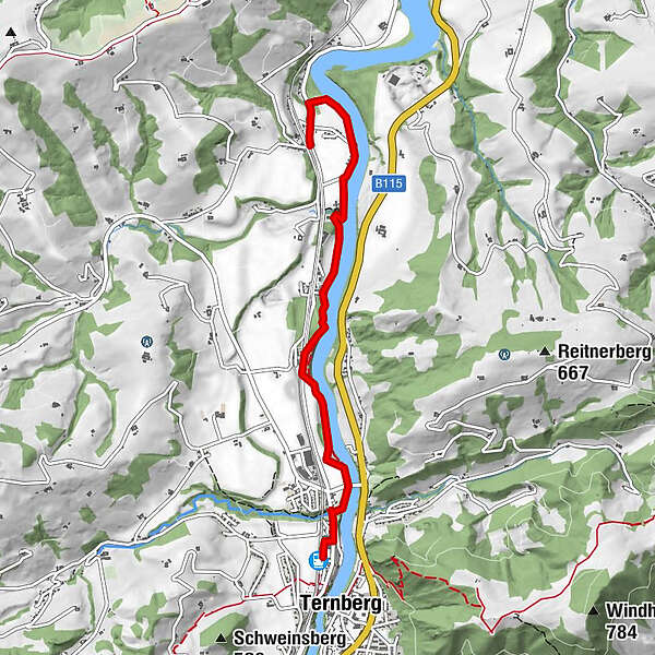
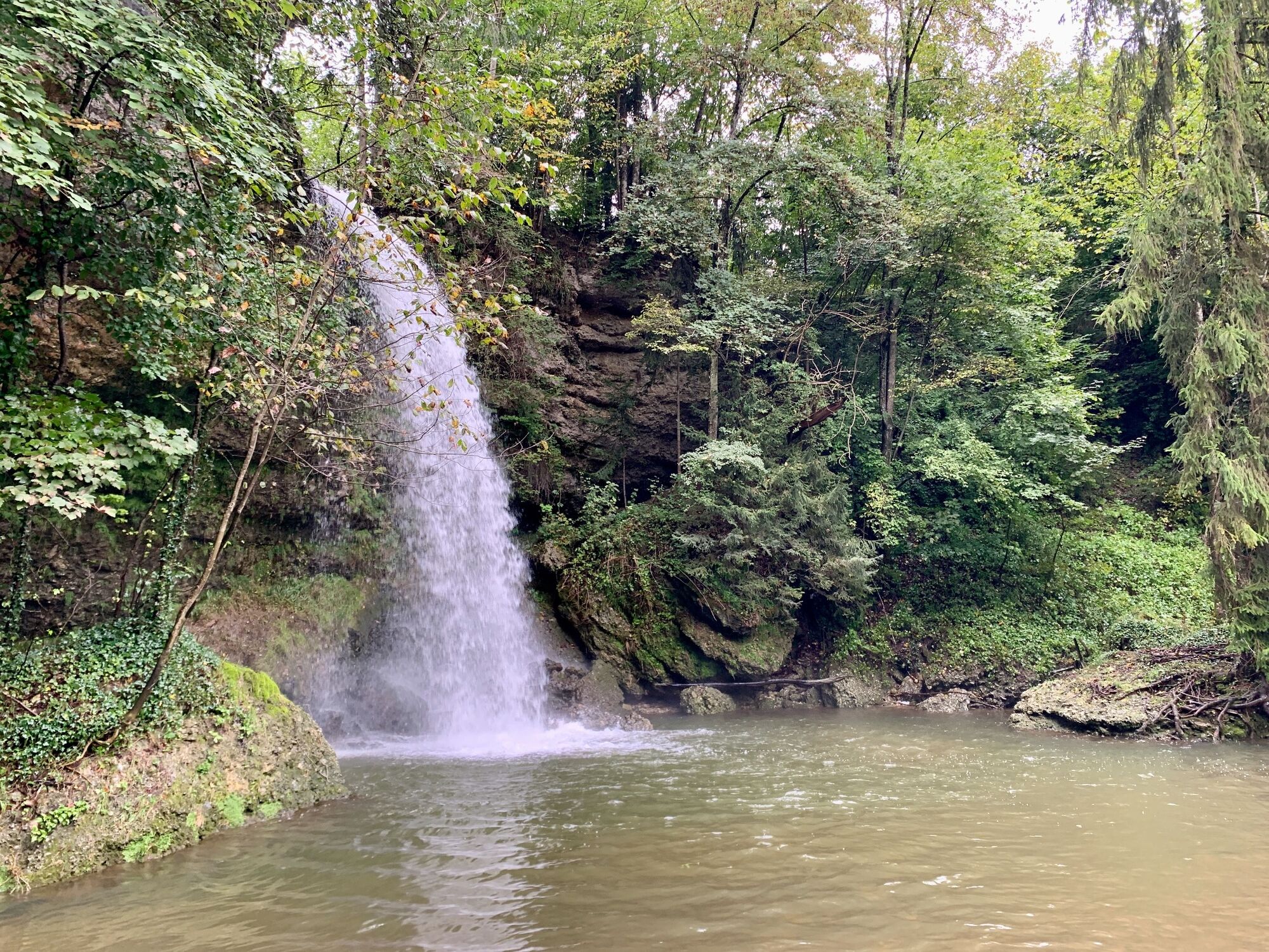
The tour starts at Ternberg station and leads down to the left bank of the Enns shortly before the petrol station after crossing the Bäckergraben. Follow the signs along the bank to the Fallerbucht. When the water flow is sufficient, this waterfall offers an impressive spectacle. After this natural spectacle, the path leads steeply up to the level of the 'Wiesenweg' road. You follow this road for a short while before descending back to the shore area at the beginning of the settlement. On the way to the 'beaver tracks' is our bench, which impressively functions as a box for the Enns cinema. Translated with www.DeepL.com/Translator (free version)
- Highest point
- 348 m
- Endpoint
-
natur.Bank. Ennsuferweg
- Height profile
-

- Tips
-
The tour can be explored further to Dürnbach station. Before boarding the train back to Ternberg, you should enjoy the good cuisine at Gerti's Wirtshaus.
- Additional information
- Directions
-
By car:
From the west: A1 motorway exit Enns-Steyr > B115 into the Ennstal valley.
From the east: A1 motorway exit Amstetten West > Waidhofen / Ybbs > Weyer
From the north: A3 Regensburg > Passau > Wels > A1 motorway exit Enns-Steyr > B115 into the Enns Valley
From the south: A9 Pyhrnautobahn > Klaus > Grünburg > Ennstal
- Public transportation
-
The Ennstalbahn runs between Linz and Weißenbach-St. Gallen.Stations are located in Ternberg, Trattenbach, Losenstein, Reichraming, Großraming, Küpfern, Kastenreith, Kleinreifling and Weißenbach-St. Gallen.
- Parking
-
Ternberg railway station car park


-

-
AuthorThe tour natur.BANK.wege | Ternberg | Ennsuferweg | 445205 is used by outdooractive.com provided.


General info
-
Traunviertel
1940
-
Steyr und die Nationalpark Region
1370
-
Ternberg
376