© Helga Baier
- Brief description
-
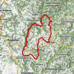
Route:
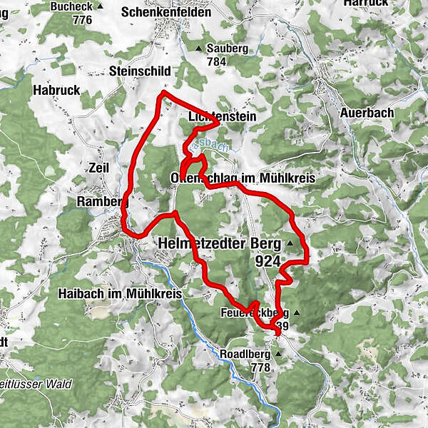
Ottenschlag - Grasbach - Lichtenstein - Schild - Rohrbach - Reichenau - Stadlerwiese - Affenberg - Wintersdorf (Roadlberg) - Helmetzedt - Ottenschlag - Difficulty
-
medium
- Rating
-
- Route
-
Ottenschlag im MühlkreisLichtenstein4.4 kmSchild5.3 kmRohrbach7.9 kmRamberg8.9 kmReichenau im Mühlkreis9.2 kmLa Bella9.3 kmLandgasthof Seyrlberg9.8 kmWintersdorf15.4 kmHelmetzedt18.5 kmOttenschlag im Mühlkreis21.3 km
- Best season
-
JanFebMarAprMayJunJulAugSepOctNovDec
- Description
-
Marking: with the number S23
Map download: S23 Steinbloß Runde - Highest point
- 846 m
- Height profile
-

- Additional information
- Author
-
The tour S23 Steinbloß Runde is used by outdooractive.com provided.
GPS Downloads


Other tours in the regions

 Gemeinde Alberndorf")