
- Brief description
-
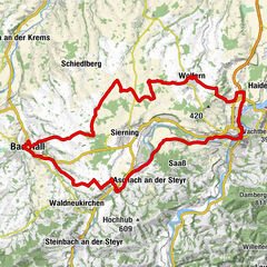
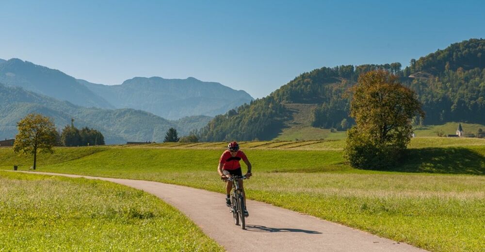
This about 35 km long round tour leads through the "land of hammers" in the middle Steyr Valley. First it goes from Bad Hall to Waldneukirchen, then further in the direction of Steinbach.
- Difficulty
-
medium
- Rating
-
- Starting point
-
Bad Hall, Eduard-Bach-Straße (Forum Hall)
- Route
-
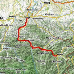
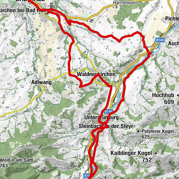
Bad Hall0.1 kmWaldneukirchen8.1 kmDorftaverne8.1 kmUntergrünburg11.8 kmSteinbach an der Steyr12.4 kmObergrünburg14.7 kmSteinbach an der Steyr19.3 kmKirchenwirt Czerny19.5 kmPfarrkirche Steinbach19.5 kmUntergrünburg19.9 kmHaus des Gebetes29.4 kmSteingrub32.1 kmBad Hall34.6 km
- Best season
-
JanFebMarAprMayJunJulAugSepOctNovDec
- Description
-
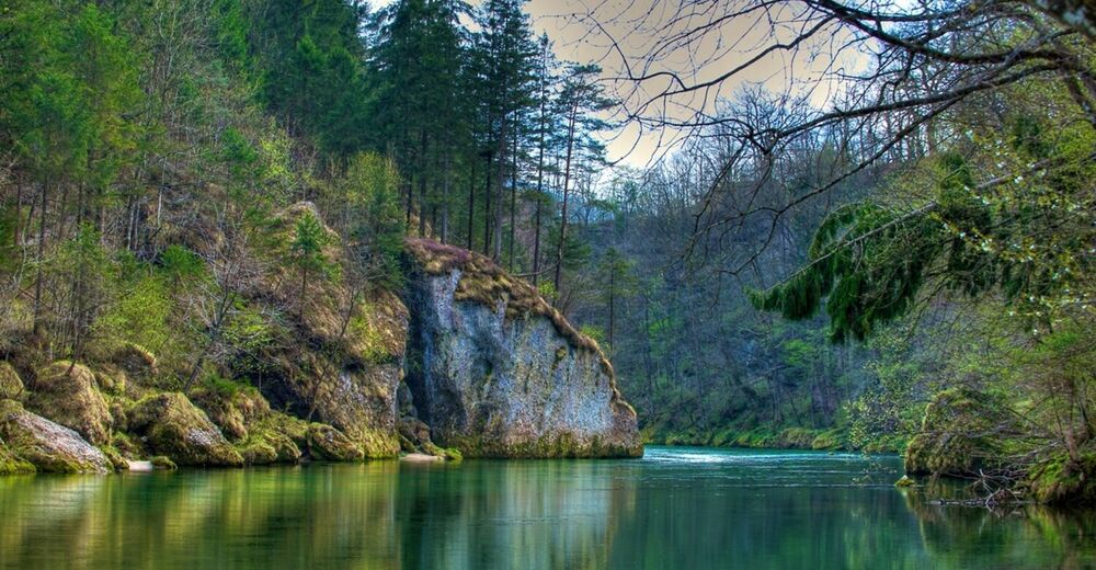
The Messererrunde starts in Bad Hall in the direction of Waldneukirchen, where you ride up the steep Kirchbühel to the country road. The route continues along the Mayhof estate road to Grünburg. Here you have a beautiful view of the river Steyr and the picturesque village of Steinbach. After a steep descent, you pass a small power station, which used to be the center of knifemakers and other craftsmen.
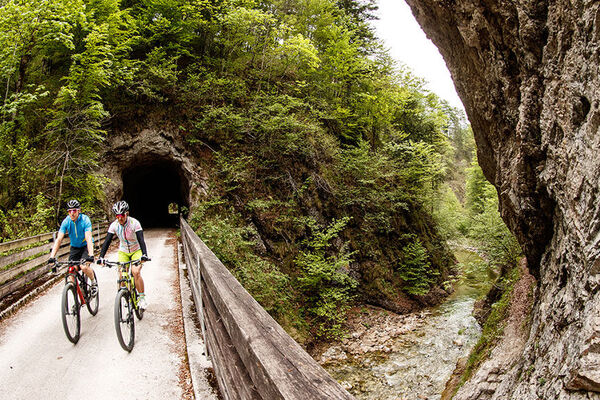
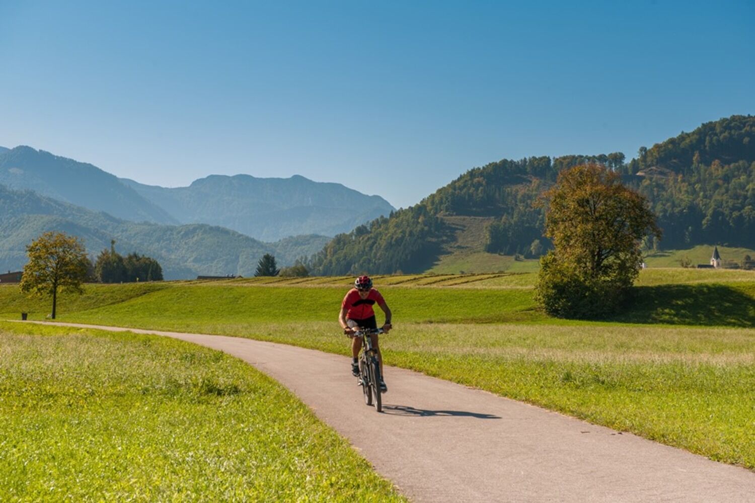
Continue cycling on the former railroad road next to the Steyr , at the Haunoldmühle, across the river. A little uphill and you reach Steinbach. The village is known for a variety of soft development concepts - not for nothing is in the revitalized Old Parsonage a "sustainability forge"!
Continue through beautiful hillside forests above the Steyr and along the bike path back to Bad Hall.
- Directions
-
Eduard-Bach-Straße - Waldneukirchen - Grünburg - Steinbach - Steinersdorf - Eduard-Bach-Straße.
- Highest point
- 465 m
- Endpoint
-
Bad Hall, Eduard-Bach-Straße (Forum Hall)
- Height profile
-

- Tips
-
Leisurely bike tour with the most energy-saving routing possible, focus on culture
Suitable for groups - Additional information
-
culinary interesting
circular route
catering possibility - Directions
-
by car:
- from Vienna: A1 to Haag, via Steyr to Bad Hall
- from Salzburg: A1 to Sattledt, via Rohr to Bad Hall
- from Liezen: A9 to Ried/Tr., via Kremsmünster u. Rohr to Bad Hall
- Public transportation
-
by train:
- Train IC via Linz Hbf. to station Rohr/Bad Hall
- Rail bus service to Bad Hall
-
-
AuthorThe tour Knifemakers’ Trail is used by outdooractive.com provided.