


- Brief description
-
Via Maria - Bavarian-Austrian Marian Way from Altötting to Mariazell
- Difficulty
-
difficult
- Rating
-
- Starting point
-
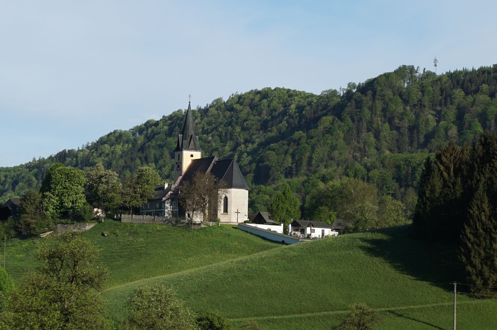
Frauenstein Pilgrimage Church
- Route
-
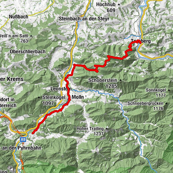
FederlehnerWallfahrtskirche Frauenstein0.0 kmRinnende Mauer9.9 kmDorngraben14.8 kmBrettmaisalm16.7 kmGrünburger Hütte17.1 kmTeufelskirche (1,080 m)20.1 kmHerndleck (1,026 m)21.4 kmTernberg27.2 kmPfarrkirche Ternberg27.3 km
- Best season
-
JanFebMarAprMayJunJulAugSepOctNovDec
- Description
-
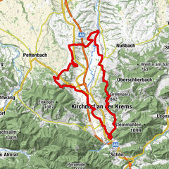
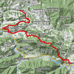
Stage for the 11th day from Frauenstein to Ternberg an der Enns (27 km)
Frauenstein - Molln - Grünburger Hütte - Ternberg an der Enns
- Directions
-
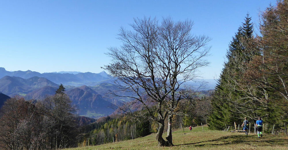
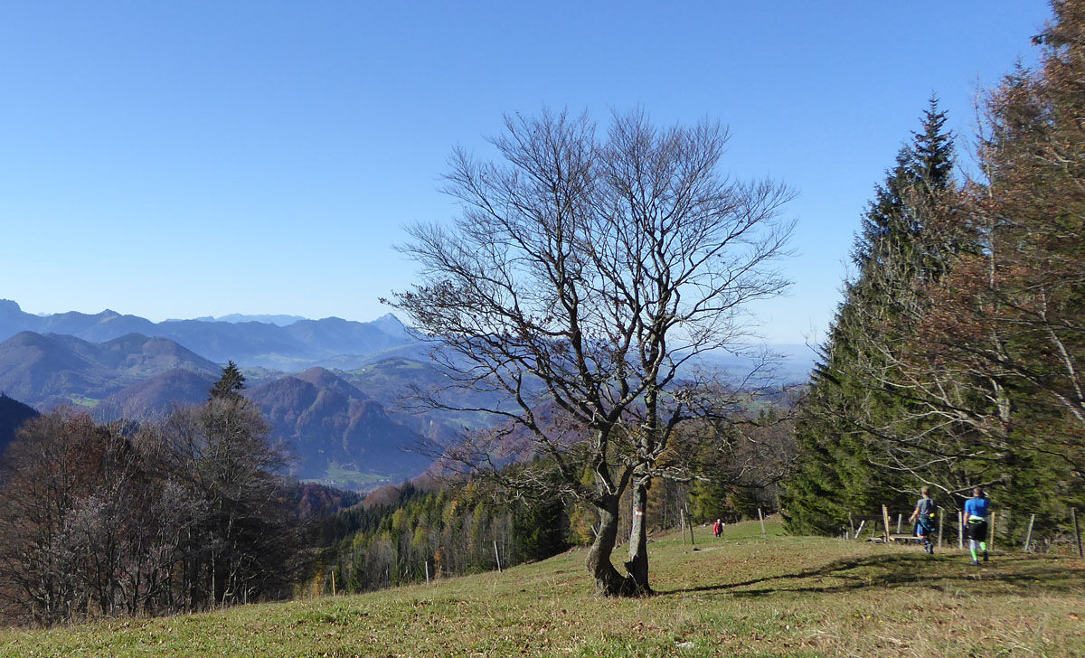
From Frauenstein (503 m) on the continuation of hiking trail 04 (06, 09, E4), we reach Molln (442 m) on mostly flat paths along the Steyr through the Steyr valley and past to the "Rinnende Mauer". From here we come through the Dorngraben to the ascent to the Grünburger Hütte (1,080 m). From here via Sulzboden, Gscheid to Herndleck (1,026 m), down towards the Ennstal valley to Ternberg (341 m). Overnight stay in Ternberg or about 45 minutes further in the direction of Sonnberg/ Maria Neustift to Gasthof Koglerhof (700 m).From Frauenstein to Molln about 2.5 hours, another 2.5 hours to Grünberger Hütte, about 1.5 hours to Herndleck, from here to Ternberg about 2 hours.
Overnight stay/rest:
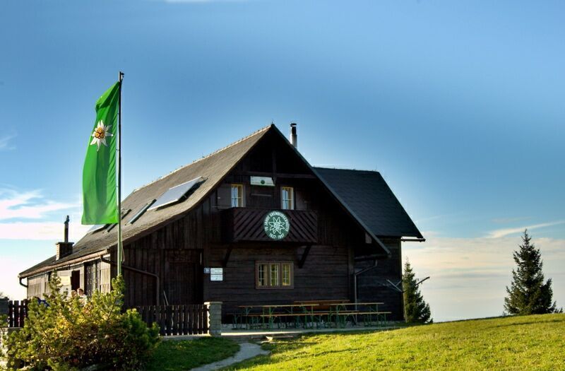
Grünburger Hütte;
Ternberg: Gasthof Mandl
Marktwirt Derfler
Bakery-Cafe Hohlrieder
on the way towards Maria Neustift: Gasthof & Alpenpension Koglerhof
Places of interest:
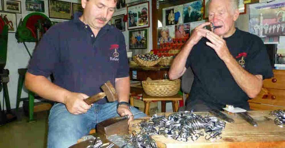
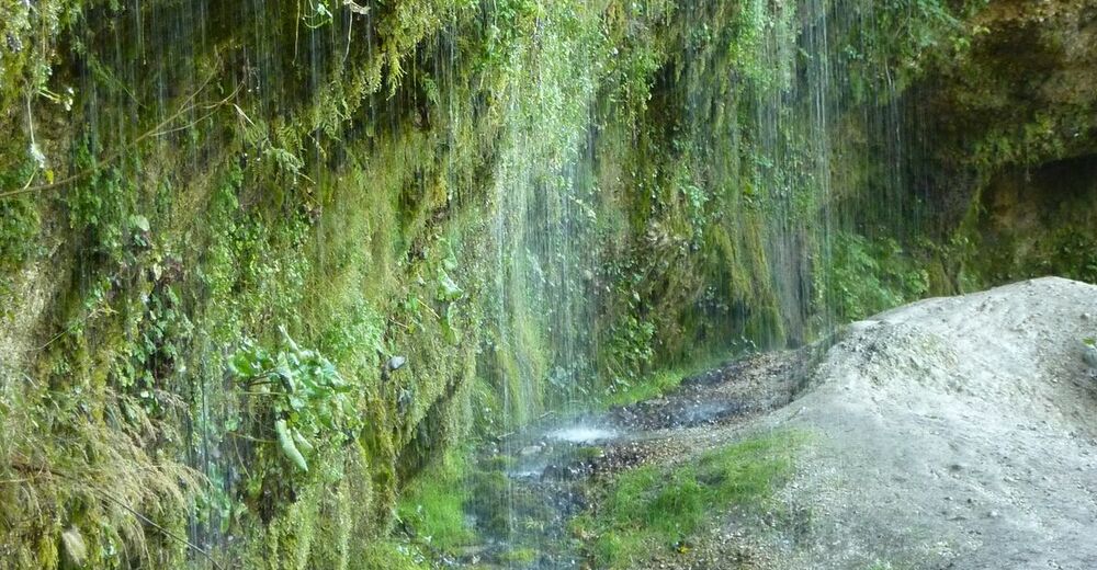
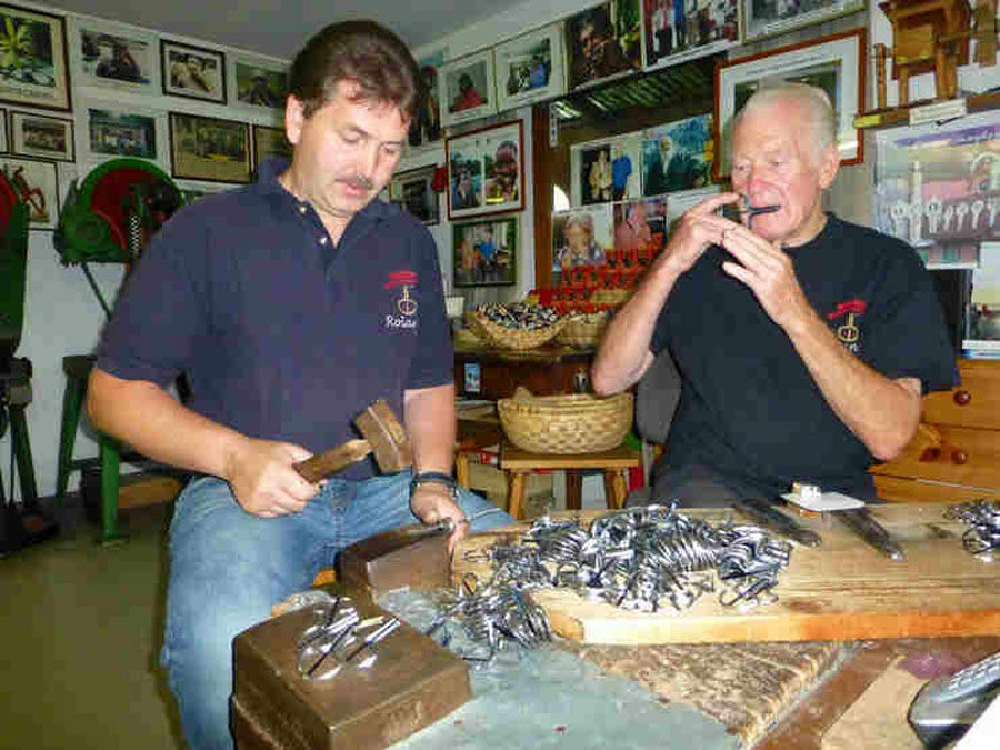
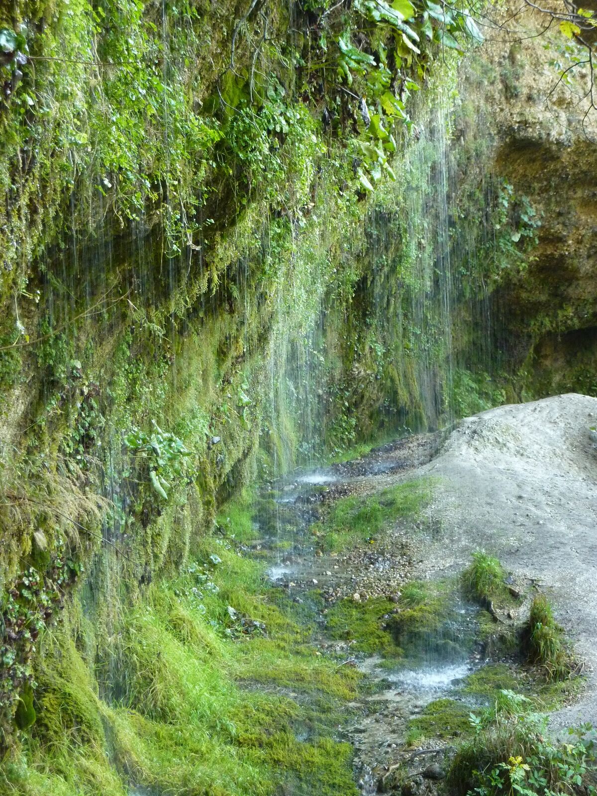
Molln: Wimmer-Bades Jew's Harp Show, Molln Jew's Harp Experience World, natural phenomenon "Rinne Wall" (eaves spring with water curtain on the steep slope of the Steyr),Ternberg/Trattenbach: Trattenbach Museum Village "In the Valley of the Feitelmacher".
- Highest point
- 1,127 m
- Endpoint
-
Ternberg local centre
- Height profile
-

- Equipment
-
Every backpack should contain: Rain, cold and sun protection, first aid kit, mobile phone (Euro emergency call 112), sufficient liquid, hiking map of the region.
- Safety instructions
-
No particular difficulties.
- Additional information
- Directions
-
Arrival by car:
From Salzburg/Linz: A1 motorway exit Sattledt > via Kremsmünster > Bad Hall > into the Steyr Valley
From Vienna: A1 motorway exit Haag > B42 > B122 > B140 into the Steyr Valley
From Passau: A8 Passau > Wels > A9 motorway exit Sattledt > Kremsmünster > Bad Hall > into the Steyr valley
From Graz: A9 Pyhrnautobahn > motorway exit Klaus > into the Steyr valley - Public transportation


- Author
-
The tour Via Maria - 11th day stage from Frauenstein to Ternberg is used by outdooractive.com provided.


General info
-
Traunviertel
1940
-
Steyr und die Nationalpark Region
1371
-
Molln
374