Donausteig Stage 3_S07 Enns - Mauthausen: „Salt, iron, and granit“


- Brief description
-
The Donausteig-simply fabulous! On this very short stage, we hike from Enns at the edge of the hilly Traun-Enns-Riedellandes (region) through the farming landscape of the Danube region to the Danube and Mauthausen. We discover the oldest city in Austria, medieval trade, the cradle of Christianity in Upper Austria, the Roman Legion camp in Lauriacum, fascinating granite art...
- Difficulty
-
easy
- Rating
-
- Starting point
-
Enns - the starting point is at the main square of Enns (a designated Donausteig-starting point is not available)
- Route
-
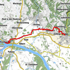
EnnsGasthaus Walter Wurdinger1.2 kmEnns1.2 kmLorch1.9 kmEnghagen3.5 kmEnghagen am Tabor6.5 kmAnlegestelle Enns6.7 kmAnlegestelle Mauthausen6.9 kmMauthausen7.3 km
- Best season
-
JanFebMarAprMayJunJulAugSepOctNovDec
- Description
-
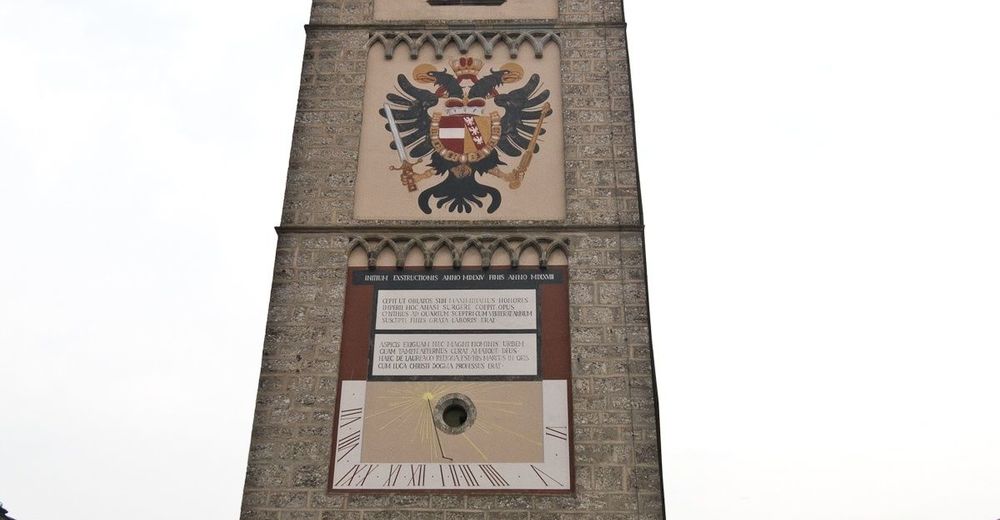
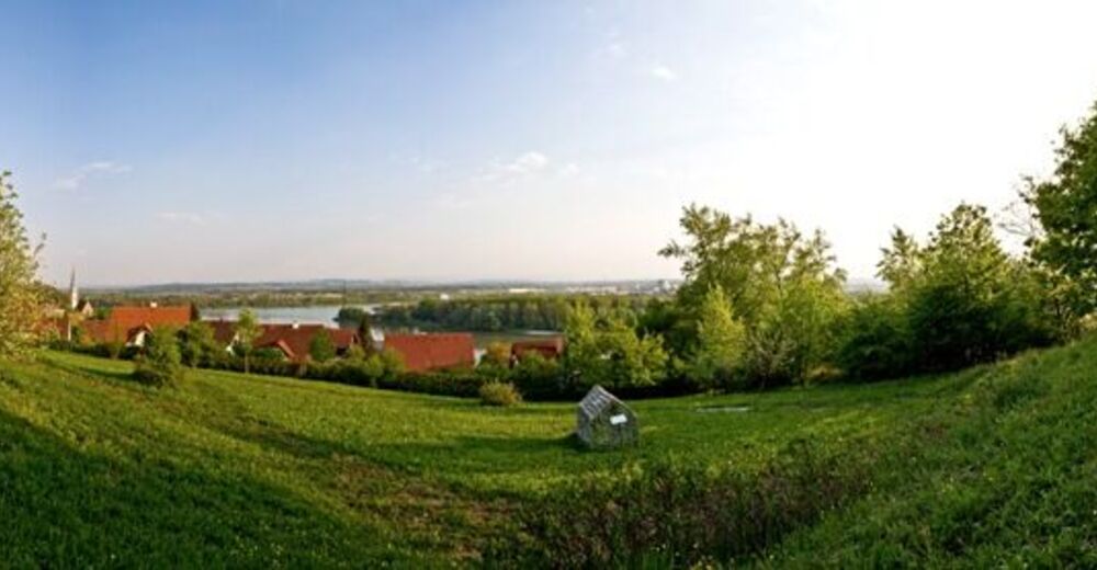
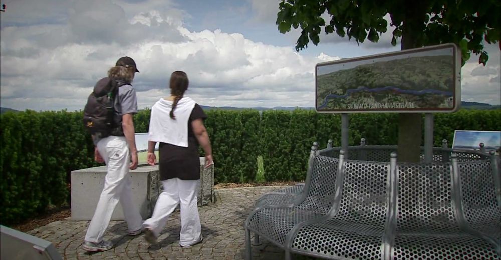
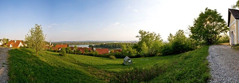
Enns, the oldest city of Austria, is the starting point of this Donausteig-stage. The historic city lies on a soft and elevated ridge, a Riedel (hill) of the Traun-Enns-Riedellandes (region). We start directly at the magnificent main square next to the 60 m high city tower. Rich facades and architectural details are evidence of prosperity and wealth springing from the salt trade. The picturesque old town is the first highlight of this stage. The trail leads down to the edge of the old town and from there in the newer parts of the town in the Danube plain. Here the next two highlights await us: the Basilica of St. Laurenz, considered the cradle of Christianity in Upper Austria, and the ruins of the Roman Lauriacums, a strategic military camp and important administrative town at the same time! Further on, the trail quiets down. After the train station, we leave the city and immerse ourselves in the rural landscape of the Danube plain. Fertile fields and farming settlements alternate at short intervals. Some grotesque, remote industries seemingly sprout straight from the fertile fields in the foreground - exciting especially for photographers! Shortly after Enghagen, the road bends towards the Danube. Initially the road continues along the edge of the Au (river), later through the lowland forest up to the lonely Donausteig-resting point „Radfähre“ directly on the banks of the Danube. The splendid view from here to the opposite Mauthausen invites to enjoy and ponder! The Radfähre (ferry) leads us, as in ancient times, across the mighty Danube River. The final highlight is the market of Mauthausen. In addition to its history, the city enchants with its granite art - simply fabulous!
Discover the following features with the Donausteig-diary:
-Enns-the oldest town of in Austria
-City Tower Enns-a confident landmark
-The Enns-iron River
-Basilica of St. Laurenz-the cradle of Christianity
-Lauriacum-border area of the Roman Empire
-Chapels-narrative monuments
- Donausteig-Resting point „Radfähre“
-Mauthausen-the granite Art Center
- ...
Download: Donausteig-diary "Stage 3_S07 Enns Mauthausen" - yet to follow!
Note: For this stage, you will need the use the Radfähre (ferry) Enns-Mauthausen (See section "Public transport" for timetables)!
- Directions
-
From the City Tower on the main square in Enns, the Donausteig follows the Linzerstrasse straight towards the West. At the Y-shaped crossroads (left next to it is a small park with a Carl Adam Kaltenbrunner monument) turn right into the Alter Schmidberg-strasse (road). After approx. 40 m downhill you reach a seemingly T-crossing. Attention: leave the Road and go straight down the stairs! The footpath turns after a few minutes into the Doktor-Marckhgott-Platz-Straße (street). Follow this street straight ahead. Cross the heavily trafficked Stadlgasse (road) and at the next crossroads turn left. Follow this settlement road to the wayside shrine of St. Severin. Turn left over the bridge into the Maria Anger-Straße (street). From the Basilica of St. Laurenz the Donausteig continues along the Lauriacumstraße (street) leading to the train tracks. At the tracks turn right and pass beneath the tracks at the station. After the railway underpass follow the Fabrikstraße 100 m East and turn into the Mühlenstraße (street). Now, the landscape is rural! At the next T‑Kreuzung (Chapel), turn left onto Lorcher Straße (street). Keep to the right at the next T junction and follow the major road up to the large Road underpass. After the underpass continue half left the rural road to the Centre of the village Enghagen. There turn right to the Inn Binder and follow the road to until a road branches off to the Cyder Inn Hammerl. At the next intersection, after 50 m, turn left. This road leads directly to the Radfähre (ferry) Enns-Mauthausen. After the Danube crossing to Mauthausenon the Danube road continue left up to the pedestrian crossing, cross it and follow East the road past the northern edge of the parking lot at Schloss Pragstein. The Donausteing-starting point "Mauthausen" is reached after approx. 250 m.
To facilitate the orientation, the Donausteig was provided with its own system of orientation - you will find the description here .
Note: for this stage you will need to use the Radfähre (ferry) Enns Mauthausen
(See section "Public transport" for timetables)!
- Highest point
- 267 m
- Endpoint
-
Mauthausen - the Donausteig-starting "Mauthausen" is located at the Tourism Office (on the waterfront) southeast of Schloss Pragstein (castle) near the stone sculptures.
- Height profile
-

- Equipment
-
Sturdy shoes
- Tips
-
Take your time - to discover Enns and Mauthausen! These historic sites have magical alleys and hidden deatils!
- Additional information
-
WGD Tourismus GmbH
Lindengasse 9
4040 Linz, Austria
Tel. +43(0)732/7277-800
Fax. +43(0)732/7277-804
info@donausteig.comTourist-Information Enns
Hauptplatz 1 (im Stadtturm)
4470 Enns
Tel.: +43(0)7223/82777
Fax: +43(0)7223/82778
www.oberoesterreich.at/enns
info.enns@oberoesterreich.at
Tourism center Mauthausen
Heindlkai 13
4310 Mauthausen
Tel.: +43(0)7238/2243 od. 2023-0 Fax: DW-51
mauthausen@oberoesterreich.at
www.tiscover.com/mauthausen
www.mauthausen.biz - Arrival
-
The starting of the stage is main square of Enns (Navigation: A-4470 Enns/Hauptplatz).
- Public transportation
-
Enns can be reached by train and bus. A transfer back from Mauthausen to Enns is possible by train and bus as well. The bus travels from the Market place of Mauthausen to the Main square of Enns. When taking the train, take notice of the stations distance from each respective city center! Information on timetables online at http://www.ooevv.at .
- Parking
-
The city center of Enns is mostly a short period parking zone. Two free of charge parking possibilities are however 5 walking minutes from the city center (corner Mauthausner Straße/Stadlgasse)


- Author
-
The tour Donausteig Stage 3_S07 Enns - Mauthausen: „Salt, iron, and granit“ is used by outdooractive.com provided.


General info
-
Mühlviertel
1784
-
Linz & Region Linz
847
-
Ennsdorf
146