Eifelsteig Etappe 01: Kornelimünster - Roetgen


- Brief description
-
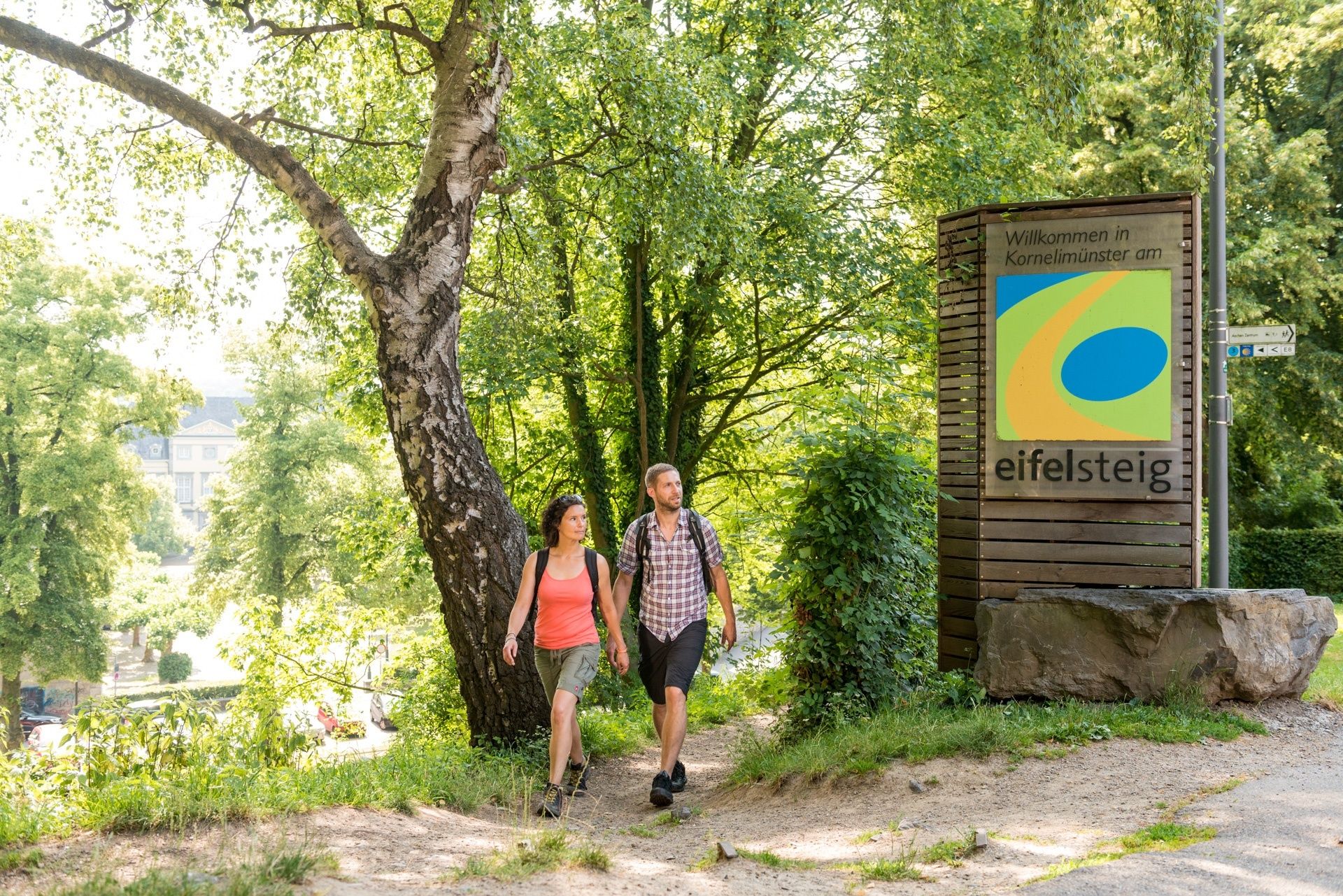
The Eifelsteig trail begins in the Kornelimünster district of Aachen, a former destination for pilgrims, and brings the hiker from the bustling city into the quietness of nature. In the Inde Valley, information boards enlighten the walker about the many limestone kilns along the trail. After a short ascent you reach the Struffelt Heath, with its moors and lowland heaths. Wooden footbridges bring you through this impressive landscape. The trail continues past the dam on the Dreilägerbach and onto Roetgen, the 'Gateway to the Eifel'.
- Difficulty
-
easy
- Rating
-
- Starting point
-
Benediktusplatz, Kornelimünster
- Route
-
KornelimünsterHahn2.5 kmWalheim4.1 kmFriesenrath5.1 kmRoetgen (410 m)13.8 kmPetergensfeld14.8 kmWanderstation14.8 km
- Best season
-
JanFebMarAprMayJunJulAugSepOctNovDec
- Description
-
The first stage of the Eifelsteig trail is ideal as a warm-up, because the 14km course is relatively short and the terrain is still quite flat. It begins in Kornelimünster, a former destination for pilgrims with an abbey and priory. Three important relics are kept here and displayed every seven years as part of the pilgrimages – the loincloth, face cloth and shroud of Jesus. A tip: Aachen's old city is very close by and the cathedral should not be missed.
Setting off from Kornelimünster, the trail passes through the Inde Valley. Here you will see several lime kilns and a well-preserved mine, with plenty of information boards inviting you to stop.
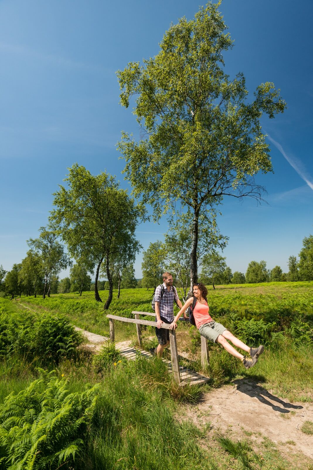
The second half of the trail passes through the forest and onto the impressive Struffelt Heath, a landscape of moorland, fen woodland, bogs, lowland heath and natural water features. But don't worry – you won't get your feet wet, thanks to a couple of hundred footbridges, built by the local organisation in Rott, which make walking across the Struffelt, the most northerly foothills of the Hohes Venn plateau, much easier. If you like, you can also change onto the Struffelt trail from here, because it is a circular trail.
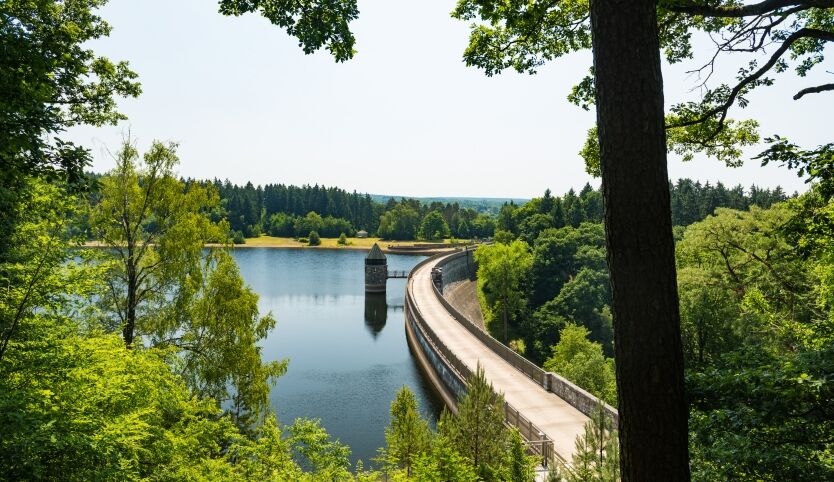
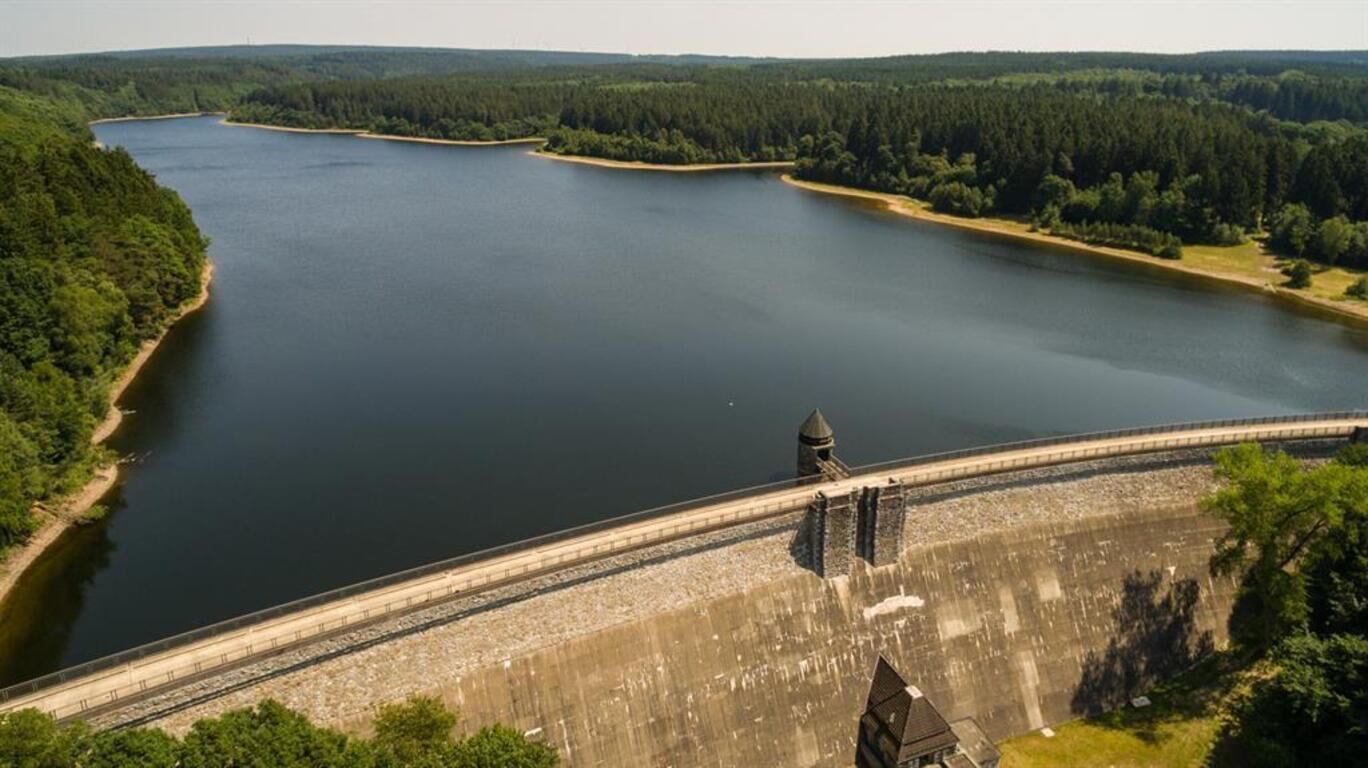
Passing the dam on the Dreilägerbach river (the most demanding part of the trail), you will eventually come to the 'Gateway to the Eifel', as the town of Roetgen is often called. Don't miss the view from the Grölisbach river of the 'dragon’s teeth' fortifications on the former Siegfried Line. And once you reach the rest station at the Pferdeweiher lake, you have plenty of time to enjoy the regional specialities in the many restaurants there.
Trail highlights
- Abbey church on the market square
- Lime kilns at the 3.6km mark "In der Au"
- Lime kilns at the Walheim lime works
- Friesenrath recreation ground
- 'Dragons teeth' fortifications on the former Siegfried Line
- Struffelt nature reserve
- Dam on the Dreilägerbach river
- Panoramic view of Roetgen and surrounding area
Eifelsteig partner organisation for Stage 1:
- 3 star hotel "Gut Marienbildchen" in Roetgen - Directions
-
More than half the trail leads through forests, meadows and forest tracks, with some short stretches of tarred paths.
- Highest point
- 451 m
- Endpoint
-
Bahnhofstraße Roetgen (Wanderstation / Pferdeweiher)
- Height profile
-
 © outdooractive.com
 - Equipment
-
Rucksack with provisions and sturdy shoes
- Tips
-
Hike without any luggage!
Eifel Tourismus (ET) GmbH has put together hiking tours of the Eifelsteig trail, lasting several days.
Book your own hiking tour with us, with hotel, packed lunch and baggage transfer all included.
www.eifel.info/wandern-ohne-gepaeck.htm
Enjoy your hike! - Additional information
-
Eifel Tourismus (ET) GmbH
Kalvarienbergstr. 1
D-54595 Prüm
Tel. +49 (0)6551 / 96560
Fax +49 (0)6551 / 965696
Email: info@eifel.info
www.eifel.info www.eifelsteig.de
District Office (Tourist Office)
Schulstr. 20
D-52076 Kornelimünster
Tel. +49 (0)2408 / 9259222
Fax +49 (0)2408 / 925921728
Roetgen-Touristik e.V.
Chamber of Commerce & Tourist Office
Mühlenstraße 2
D-52159 Roetgen
Tel. +49 (0)2471 / 4633 and +49 (0)2471 / 8478
Fax +49 (0)2471 / 677
www.roetgen-touristik.de
Tourist Info Point at the rest station (Pferdeweiher)
Eifelsteig Tourist Office
Bundesstraße 18 A
D-52159 Roetgen
Tel. +49 (0)2471 / 132276 - Directions
-
1. from Cologne, Mönchengladbach, Düsseldorf
=> from Cologne take the A4 in the direction of Maastricht Heerlen to Aachen interchange
=> exit onto the A44 towards Lüttich
=> take exit 3 (Aachen-Brand, Aachen-Zentrum, Aachen-Stolberg)
=> turn right onto the B258 towards Monschau/Stolberg/Kornelimünster/Brand
2. from the Schleiden Valley
=> Einruhr => Simmerath => Roetgen
=> B258 to Kornelimünster - Public transportation
-
1. Getting back to the starting point at Kornelimünster
DB Bahn trains:
From Cologne central station to Aachen central station or Aachen-Rothe Erde with regional trains, then onwards by bus
Bus:
Bus 35: Aachen bus station => Aachen, Rothe Erde train station => Aachen Kornelimünster, Napoleonsberg (Eifelsteig)
Bus 55: Aachen bus station => Aachen, Rothe Erde train station => Kornelimünster Schulberg
Bus 68: Aachen bus station => Aachen, Rothe Erde train station => Aachen Kornelimünster, Napoleonsberg (Eifelsteig)
Bus 66: Aachen bus station => Aachen, Rothe Erde train station => Aachen Kornelimünster, Napoleonsberg (Eifelsteig)
Bus 166: Aachen bus station => Aachen, Rothe Erde train station => Aachen, Kornelimünster, Napoleonsberg (Eifelsteig)
www.avv.de
2. Getting back to the starting point at Kornelimünster
Bus 66: Roetgen train station => Aachen, Kornelimünster Napoleonsberg (Eifelsteig)
Bus 68: Roetgen train station => Aachen, Kornelimünster Napoleonsberg (Eifelsteig)
We recommend calling a taxi at this stage of the trail:
Aachen:
Tel. +49 (0)241 / 19410 or 900700
Roetgen:
Choudrey A. Care Hire Service Tel. +49 (0)2471 / 134207
Lux Thomas Taxi Equipment Hire Tel. +49 (0)2471 / 4755
Taxi Simons Tel. +49 (0)2471 / 8800 - Parking
-
START: Benediktusplatz, Kornelimünster
FINISH: Bahnhofstraße, Roetgen (rest station / Pferdeweiher lake), former Vennbahn station in Roetgen


- Author
-
The tour Eifelsteig Etappe 01: Kornelimünster - Roetgen is used by outdooractive.com provided.


General info
-
Eifel & Aachen
1425
-
Hohes Venn
601
-
Roetgen
257


