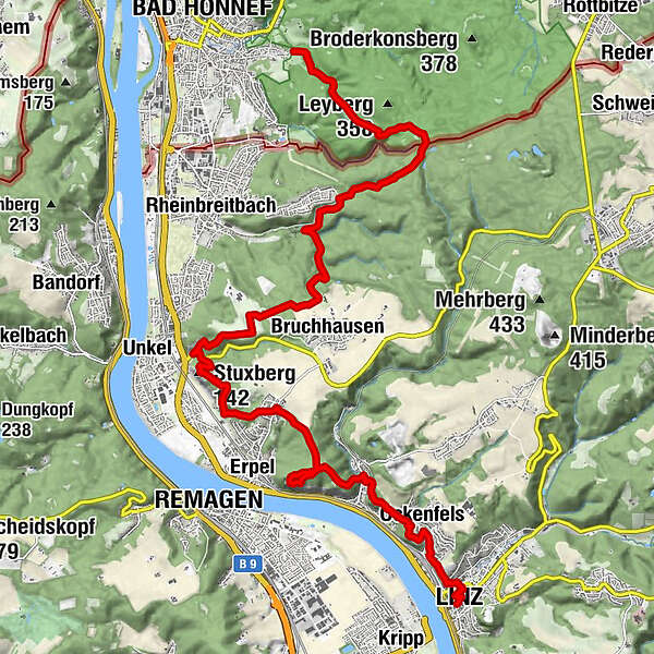
Rheinsteig Stage 3: Bad Honnef–Linz (north–south)


- Brief description
-
Fabulous Rhine views
- Difficulty
-
medium
- Rating
-
- Route
-
Bad Honnef (75 m)Auge Gottes3.1 kmBreite Heide4.9 kmBreitbach6.7 kmBruchhausen6.9 kmKaskade von Unkel9.6 kmStuxberg (142 m)10.2 kmOrsberg11.9 kmRemagen13.7 kmErpeler Ley (191 m)13.7 kmKasbach15.5 kmAuf der Lay16.5 kmIm der Hütget16.5 kmAufm Rabennest16.5 kmBurgweg16.7 kmIn den Bitzen16.8 kmOckenfels16.9 kmIm Hausener Tal17.3 kmAuf der Rheinhölle17.5 kmLinz18.4 km
- Best season
-
JanFebMarAprMayJunJulAugSepOctNovDec
- Description
-
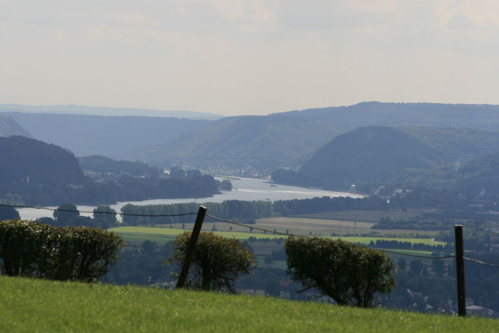
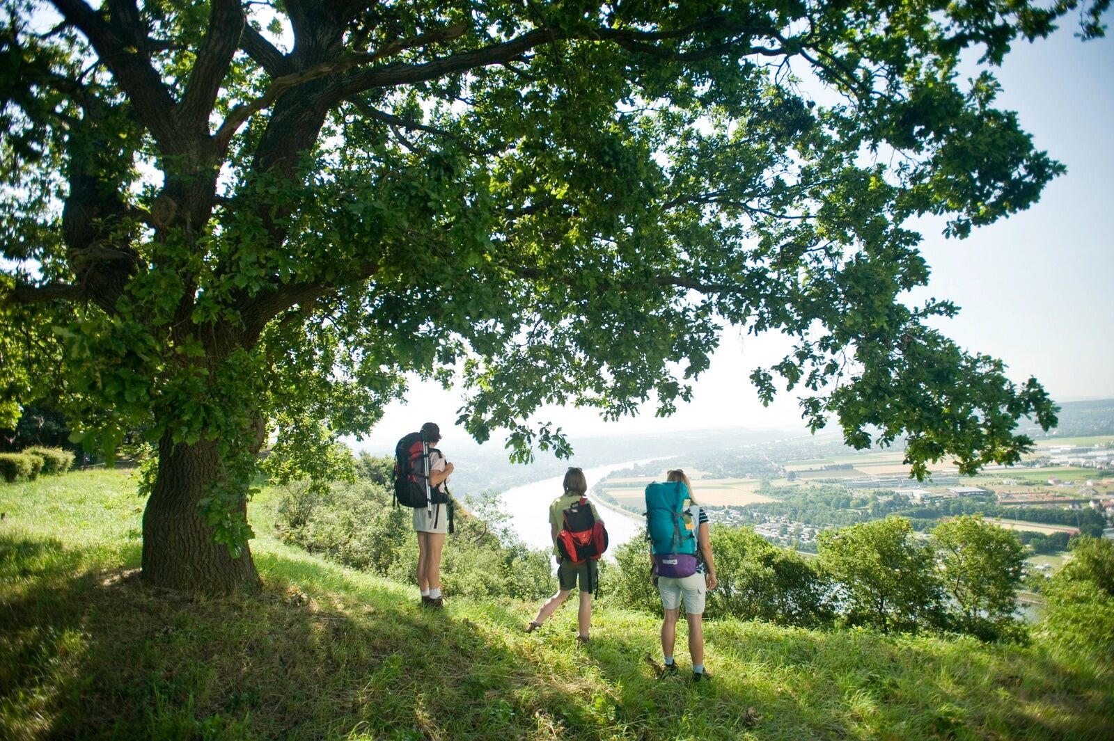
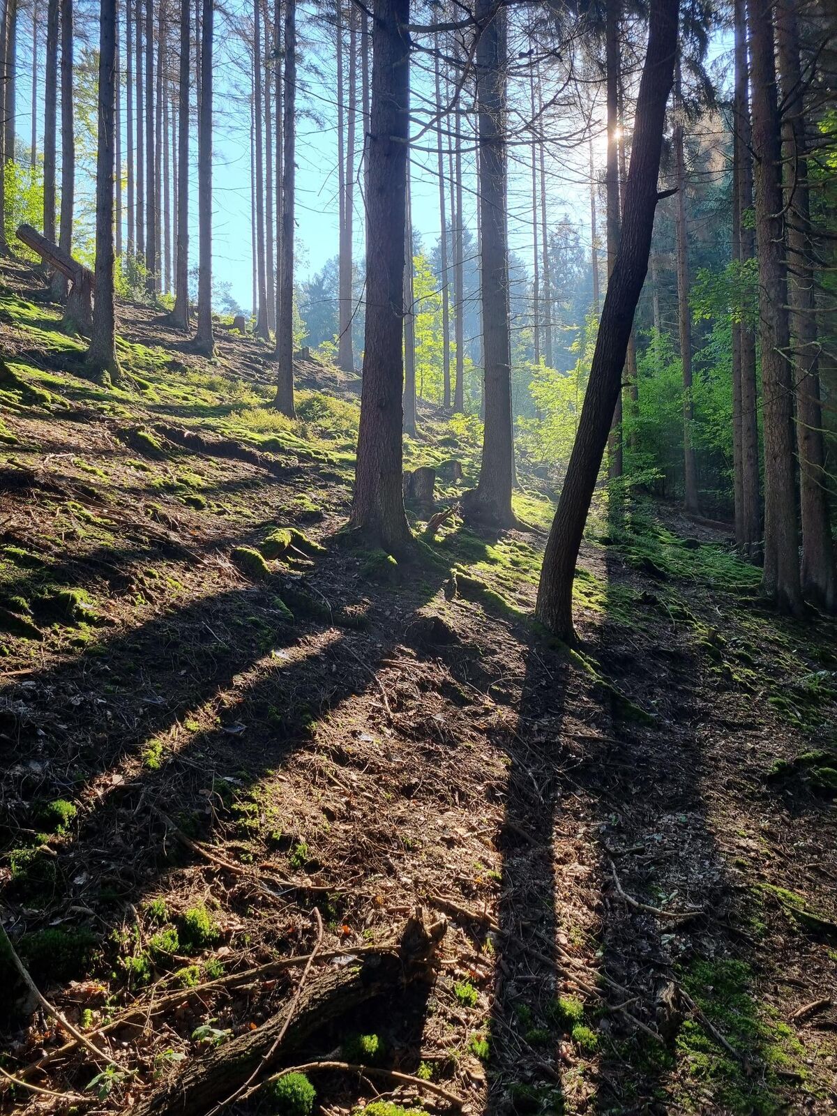
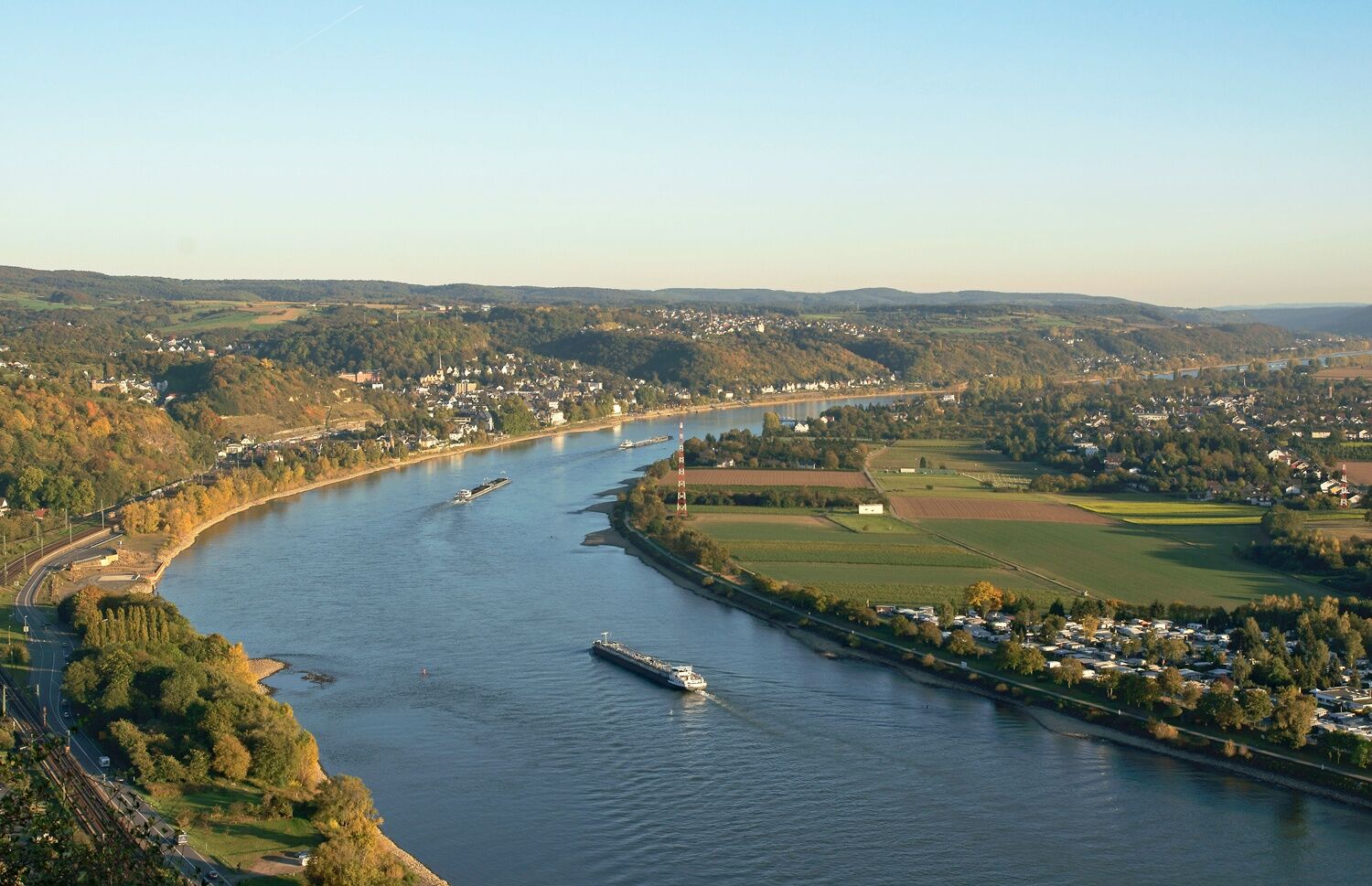
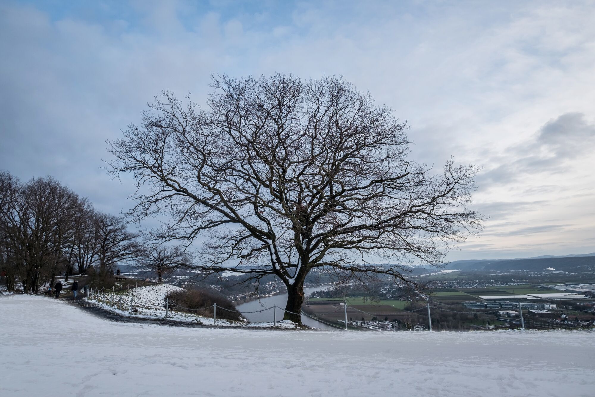
Today the Rheinsteig inspires with wonderful forest passages and fabulous views. Geology is also in the limelight in many places. One of the highlights of the stage is the Erpeler Ley, a basalt base high above the Rhine, from which you can see the Rhine Valley and the relics of the famous Remagen Bridge from a bird's eye view. This charming stage comes to an end in the old town of Linz, the "colorful city on the Rhine".
- Directions
-
Access: From the train station, the southern access path leads past the youth hostel to the edge of the forest, where you meet the Rheinsteig (RS). The RS climbs path-like in the shade of the trees. When the path forks, you can continue to gain altitude through a small stream valley. As soon as the RS flattens out a bit, a forest meadow opens up, where a rest area at the former Barbarahütte invites you to linger. Now the Hasenhardt is conquered and after the highest point you change unnoticed from NRW to RLP. Shortly thereafter you stand at a forest crossing with a wayside chapel and benches, over which the painted "God's Eye" watches, which was once intended to deter wood thieves. Relaxed forest hiking follows downhill to the edge of Rheinbreitbach. At the Westerwaldstrasse, turn left and walk a little further down next to a brook. Not far from the Alte Schmelze, the RS takes a sharp left turn and climbs through the Breitbachtal. A few meters higher, the RS leaves the forest, passes the turn-off to Marienberg and an honorary cemetery. Then you walk almost flat over the Bruchhäuser Heide to the campsite at Gut Haanhof. Now your gaze wanders around and if visibility is good, the Drachenfels can be seen on the horizon. After a left turn, an old tree-lined avenue lines the RS, a sublime passage! Then you head for a wooden cross at the edge of the forest and dive into the forest there. Soon a great view of the Rhine Valley opens up at a rest area before the path leads steeply into the valley to the L 252. After crossing it, you turn left at the shoulder and a few meters later you are in front of a small waterfall! It goes uphill again: the RS conquers the Stuxhöhe in serpentines, where the next wonderful view opens up and from the benches you can see Marienberg Castle and the Rhine in the view.In the following, the RS leads through sparse forest and hedge areas to the view of the Apollinaris Church in Remagen. You hike down through dense vegetation and reach a few houses. But the RS immediately swings uphill again, leaves the woods and reaches Orsberg via a meadow. From the town center you quickly walk back into nature and pass the Orsberg fountain in a valley. You quickly master the ascent to the plateau and stroll comfortably through the forest to the junction to the Erpler Ley. The loop to the edge of the slope begins at a junction of the RS, where not only is there a place to stop for refreshments, but above all a phenomenal view. So this round is definitely worth it! Back at the intersection, follow the RS to the right and descend to Kasbach via a very steep stairway. The village is quickly hiked through and the viaduct of the Kasbachtalbahn passed under. The RS climbs again and leads through the forest to the first foothills of Linz. With a detour to the edge of the slope you reach Ockenfels Castle and enjoy the great view of the Rhine and Linz. Before you get there, you have to cross a side valley and hike uphill one last time. Views reward the effort, then the city worth seeing finally calls. This great stage ends at the market square, in the middle of the picturesque half-timbered backdrop.
- Highest point
- 310 m
- Endpoint
-
Linz
- Height profile
-
 © outdooractive.com
 - Safety instructions
-
Health and safety
Wear suitable weatherproof clothing that will protect you from cold, wet, heat and sunshine. Make sure you take regular breaks and don't overexert yourself. Take enough fluids with you as there are sections without rest stops. Wear suitable hiking boots/shoes which give you enough grip on slippery, steep, rocky and uneven surfaces. Avoid any sections of the route which you feel are too difficult for you. Natural trails can quickly become wet and slippery in adverse weather conditions. Particularly in autumn, you should be careful of uneven ground, roots, stones or holes that have been covered by leaves. You need to take these kinds of adverse conditions into account every time you go on a hike. Particularly steep and dangerous places are made safer with handrails or ropes. Please use these as safety aids. Handrails are not to be climbed on or used to get a better view! - Tips
-
The path across the Erpeler Ley is an extra loop on this section of the trail but worth the effort for the view and the chance to stop off for some refreshment!
- Directions
-
Follow the B42 along the Rhine to get to Bad Honnef and Linz.
Access by train or ship (in the summer) possible.
There is a car ferry in both Bad Honnef and Linz.
- Public transportation
-
Bad Honnef and Linz are both on the regional stopping and regional express train network which operates a regular service. You can also get to Bad Honnef by suburban train from Königswinter or Bonn in the north. The access path with its yellow signs from the main line and suburban train stations to the main trail is about two and 2.5 kilometres long.
The Selhof Kirche stop is closer to the main trail (about one kilometre). Bus 566 leaves from the train station in Rhöndorf.
- Parking
-
You can park at the main line and suburban train stations and at various places in town.


- Author
-
The tour Rheinsteig Stage 3: Bad Honnef–Linz (north–south) is used by outdooractive.com provided.


General info
-
Ahrtal
1259
-
Siebengebirge
707
-
Remagen
268