- Brief description
-
Hike over the Sperberhaier Damm aqueduct, one of the core parts of the Upper Harz water Management System. Restaurants invite you to take a break both at the start and at the end.
- Difficulty
-
easy
- Rating
-
- Starting point
-
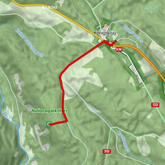
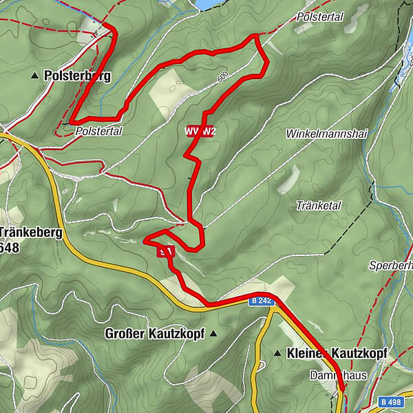
Sperberhaier Damm car park at thr B 242 Clausthal - Braunlage
- Route
-
Dammhaus0.0 kmSperberhaier Dammhaus0.0 km
- Best season
-
JanFebMarAprMayJunJulAugSepOctNovDec
- Description
-
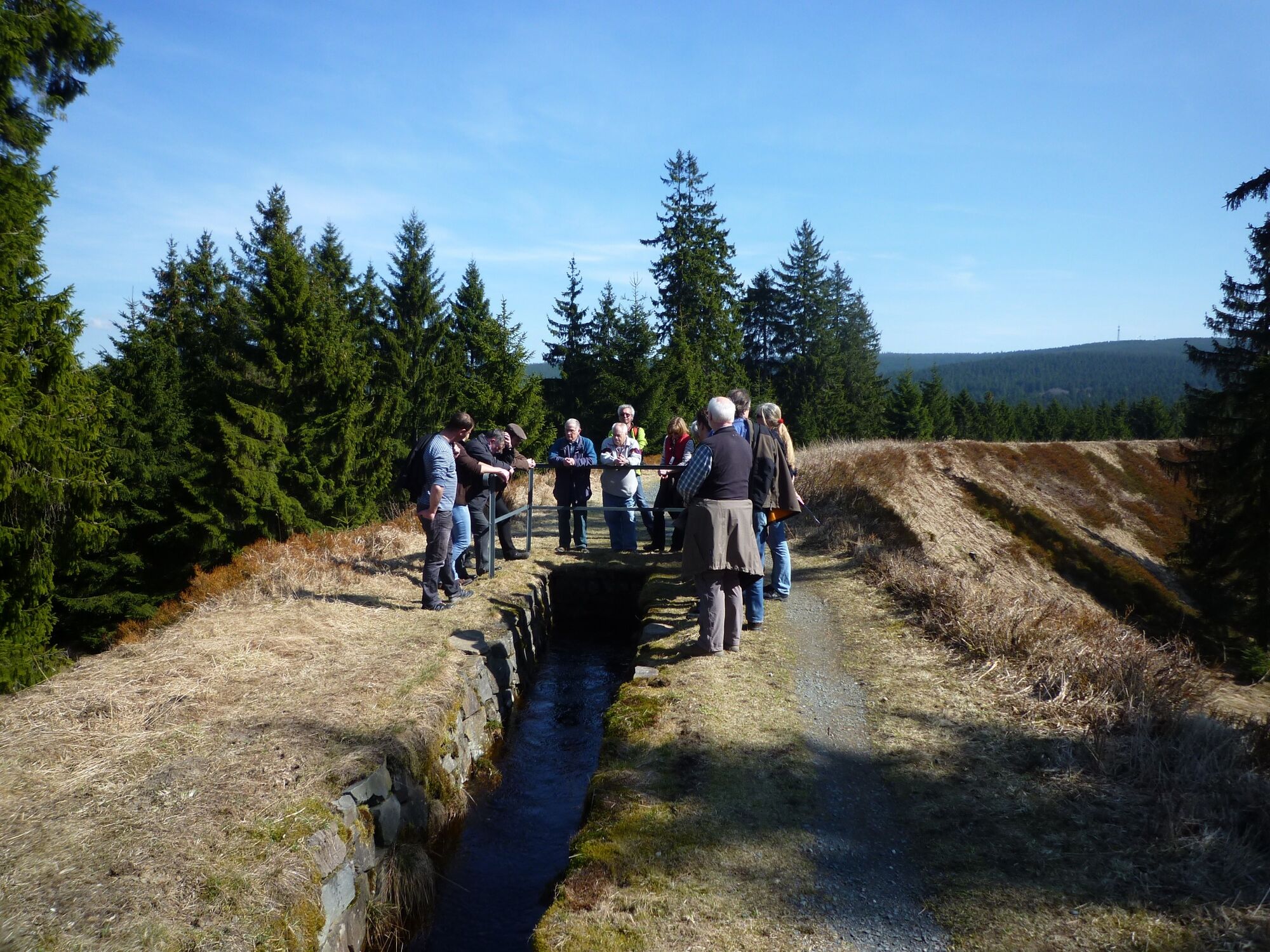
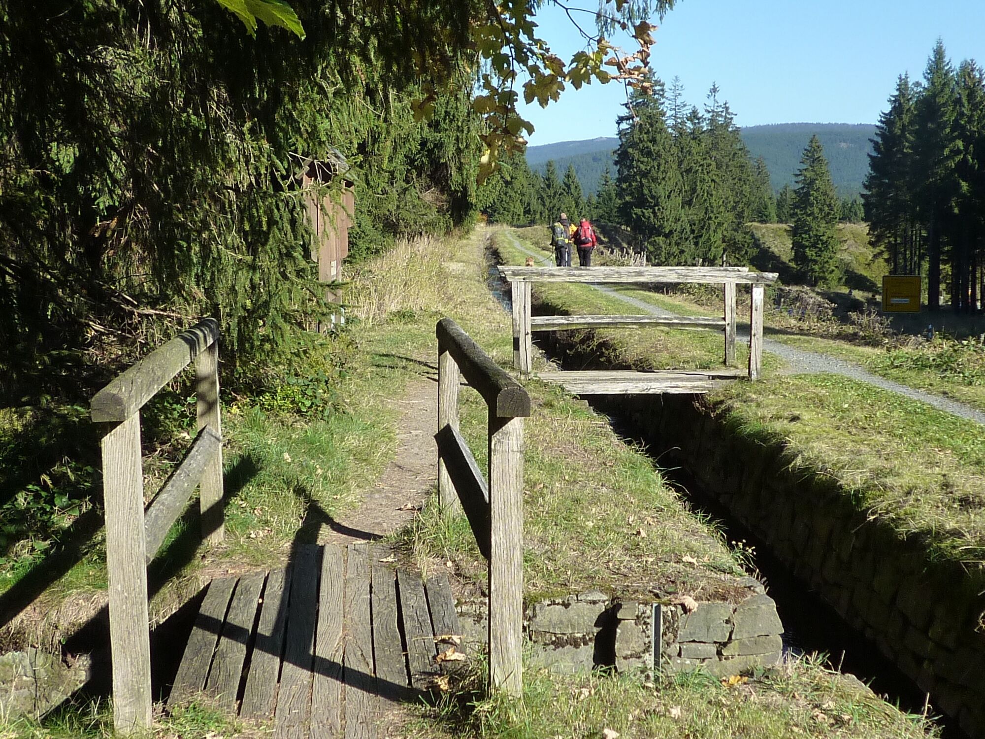
The Sperberhaier Damm aqueduct is the mightiest structure of the Upper Harz Water Management System and the core of the dam ditch system named after it. The 940 m long and 16 m high aqueduct directs the water over a depression at the sparrow shark to the Clausthal plateau. With all the foothills that reach up to the Brockenfeld, the Dammgraben system has a length of almost 50 km. From its "cradle" below Torfhaus to the Oberen Hausherzberger Teich pond near Clausthal-Zellerfeld, the 20 km long ditch only loses 60 m in height.
- Directions
-
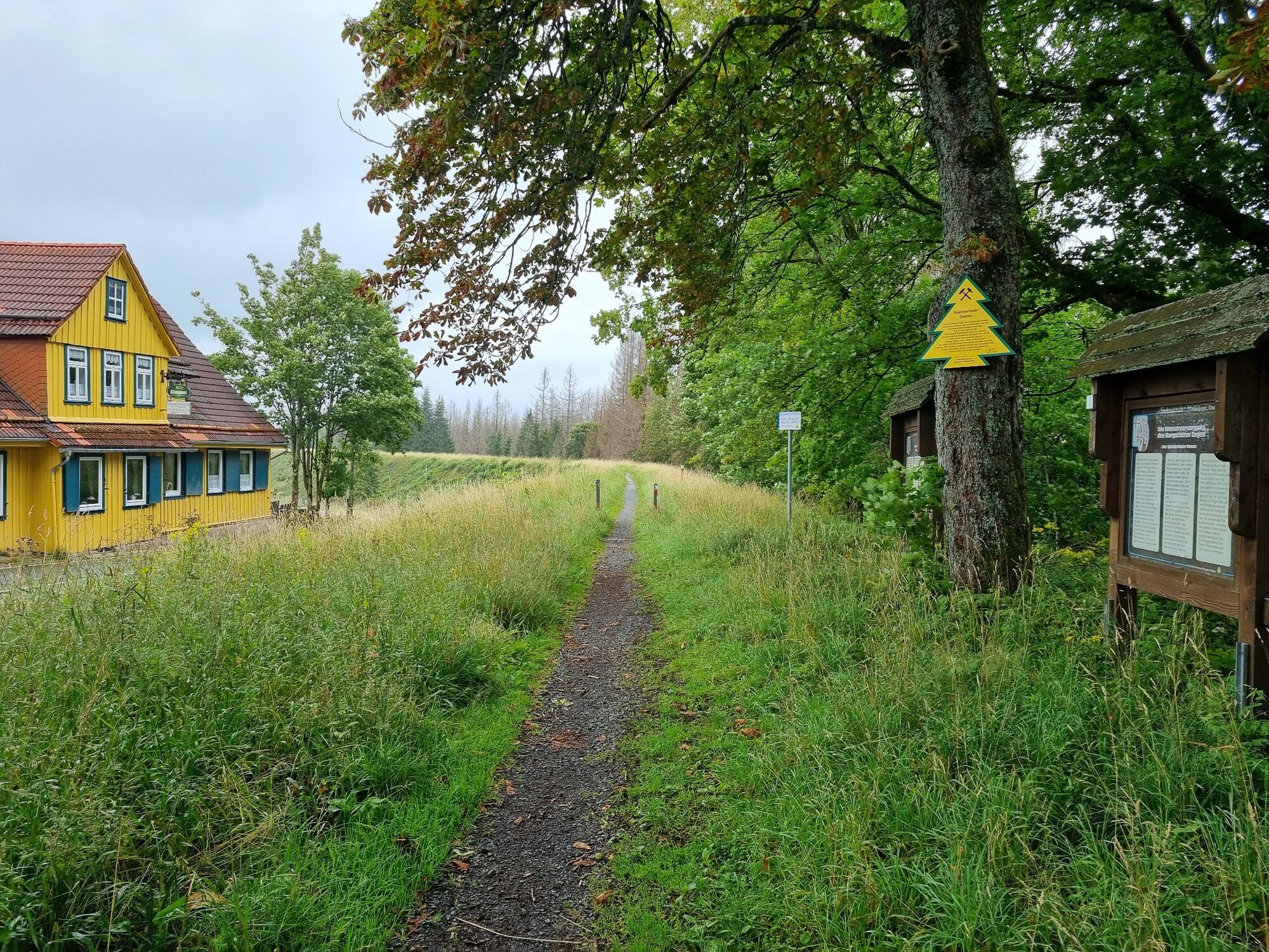
The Sperberhaier Dammhaus restaurant is located in the former grave keeper's house. From the crest of the dam there is a wonderful view of the wide Harz landscape. The section of the ditch that is 330 m long was reconstructed in 1992. From there, the path follows the water-carrying Dammgraben and the disused Alter Dammgraben to the former Polsterberger Hubhaus, which is now a restaurant.
- Highest point
- 584 m
- Endpoint
-
Polsterberger Hubhaus
- Height profile
-
 © outdooractive.com
 - Tips
-
The Polsterberger Hubhaus now houses a very nice restaurant. The products on the seasonal menu are all locally sourced. The fresh and homemade cakes are particularly delicious. Polsterberger Hubhaus Polsterberg 1, 38678 Clausthal-Zellerfeld Tel.: 05323 5581 Polsterberger-hubhaus@harz.de, www. Polsterberger-hubhaus.harz.de
- Parking
-
Car park at the Sperberhaier Dammhaus
-

-
AuthorThe tour WatersideWalk Sperberhaier Damm is used by outdooractive.com provided.


General info
-
Der Harz/ Niedersachsen
1061
-
Oberharz
685
-
Altenau im Harz
344