- Brief description
-
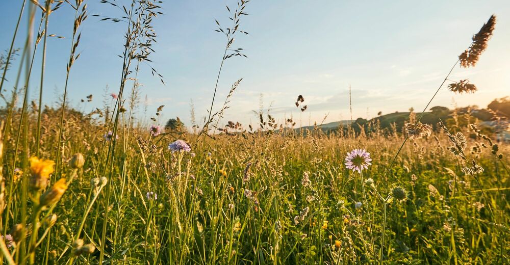
Experience "pure solitude" in the Biosphärenpark Wienerwald. A very special hike.
- Difficulty
-
difficult
- Rating
-
- Starting point
-
Laaben
- Route
-
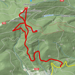
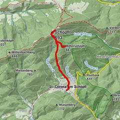
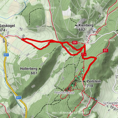
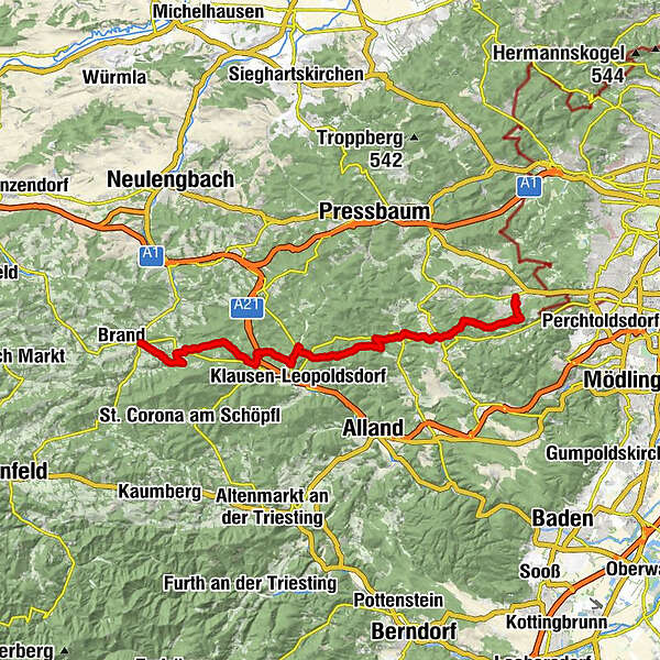
LaabenLand Gasthof zur Linde0.0 kmHofern0.9 kmGasthaus Forsthof3.9 kmGasthof Fam. Stegermaier5.2 kmHametberg (602 m)5.6 kmKleinkrottenbach12.8 kmGföhler20.3 kmGruberau23.3 kmSchusternazl23.3 kmGasthof Wöglerin25.1 kmWöglerin25.5 kmHelenenquelle29.9 kmLattermaißberg (452 m)30.6 kmSantorini im Grünen Baum33.5 kmBreitenfurt Ost33.5 km
- Best season
-
JanFebMarAprMayJunJulAugSepOctNovDec
- Description
-
Tip/Fun-Fact: “Pure solitude” is the slogan for this hiking route. Enjoy the tranquillity and the seclusion – a sharp contrast to the hustle and bustle of everyday life.
- Directions
-
From Laaben, we will hike eastwards, and take the first turn-off to the right (WWW 04, red). At the Icelandic horse farm, WWW 04 branches off to the left, and leads to the golf course. Once there, we will leave WWW 04 and bear right onto an unmarked route. Back on the country road, we will head eastwards, crossing the Lammeraubauch (no bridge!) after approx. 500 m, and hike to Klein- Krottenbach. We will head north along the country road, for approx. 12 km until we reach the lumber yard, and then turn right towards Schusternazl, once again passing through Kleiner Winkelberg and the “Die Woeglerin” inn. The next step is to follow a blue signposted, 700 m walking route along the country road to Stangau. Once there, we will turn left towards Eichberg and Gernberg. At the “Sieben Eichen” rest point, we will keep left until the sports field, and then bear left through the forest, following the blue route. After passing the red cross, we will switch to the green route marked (after approx. 600 m). The trail will take us to Breitenfurt, where our hike ends at the sports field.
- Highest point
- 626 m
- Endpoint
-
Breitenfurt
- Height profile
-

- Equipment
-
sturdy shoes, water, rain protection
- Tips
-
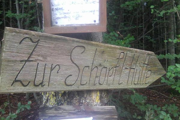
Rest points Landgasthof zur Linde Schöpfl Schutzhaus Gasthaus Stegermaier Landcafe Breitenfurt
Updated on: 12.11.2020
- Public transportation
-
Arrival with public transport
Start point: by bus to the stop "Laaben Hauptplatz"
End point: by bus to the stop "Breitenfurt Grüner Baum" - Parking
-
At the community office Laaben
At the sportfields Breitenfurt
- Author
-
The tour “Pure solitude” from Laaben to Breitenfurt is used by outdooractive.com provided.


General info
-
Wienerwald
4209
-
Elsbeere-Wienerwald
1216
-
Klausen-Leopoldsdorf
502