


- Brief description
-
The footpath from the Knappenhof via the Törlweg is the perfect mountain trail that leads up to the Ottohaus on the Raxalpe.
- Difficulty
-
difficult
- Rating
-
- Starting point
-
Knappenhof car park
- Route
-
Henriettenkapelle0.1 kmHirschwang an der Rax0.4 kmKnappenberg2.2 kmLammelbrünnl4.0 kmTörlkopf (1,607 m)5.9 kmStaiger-Fenster5.9 kmTörl6.0 kmSchwaigboden6.1 kmOttohaus6.4 km
- Best season
-
JanFebMarAprMayJunJulAugSepOctNovDec
- Description
-
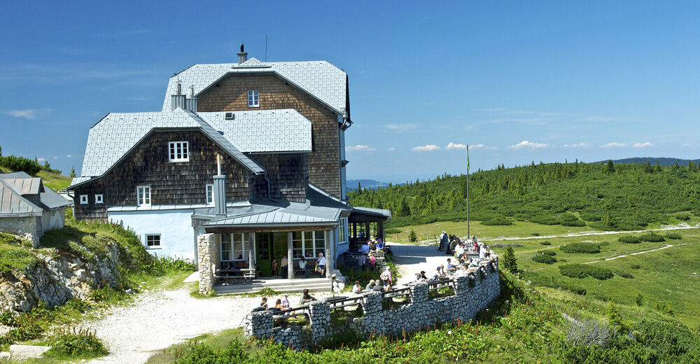
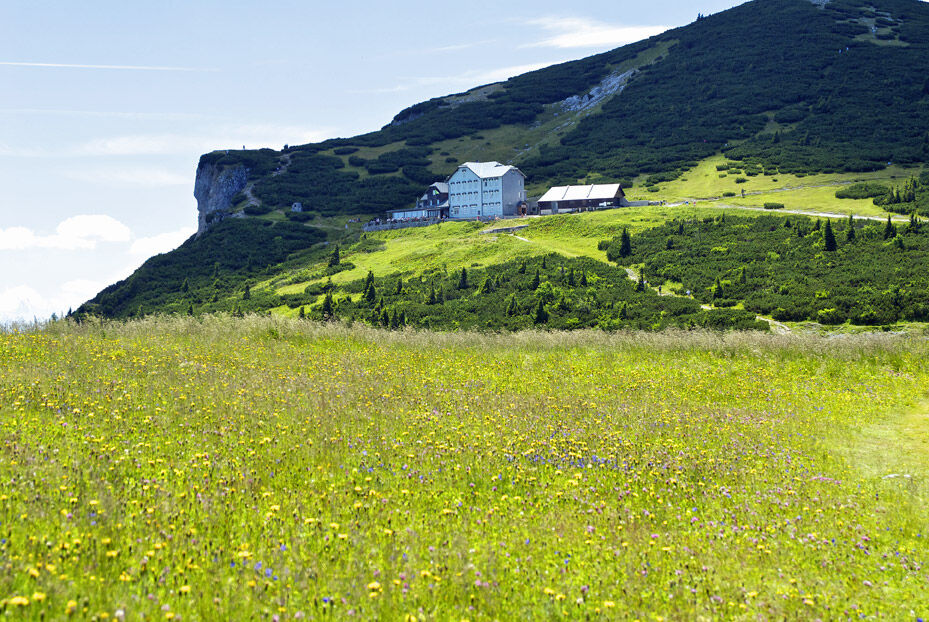
This route on the Rax will take you way up high! Built on the Raxalpe in 1893, the Ottohaus is situated at 1,644 metres above sea level and has attracted countless visitors. Even Sigmund Freud visited the rustic Ottohaus, and stayed there overnight. You can walk from Knappenberg (768 m) to this mountain inn in under 3 hours. If you choose to, you can build up your strength in Knappenhof before the tour. The route leads straight across the path along the Viennese Alpine Arc. You can also get to the Knappenhof on this route, by starting in Payerbach or Reichenau and following the blue signs for the Viennese Alpine Arc. It is also possible to start in Edlach an der Rax. This is ideal if you arrive by public transport. The Ottohaus is part of the “inn-hopping” trail on the Rax. This means that you can also easily reach the Raxalpen Berggasthof inn, which is in the direct vicinity of the Rax cableway mountain station.
No matter which route you choose, the Ottohaus invites you to relax. Whether you stay overnight, or just stop for a rest and a view of the 400 sqm Rax Alpine Garden with 200 plant species typical of the Rax and Schneeberg area, or choose to rebuild your strength – for example by tucking into the legendary Holzfällerbraten (“lumberjack roast”), the Ottohaus is not to be missed.
- Directions
-
We will start the hike from the car park of the Knappenhof hotel. We will go straight on, following an asphalted road. At the right-hand bend, we will continue to follow the hiking trail by going straight on. When we reach a fork in the road, we will bear left. We follow this path for approx. 800 m, and then make a sharp right turn. We will cross a road, and continue to follow the hiking trail. At the next opportunity, we will turn left onto the path. When we reach a fork in the road, we will bear right. We will go uphill along the Törlweg path, which includes some bends, and straight to the Ottohaus.
- Highest point
- 1,639 m
- Endpoint
-
Ottohaus auf der Rax inn
- Height profile
-

- Equipment
-
Always take appropriate maps with you. Wear sturdy shoes suitable for the tour, and bring sun and rain protection, as well as water and snacks. Take your mobile phone with you and add the emergency number for Mountain Rescue to your contact list: 140
- Safety instructions
-
Your walks in the Viennese Alps should be a thoroughly enjoyable and safe experience. Please therefore take note of the following:
Preparation
When choosing the route, make sure it is suitable for your level of fitness and experience. Consult the weather forecast in advance. The weather can change with surprising rapidity in the mountains. Always make sure that you are suitably equipped before setting out (e.g. rain protection).
Check whether the inns and snack stations you intend to visit en route are open. Before setting out, inform someone which route you are taking and when you expect to return.
- Additional information
-
Wiener Alpen in Niederösterreich, www.wieneralpen.at, +43 / 2622 / 78960
Schutzhütte Ottohaus, www.raxalpe.com/de/schutzhuette-ottohaus-home
- Directions
-
From Vienna, follow the A2 southern motorway. Turn onto the S6 express road, and take the exit for Gloggnitz. Follow the B27 to Reichenau an der Rax, go straight on at the roundabout, and then turn left onto Trautenberg Strasse. Trautenberg Strasse continues to the left and becomes Hirschwang an der Rax. Head from Hirschwang to Thonberg. Turn right and then left, to stay on Thonberg. Follow the road to the Knappenhof hotel.
From Graz, follow the S35 or A2 southern motorway. Turn onto the S6 express road, and take the exit for Gloggnitz. Follow the B27 to Reichenau an der Rax, go straight on at the roundabout, and then turn left onto Trautenberg Strasse. Trautenberg Strasse continues to the left and becomes Hirschwang an der Rax. Head from Hirschwang to Thonberg. Turn right and then left, to stay on Thonberg. Follow the road to the Knappenhof hotel.
- Public transportation
-
Take a regional train (final destination Payerbach-Reichenau) from Vienna via Wiener Neustadt to the terminus. Take a taxi to the Knappenhof hotel, or catch the number 1748 bus (final destination Prein/Rax Gh Oberer Eggl). Alight at Edlach or Dörfl. From there, the starting point is approx. 30 minutes on foot.
- Parking
-
Parking spaces are available outside the Knappenhof hotel.


- Author
-
The tour Hiking to the Ottohaus ( from the Knappenhof) is used by outdooractive.com provided.


General info
-
Hochsteiermark
4066
-
Waldheimat
2182
-
Reichenau / Rax - Raxalpe
930


