


- Brief description
-
Regional Route B is a high-altitude hike with numerous views across the whole of the Viennese Alps region. The Regional Routes are part of the network of paths making up the Viennese Alps (WAB) route. Hikes along these routes lead you to unique views and also insights. The Regional Routes are linked to the network of paths making up the Viennese Alps route. This results in circular hikes in conjunction with the long-distance path.
- Difficulty
-
medium
- Rating
-
- Starting point
-
Krumbach municipal office, in the town centre
- Route
-
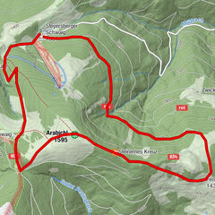
Krumbach - MarktSt. Stefan0.1 kmWiesfleck4.9 kmWetterkreuzriegel (855 m)5.1 kmGasthof Maria Schnee12.2 kmKaltenberg12.4 kmMaria Schnee12.6 km
- Best season
-
JanFebMarAprMayJunJulAugSepOctNovDec
- Description
-
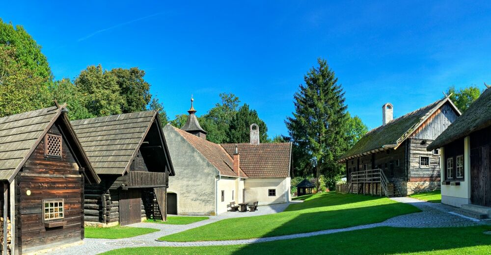
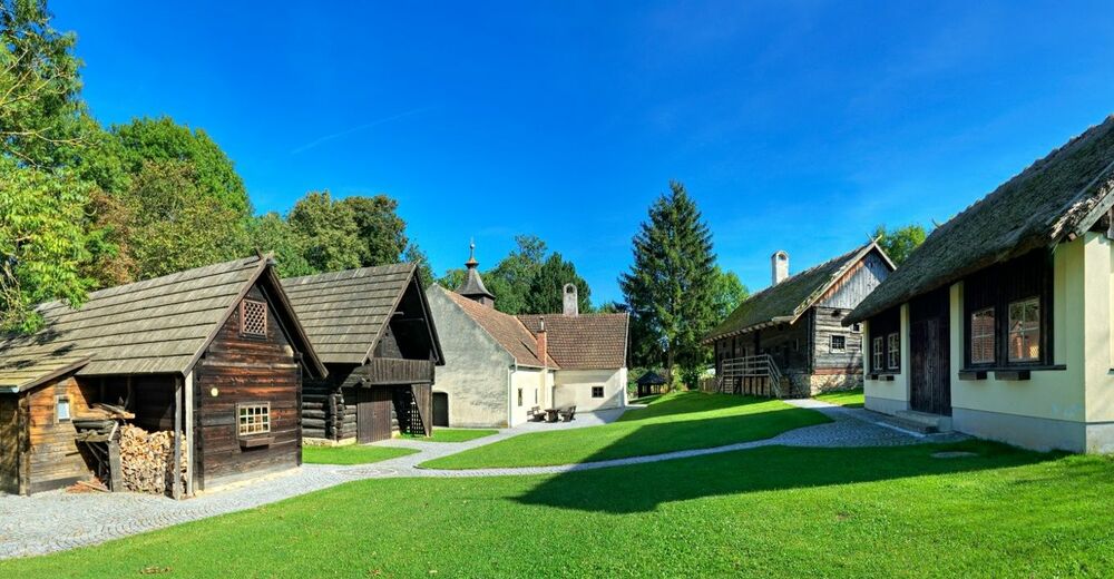
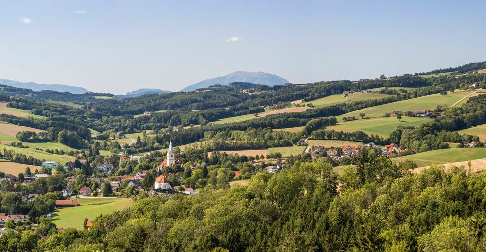
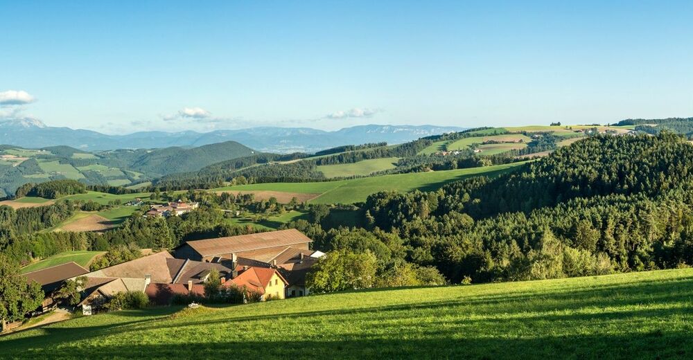
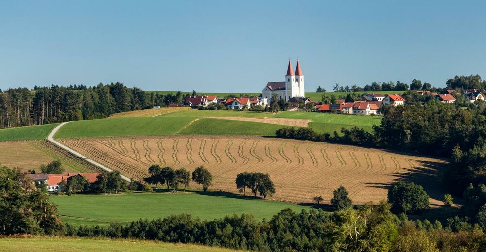
Experience the fascinating atmosphere of the Bucklige Welt, an atmospheric range of hills, a rural cultivated landscape that radiates honoured traditions and authenticity, a paradise of views and of insights, a landscape full of harmony. This section is a high-altitude hike in hilly terrain with splendid views across the whole of the Viennese Alps. The highlight at the start of the hike is the historic market in Krumbach. The highlight at the end is the Maria Schnee Pilgrimage Church in the traditional village of Kaltenberg.
- Directions
-
The start of Regional Route B is located at the municipal office in Krumbach. We hike slightly uphill to Pfarrkirche St. Stefan and then head right into Kirchengasse. At the end of this short alley we turn slightly left into Knappenhofweg. Whilst consistently climbing, we head towards the highest point of the tour. We reach the Knappenhof around half-an-hour after the start going past the first farm. From here onwards the terrain is not paved, but becomes field paths (with occasional blue markings).
We hike through a rural cultivated landscape, past a small forest, and ascend to even higher altitudes. There are magnificent views of the Bucklige Welt and beyond on the way to a wayside shrine. Shortly afterwards we turn right onto a field path which is part of an unusual crossroads as we ignore the paved road signposted as a hiking route on the left past the farmhouse. We head uphill through a wood and then come across a solitary tree and a small chapel next to a paved road. We briefly walk northwards along this road and then turn onto a field path offering great views after a few metres. However, this is only short as we soon enter the woods again and ascend to the highest part of the route. At this point we are not much lower than the 896 metre high Kühriegel, which is the same altitude as the Hutwisch at Hochneukirchen. Hiking downhill once again, we come to a road, turn right through the tiny hamlet of Wiesfleck, turn directly at the chapel and then opposite the fire brigade turn left onto a field path and follow the avenue of trees. At the end of a long straight section, we turn left and head north. Continue along the subsequent rough track through Ebenhof and head slightly downhill along the attractive road to the hamlet of Grub. The route continues north and slightly uphill past Winterhof before being constantly up and down towards the crossroads in Sonnberg. The final destination of Regional Route B, the Maria Schnee Pilgrimage Church, is very close. Once in Sonnberg, we turn right onto Panoramastraße, follow the road and then turn right onto Hauptstraße in Kaltenberg. We reach the Gasthof Maria Schnee (Maria Schnee Inn) after a few minutes on Hauptstraße, whilst the narrow road to the Wallfahrtskirche branches off to the right just in front of it. It is possible to stay overnight at Maria Schnee Inn. When in Kaltenberg it is possible to carry on the Viennese Alps route and you can continue hiking to either Wiesmath or Thernberg. A descent to Edlitz-Grimmenstein railway station is possible on Regional Route F. Buses between Wiener Neustadt Hauptbahnhof and Lichtenegg stop in Kaltenberg.
- Highest point
- 867 m
- Endpoint
-
Maria Schnee Pilgrimage Church in Lichtenegg
- Height profile
-

- Equipment
-
Always bring suitable maps. Always wear appropriate, sturdy footwear, bring sun and rain protection and water, as well as a little something to eat. Bring your mobile phone with you and save the mountain rescue emergency number: 140
- Safety instructions
-
Your hiking experience in the Vienna Alps should be a thoroughly enjoyable and safe one. Therefore, please bear the following in mind:
Preparation
When choosing a route, make sure it corresponds to your experience and physical fitness level. Check the weather forecast before you set off. The weather can change surprisingly quickly in the mountains. Always take appropriate equipment with you (e.g. rain protection).
Check whether the cabins and snack stations you intend to visit along the way are open. Inform someone before you set off of your chosen route and when you plan to return.
- Tips
-
Combine your hike with a stay at the Krumbacherhof, ran by the Ottner family.
It is also possible to stay at Maria Schnee Inn near the Wallfahrtskirche.
- Additional information
- Directions
-
If coming from Vienna on the A2 travel as far as the Krumbach exit, then take the A55 to Krumbach. If coming from Graz carry on as far as the Aspang exit, continue on the L137 to Zöbern, then veer left towards Kampichl on the L137, then change over to the B55 at Unterhaus.
- Public transportation
- Parking
-
Car parking is available at Krumbach municipal office.


- Author
-
The tour WAB - Regional Route B: Krumbach - Maria Schnee is used by outdooractive.com provided.


General info
-
Wiener Alpen
3044
-
Wechselland - Wiener Alpen
1702
-
Lichtenegg
251

")


