


- Brief description
-
Regional Route I is from Kirchberg am Wechsel to Maria Schutz Pilgrimage Church. The Regional Routes are part of the network of paths making up the Viennese Alps (WAB) route. Hikes along these routes lead you to unique views and also insights. The Regional Routes are linked to the network of paths making up the Viennese Alps route. This results in circular hikes in conjunction with the long-distance path.
- Difficulty
-
medium
- Rating
-
- Starting point
-
Kirchberg / Wechsel municipal office
- Route
-
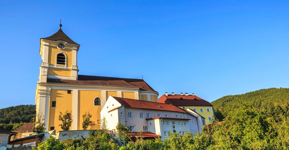
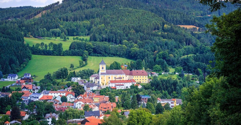
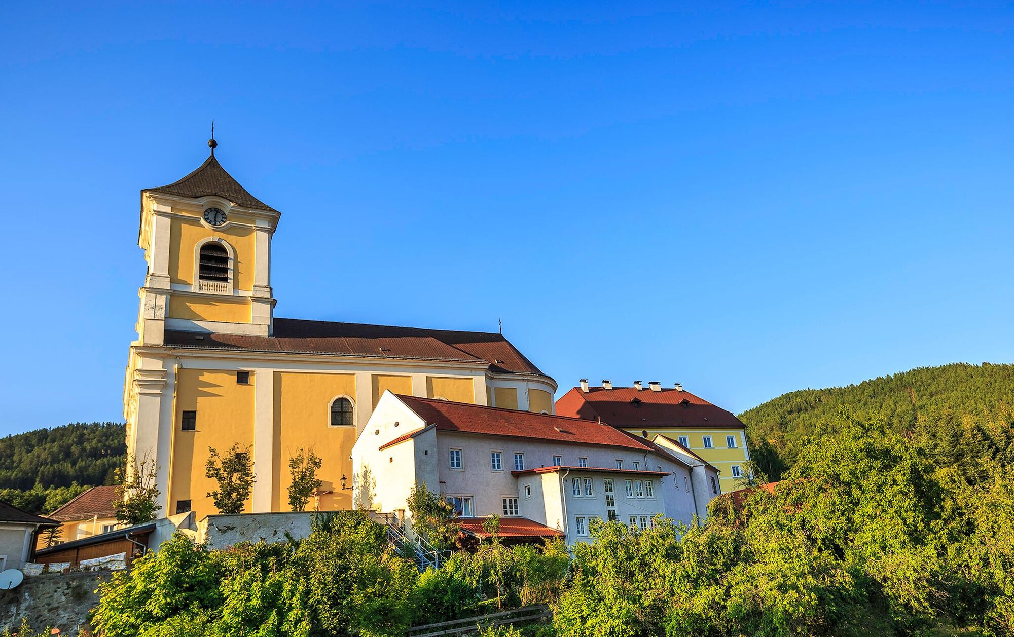
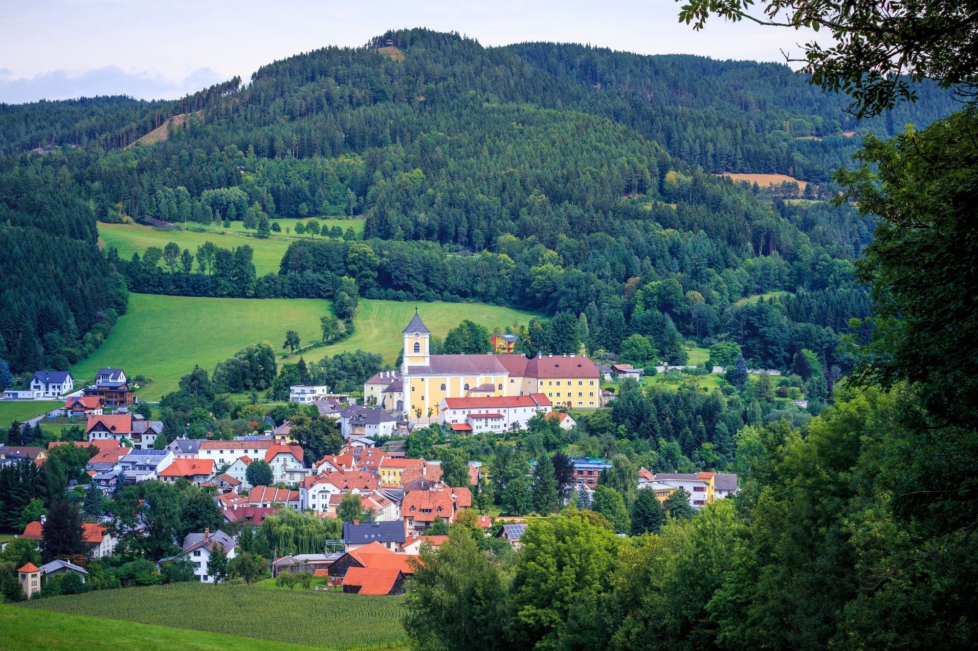
Kirchberg am Wechsel0.1 kmEselberg (974 m)3.0 kmSilo4.1 kmRamswirt4.9 kmGasthof Diewald, Waldpension9.0 kmRaach am Hochgebirge9.1 kmSt. Ägydius9.1 kmSchlagl10.0 kmSchanzkapelle12.2 kmGöstritzloch II13.3 kmWallfahrtskirche und Passionistenkloster Maria SchutzMaria Schutz15.3 kmKirchenwirt15.3 kmGasthaus Auerhahn - Familie Rumpler15.4 kmMaria Schutz15.4 km
- Best season
-
JanFebMarAprMayJunJulAugSepOctNovDec
- Description
-
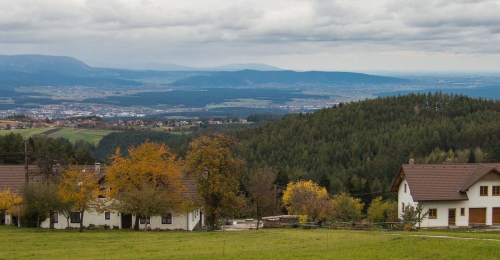
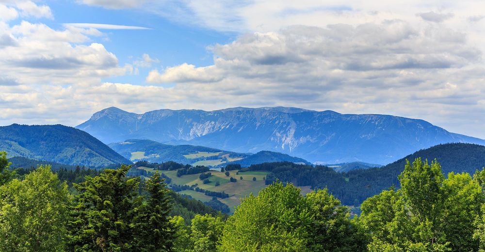
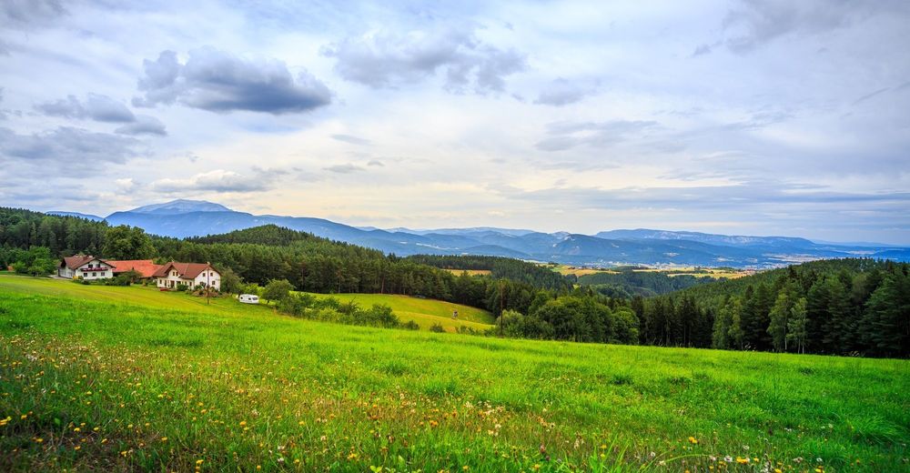
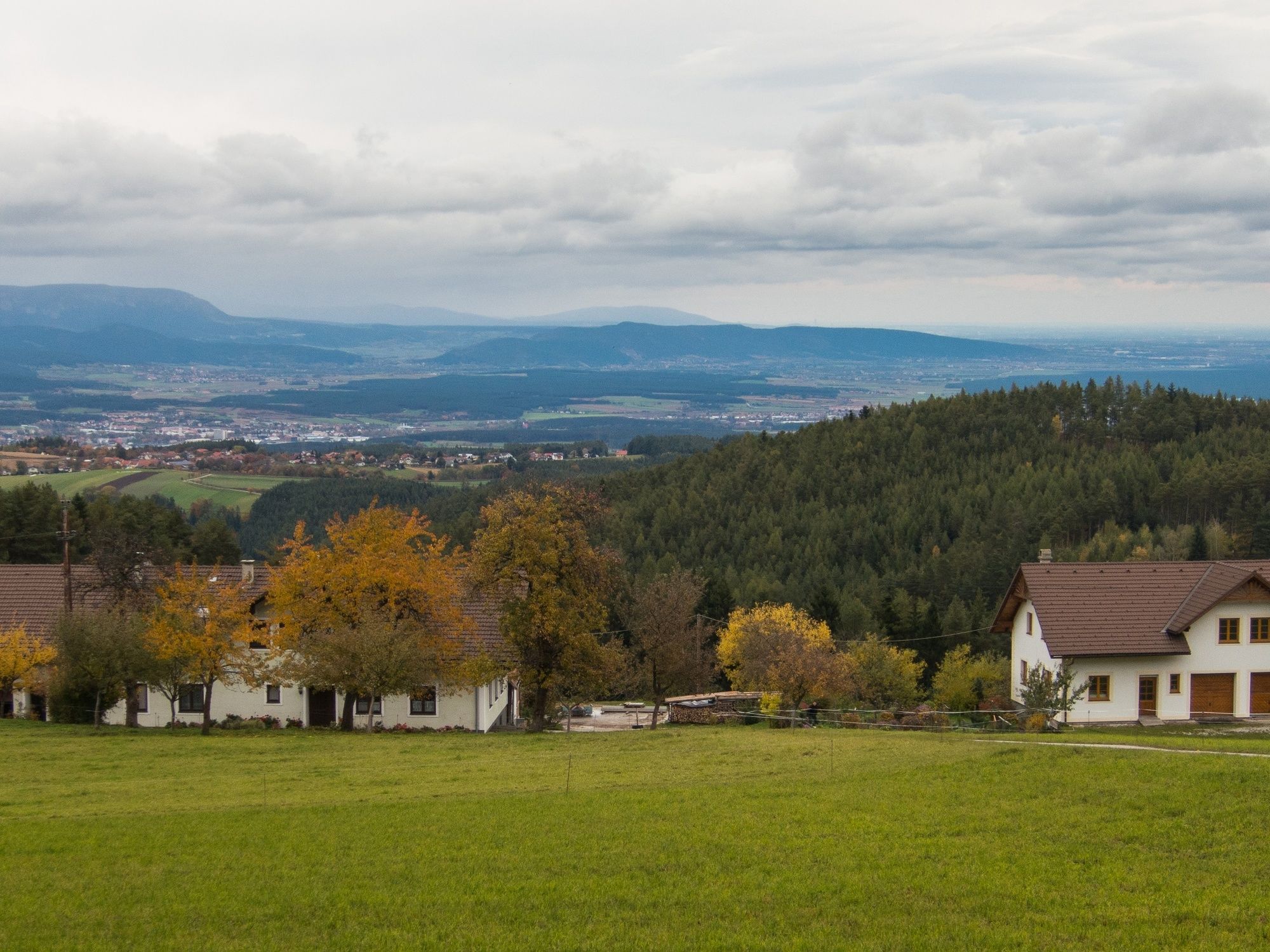
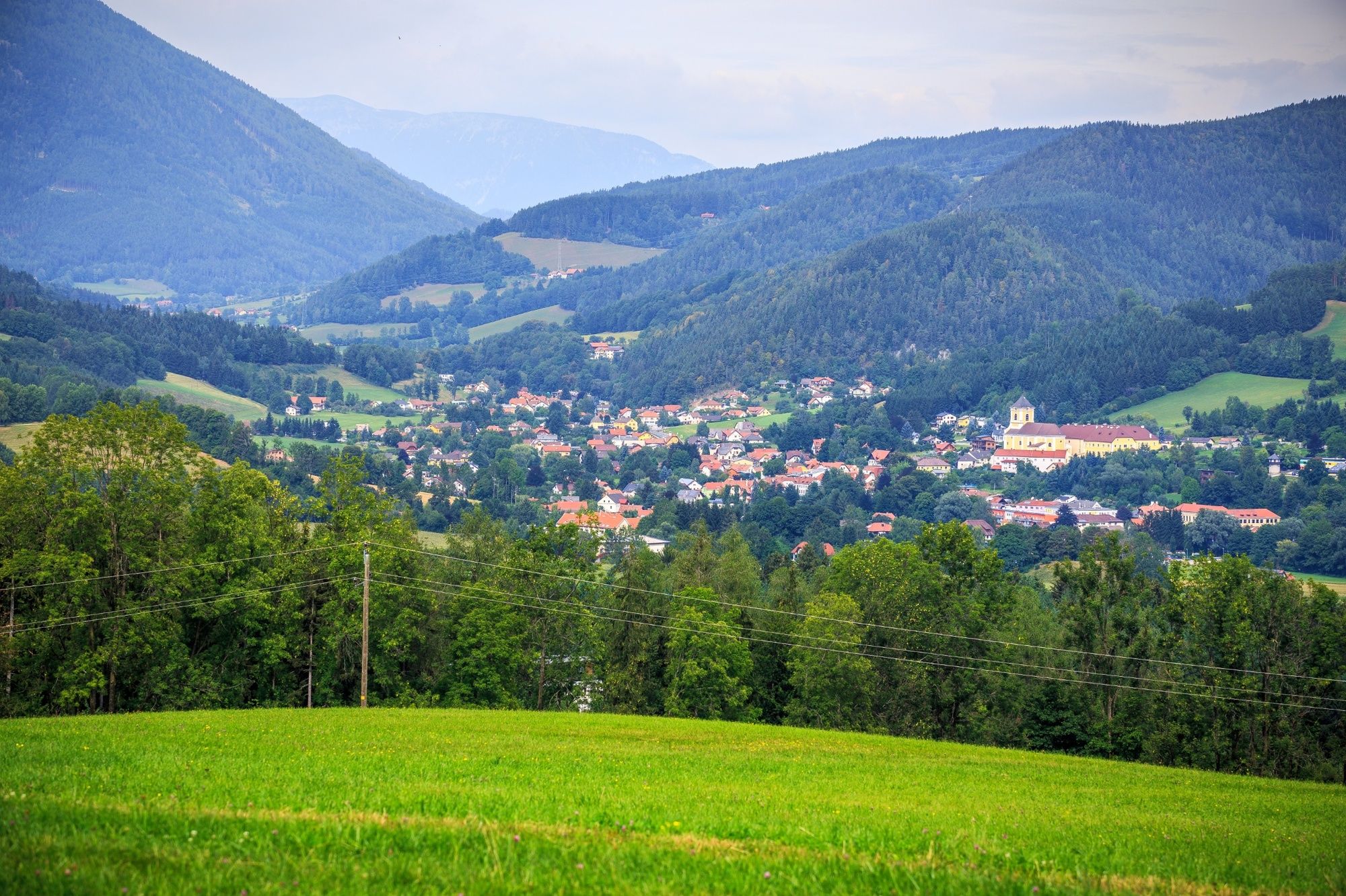
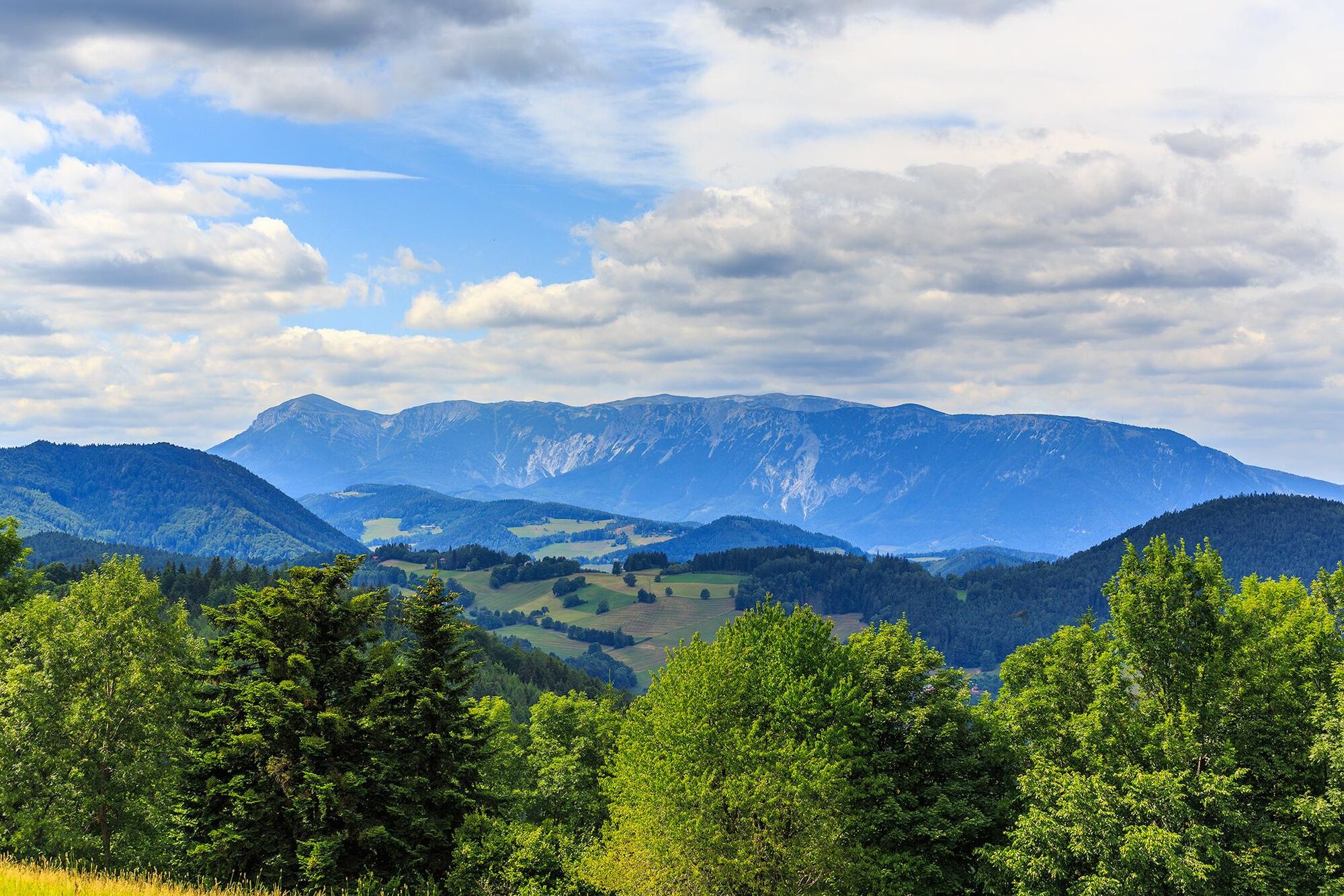
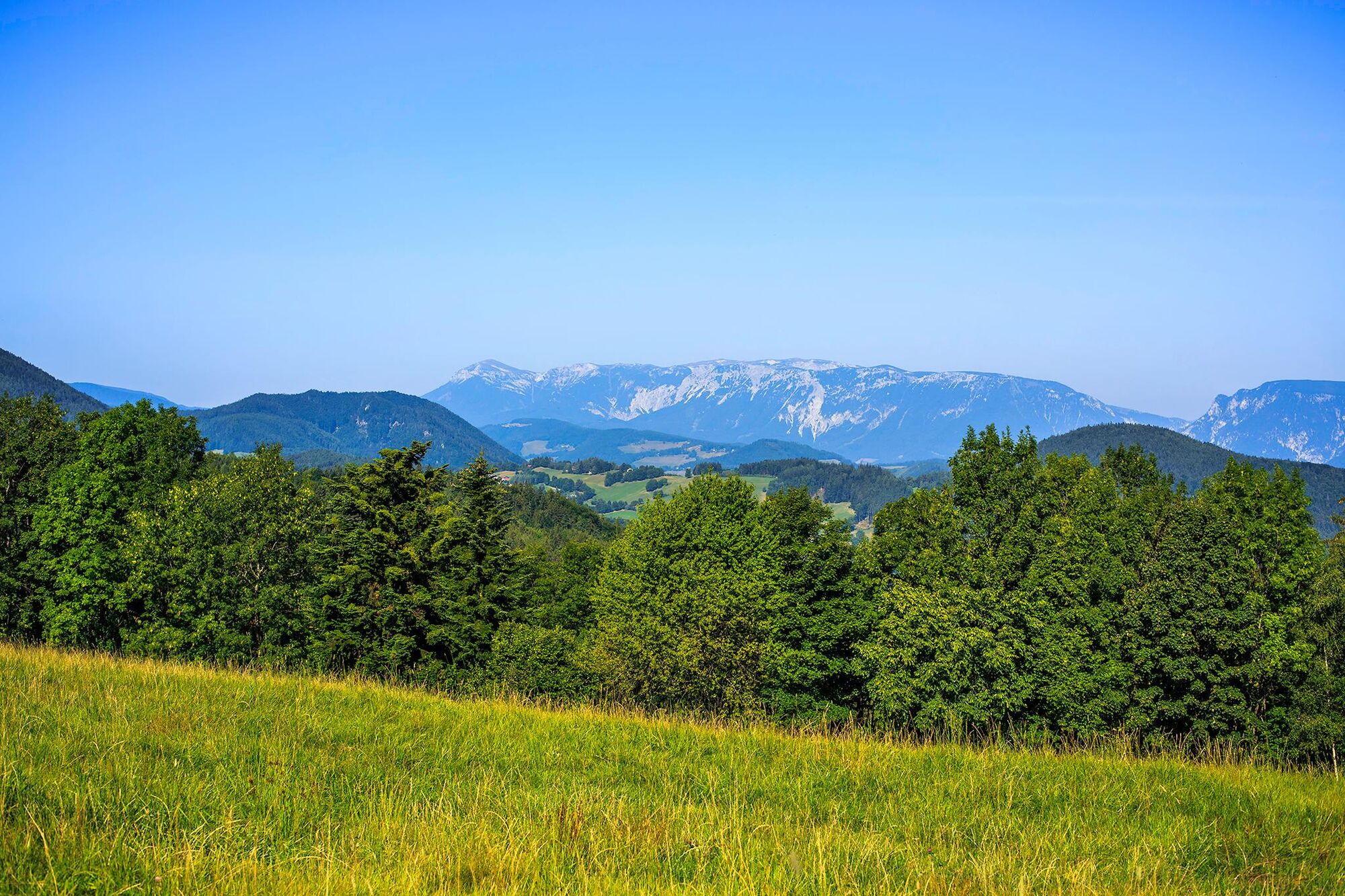
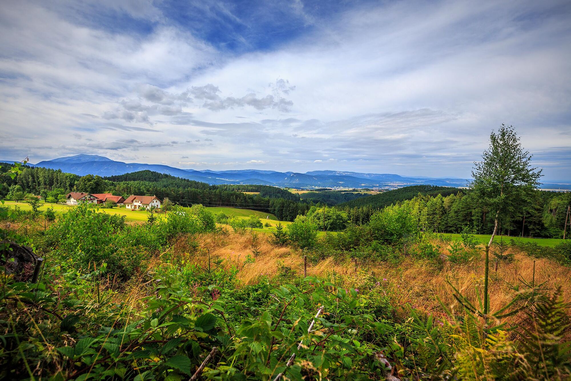
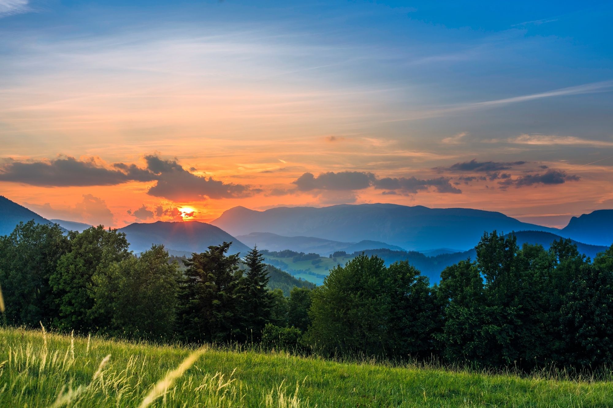
This route provides an appealing hike through a glorious cultivated landscape and is a veritable paradise for its views. After a brief ascent from Kirchberg/Wechsel in the valley, the next part is a comfortable hike over a crest - past the huge Fleckvieh cattle at Ramswirt - until finally catching a view of the construction site for the Semmering base tunnel and the picturesque pilgrimage site of Maria Schutz. The rural cultivated landscape always allows for atmospheric views of both sides of the ridge, conveying a pure sense of idyll in the countryside.
- Directions
-
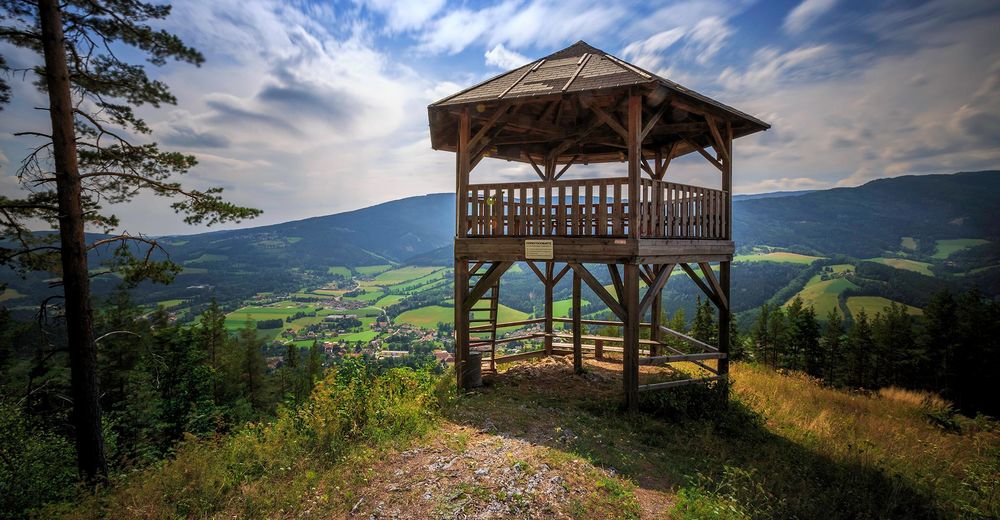
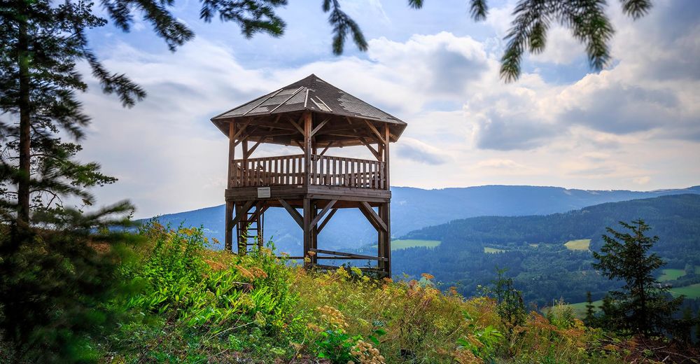
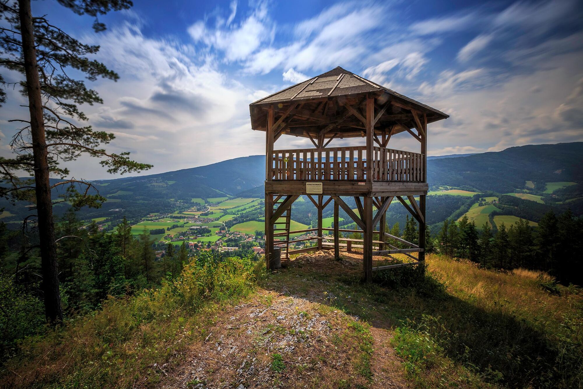
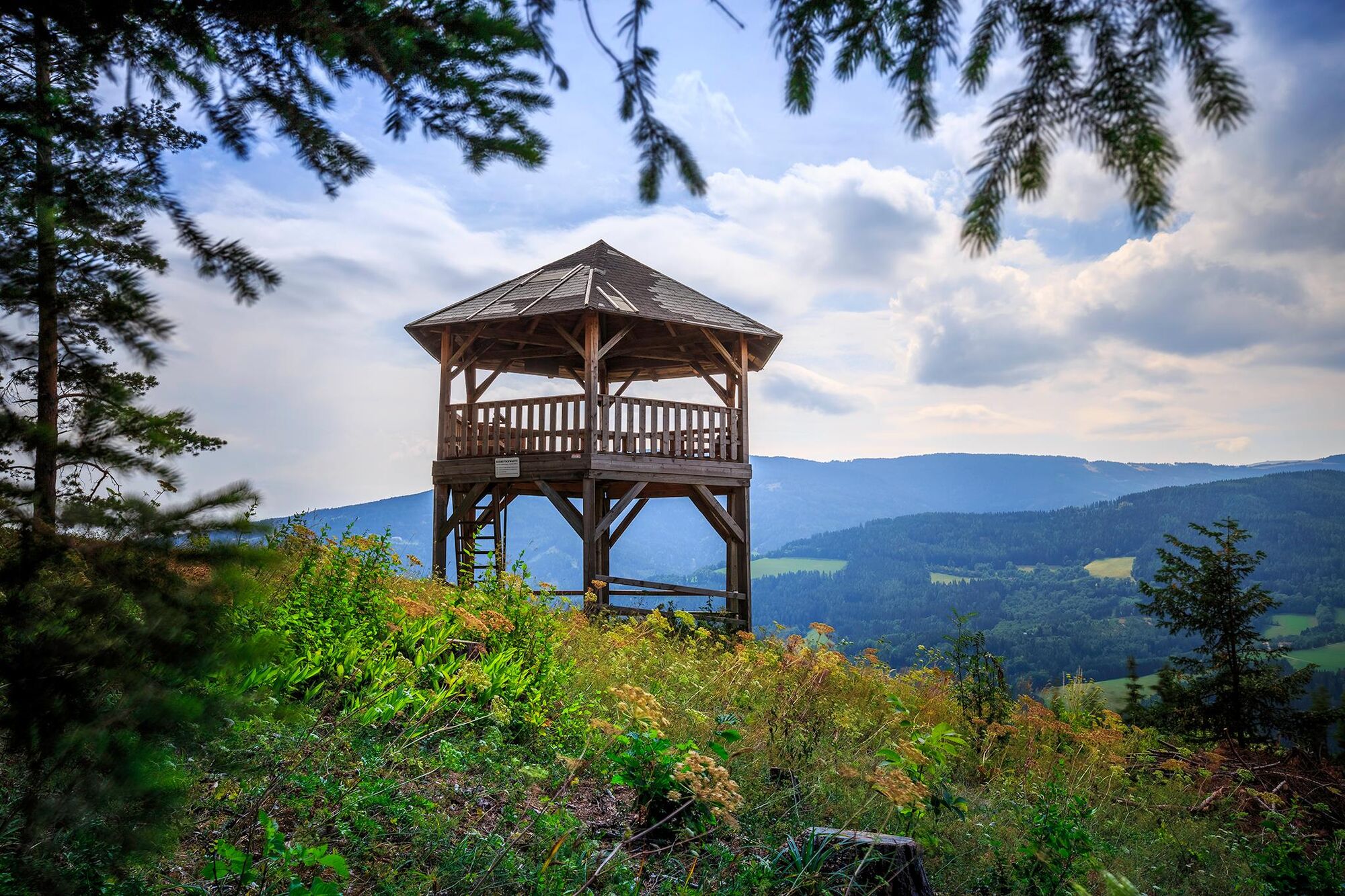
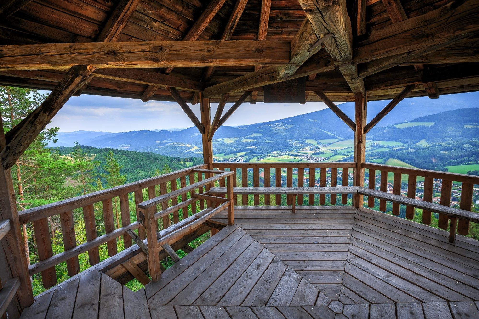
This starts with a hike along Regional Route I at Kirchberg am Wechsel municipal office. The start takes us uphill past Pfarrkirche St. Jakob and then soon onto a hiking path, which ascends almost 300 metres up to the Kalvarienberg and on to the Kernstockwarte observation point (marked in red). A detour to the observation point, which doesn't need a head for heights, is worth it. The highest part of the route has not yet been reached, as we hike across forest and cart paths, some offering wonderful views and others far more shadowy, along the western edge of the Eselberg before continuing northwards on another path towards Karlshöhe. The fact that this is not the highest part of the stage becomes clear after a few kilometres.
We turn left at the Karlshöhe summit and follow the track to Rams (also part of the North Alpine Way, marked in red). When behind Ramswirt we turn left at the car park and walk slightly uphill along the street. Head left a few minutes after a right-hand band, then turn right almost instantly afterwards on a cart track along the ridge. We come across a road and follow this in a north-westerly direction to Raach am Hochgebirge. When in the village we keep left and follow the road to Schlagl. We cross over the country road, head through the tiny hamlet of Schlagl, then head uphill to Schanzkapelle, go through a small dip, then reach the highest point of Regional Route I. We now walk down a steep descent towards Göstritz, leave the village and the construction site of the Semmering base tunnel to the right and wander south into the Göstritzbachgraben (partially marked in green), switch over to the other side of the ditch after a few minutes, then start a slight ascent up the Parapluieweg path. The hiking route takes us ever closer to the country road and subsequently also to Maria Schutz Pilgrimage Church. Regional Route I ends here. You now have the option of staying overnight at the Kirchenwirt next door, or keep hiking along Regional Route M to Payerbach or the Sonnwendstein. Otherwise, take the bus from Maria Schutz to Semmering or to Payerbach railway station. The Viennese Alps trail can be picked up again from any point.
- Highest point
- 979 m
- Endpoint
-
Maria Schutz Pilgrimage Church
- Height profile
-

- Equipment
-
Always bring suitable maps. Always wear appropriate, sturdy footwear, bring sun and rain protection and water, as well as a little something to eat. Bring your mobile phone with you and save the mountain rescue emergency number: 140
- Safety instructions
-
Your hiking experience in the Vienna Alps should be a thoroughly enjoyable and safe one. Therefore, please bear the following in mind:
Preparation
When choosing a route, make sure it corresponds to your mountain experience and physical fitness level. Check the weather forecast before you set off. The weather can change surprisingly quickly in the mountains. Always take appropriate equipment with you (e.g. rain protection).
Check whether the cabins and snack stations you intend to visit along the way are open. Inform someone before you set off of your chosen route and when you plan to return.
- Tips
-
Combine your hike with an overnight stay at Ramswirt and visit the bull show.
- Additional information
-
You may like to hike the adjoining routes:
WAB - Regional Route H: Kranichberger Schwaig - Kirchberg/Wechsel
WAB - Regional Route J: Payerbach - Waldburgangerhütte - Knofeleben
Viennese Alps in Lower Austria, www.wieneralpen.at, +43 / 2622 / 78960
Kirchberg am Wechsel tourist office, www.kirchberg-am-wechsel.at, +43 / 2641 / 2460
- Directions
-
If you are travelling from Vienna or Graz, take the A2 to the Edlitz or Grimmenstein exit. Head along the B54, turn onto the L134 and travel as far as Kirchberg am Wechsel.
- Public transportation
- Parking
-
Car parking is available at Kirchberg municipal office.


- Author
-
The tour WAB - Regional Route I: Kirchberg/Wechsel - Maria Schutz is used by outdooractive.com provided.


General info
-
Wiener Alpen
3035
-
Semmering - Rax
2302
-
Otterthal
613


