
- Brief description
-
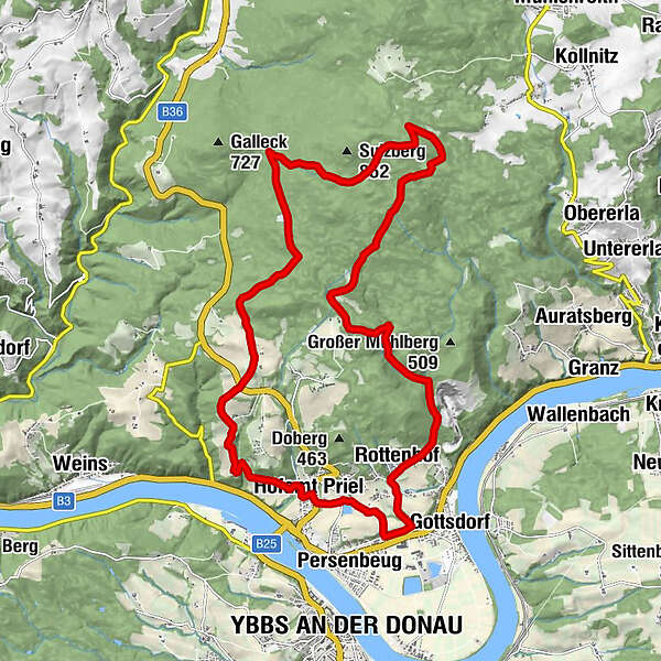
Weg Nr. 24
Eine Wanderung, wo Sie die Natur genießen und auch viel für Ihre Gesundheit und Wohlbefinden tun! Es erwartet Sie eine Kneippstelle, Rastplätze und besondere Steinformationen zum Kraft tanken. Der herrliche Ausblick weit in das Alpenvorland rundet die Besonderheit dieses Kneippweges ab.
- Difficulty
-
medium
- Rating
-
- Route
-
Hofamt Priel0.1 kmKnogl1.0 kmGasthof Nagl1.1 kmGartln2.3 kmEben3.8 kmNaturfreundestein18.4 kmRottenhof19.0 kmForsthub19.5 kmRehberg20.1 kmHofamt Priel22.2 km
- Best season
-
JanFebMarAprMayJunJulAugSepOctNovDec
- Highest point
- 785 m
- Endpoint
-
Parkplatz beim Gemeindezentrum
- Height profile
-

- Author
-
The tour Kreuzweg is used by outdooractive.com provided.
GPS Downloads


Other tours in the regions
-
Mostviertel
2453
-
Südliches Waldviertel
936
-
Hofamt Priel
204