


- Brief description
-
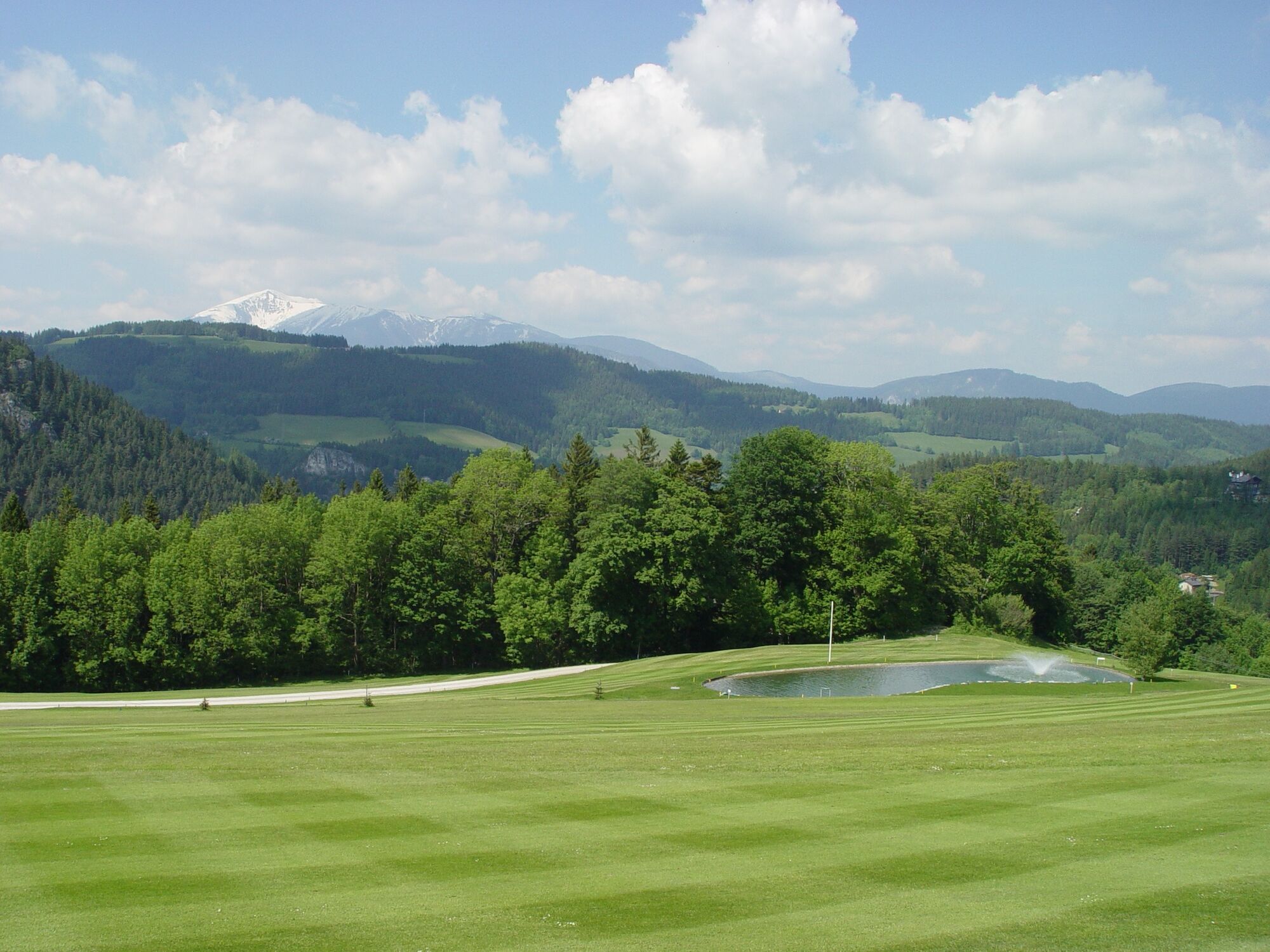
The Magic Views route follows part of the Bahnwanderweg, before heading back over the golf course to the Südbahnhotel, via the elevated road, to the top of the pass and back to the starting point, Semmering station. Let yourself be enchanted by the views!
- Difficulty
-
easy
- Rating
-
- Starting point
-
Semmering station
- Route
-
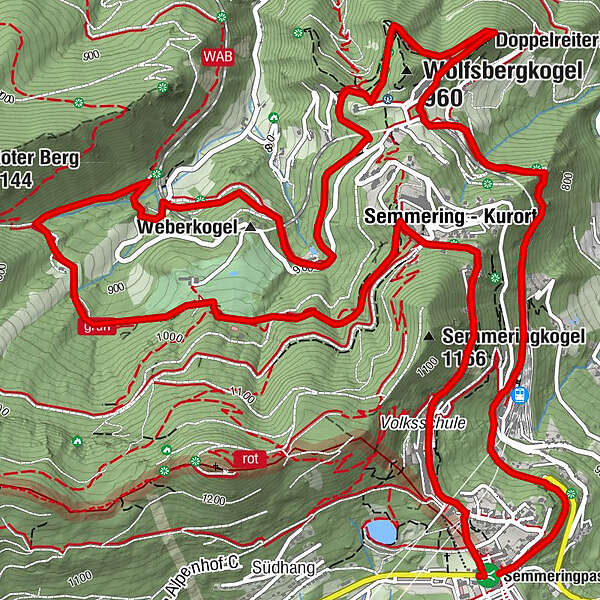
Kinderbahnhof Semmering1.7 kmSemmering - Kurort2.4 kmDoppelreiterkogel3.3 km20-Schilling-Blick3.9 kmAusschank Hinterholz5.6 kmSemmering - Kurort9.6 kmHl. Familie10.5 kmSemmeringpass (984 m)11.2 km
- Best season
-
JanFebMarAprMayJunJulAugSepOctNovDec
- Description
-
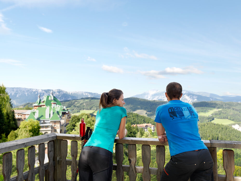
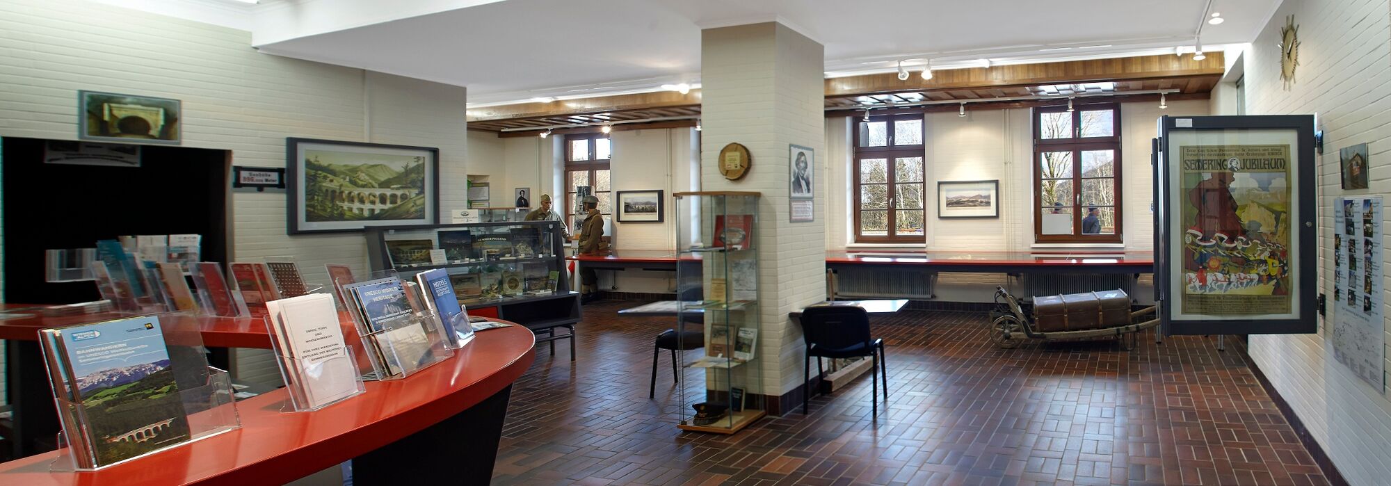
The route leads to the most beautiful viewpoints on the Bahnwanderweg, heading towards Breitenstein, and goes up to the Fleischmann Viaduct, where you can admire the impressive Semmering Railway, which is a UNESCO World Heritage Site. Enjoy enchanting views from the imposing Doppelreiter lookout post, and the 20 Schillingblick viewpoint. The route back to Semmering passes the golf course, imposing Semmering villas and the Hochstrassenmuseum (“high road museum”), where display cases are dotted along the road, giving an insight to the history of Semmering. Back at the starting point, Semmering station, you can visit the World Heritage Information Centre.
- Directions
-
Starting from Semmering station, our route will take us along the Lower Austrian Bahnwanderweg to the Doppelreiter lookout post and the 20 Schillingblick viewpoint. We will continue to the Fleischmann Viaduct. After the Fleischmann bridge, the Magic Views route splits from the Bahnwanderweg, and leads us past the golf course to the high road. We will pass old villas, the Holy Family parish church and the Panhans Hotel, and then go over the pass to where we started – Semmering station.
- Highest point
- 1,038 m
- Endpoint
-
Semmering station
- Height profile
-

- Equipment
-
Bring a suitable map. Wear suitable, sturdy shoes, and bring sun and rain protection, as well as water and a bite to eat. Bring your mobile phone, and save the emergency number of the mountain rescue team: 140
- Safety instructions
-
Walking in the Viennese Alps should be a completely safe and beautiful experience. Therefore, please note the following:
Trail conditions: Forest route
Preparation
Make sure that your choice of route matches your hiking experience and your physical condition. Check the weather forecast. In the mountains, the weather can change surprisingly quickly. For this reason, make sure you are well-equipped (e.g. bring rain protection).
Check that the huts and refreshment stations that you want to visit along the way will be open. Tell someone which route you have chosen, and when you hope to return, before you set off.
- Tips
-
Several information boards about the history of the World Heritage Site of the Semmering Railway, the Hochstrassenmuseum (“high road museum”) and a few geocaches along the way offer something for culture lovers and treasure hunters alike.
- Additional information
-
Hiking maps of Semmering are available for €1 from the tourist office.
Tourismusbüro Semmering, www.semmering.at, +43 / 2664 / 20025
Wiener Alpen in Niederösterreich, www.wieneralpen.at +43 / 2622 / 78960
- Directions
-
Go down the A2 motorway to the S6 Semmering dual carriageway, and take the Maria Schutz exit. Turn right, onto the L4168. Continue down Semmering/L4168 and Semmeringstrasse. Turn right, onto Bahnhofstrasse.
Go down the S6 Semmering dual carriageway, and take the Spital/Semmering exit. Turn left, onto Semmering Ersatz Strasse/B306. Continue along the B306. At the roundabout, go straight on to Semmering. Continue along Passstrasse – this turns slightly to the right and changes into Semmering. Turn left, onto Bahnhofstrasse.
- Public transportation
-
Semmering station is accessible by train from Vienna and Graz.
See www.oebb.at and www.vor.at for more information.
- Parking
-
Parking facilities are available at Semmering station.
- Author
-
The tour The Magic Views of Semmering route is used by outdooractive.com provided.


General info
-
Hochsteiermark
4082
-
Semmering - Rax
2314
-
Breitenstein
866


