
- Brief description
-
Wanderwege rund ums Mohndorf Armschlag
- Difficulty
-
easy
- Rating
-
- Route
-
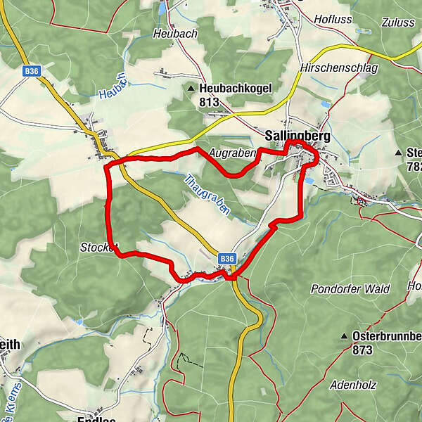
Gasthaus und Fleischhauerei, Familie Macher0.0 kmPfarrkirche, Johannes dem Täufer0.0 kmSallingberg0.0 kmLugendorf2.7 kmSchneiderwald3.6 kmArmschlag5.2 kmMohnwirt Neuwiesinger5.3 kmTeichstüberl7.3 kmSallingberg7.9 km
- Best season
-
JanFebMarAprMayJunJulAugSepOctNovDec
- Highest point
- 812 m
- Endpoint
-
Sallingberg
- Height profile
-

- Author
-
The tour Mohnleut'weg Nr. 11 is used by outdooractive.com provided.
GPS Downloads


General info
Refreshment stop
Other tours in the regions
-
Waldviertel
1778
-
Waldviertel Mitte
1246
-
Sallingberg
229