
- Brief description
-
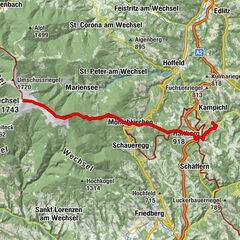
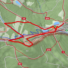
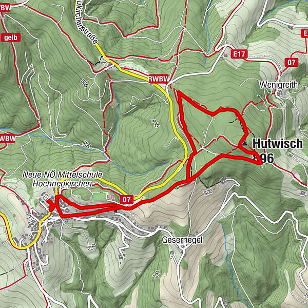
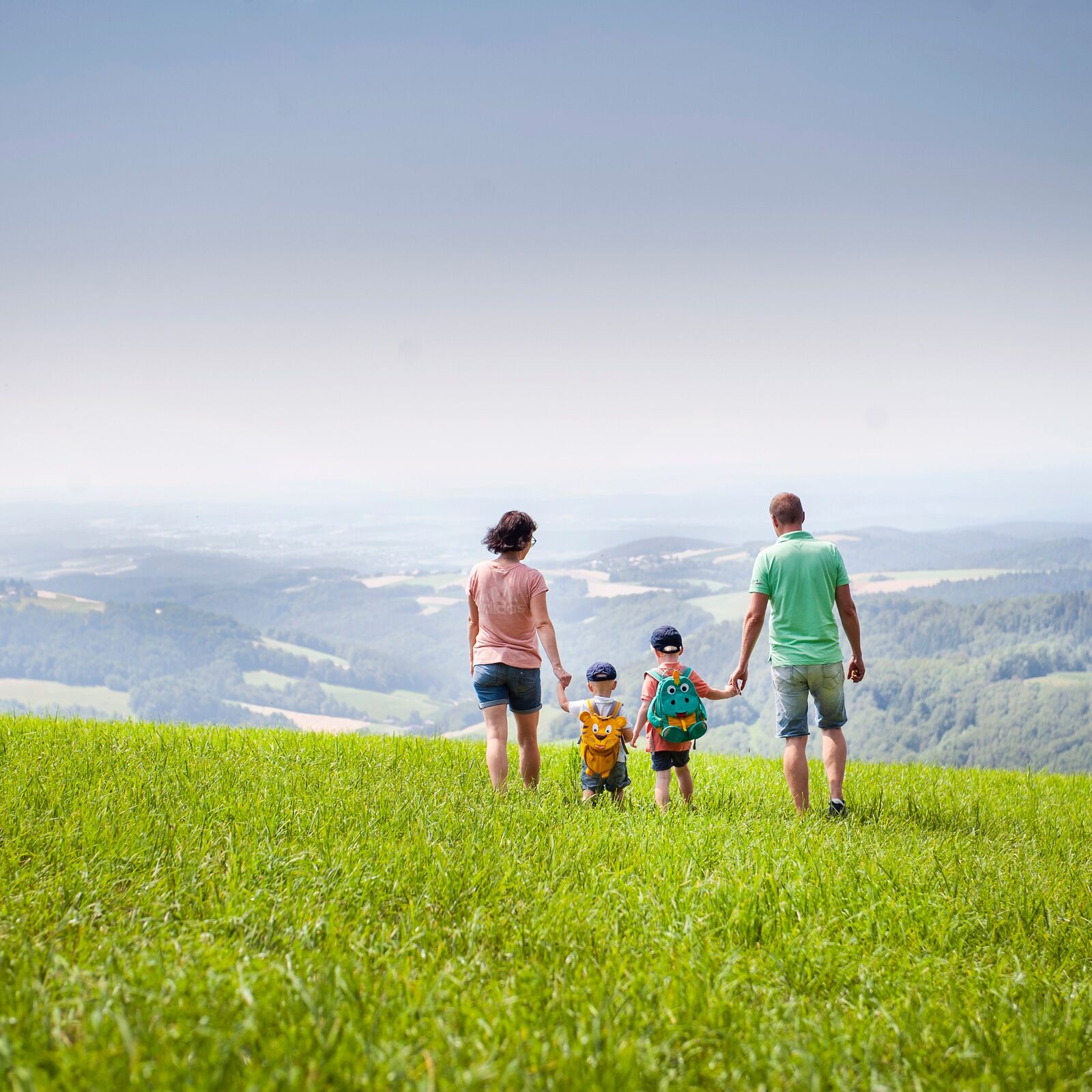
The circular trail with the Bakabu listening stations leads from Hochneukirchen to the Hutwischwarte and back again.
- Difficulty
-
medium
- Rating
-
- Starting point
-
Hochneukirchen town centre
- Route
-
Pfarrkirche Hochneukirchen0.1 kmHochneukirchen0.1 kmzur Linde0.3 kmHutwisch (896 m)2.3 kmHochneukirchen5.3 km
- Best season
-
JanFebMarAprMayJunJulAugSepOctNovDec
- Description
-
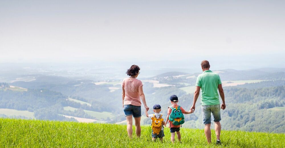
There are many listening experience stations for children and the young at heart along the route. A story for children is told over 9 stations (book & audio), in which “Bakabu” and his best friend, Charlie Gru, the clay pigeon, set off in search of the highest point in Austria’s “Bucklige Welt” – that place where the wind whistles more beautifully than anywhere else. On their way, they meet a different animal at each stop, which brings them a little closer to their goal. They learn the story of the bearded Gretel (“boardate Gretl”) and unravel the mystery of the legendary “Schimmel ohne Schädel”.
In between, recreation spots in the forest invite you to kick back and relax.
- Directions
-
The tour starts at the car park with large information board in Hochneukirchen. You can stock up on regional specialities at the information and refreshment point in the village, so that you are prepared for a rest along the way. The path is marked with birdhouses, which lead all the way to the observation point and back again.
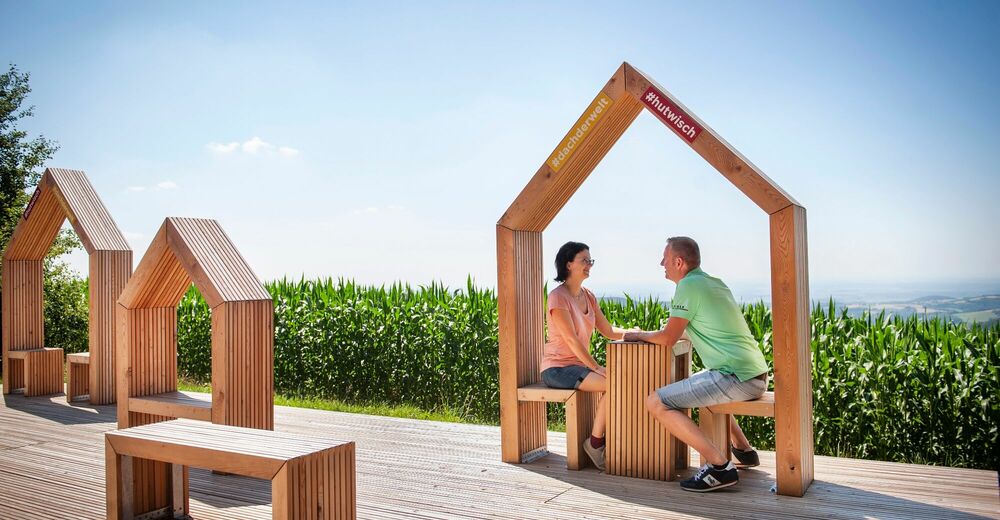
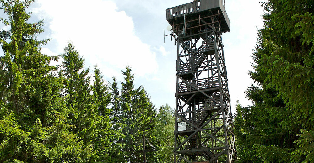
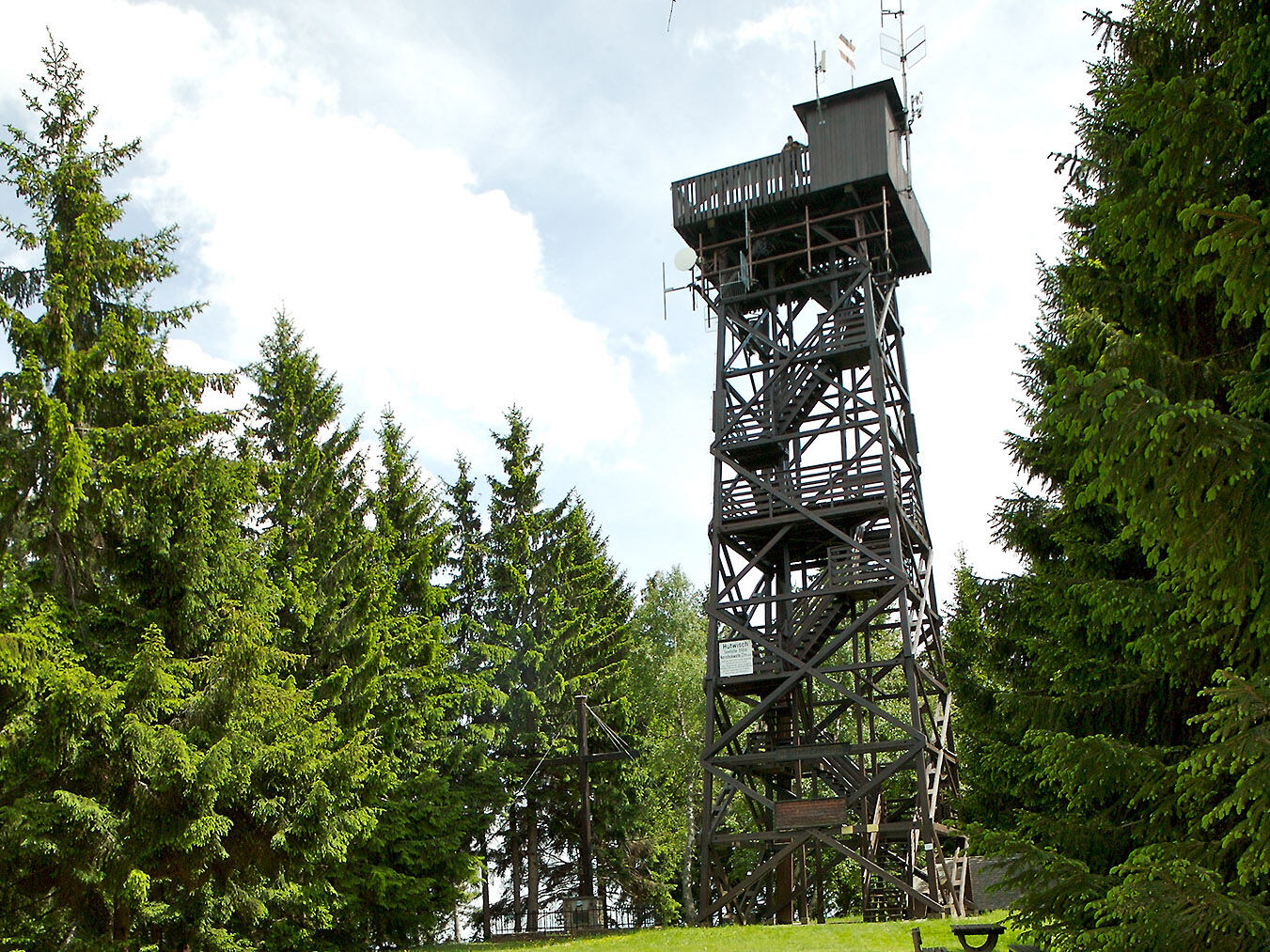
The loop then starts via Brunnenplatz, then left via Panoramastraße and Kurzen Weg. From there, keep to the right (always following the bird houses) until you reach the “Hutwischwarte”. There you can climb steps to the platform, from where you have a 360° view of 5 different states in good weather. The newly erected rest benches are ideal for a short break. The circular trail continues opposite the observation point and leads in a beautiful sweeping curve back to the starting point in Hochneukirchen. There, the Beiglböck pastry shop awaits to satisfying even the biggest hunger.
- Highest point
- 889 m
- Endpoint
-
Hochneukirchen town centre
- Height profile
-

- Equipment
-
Always take suitable maps with you. Wear sturdy shoes suitable for the tour, take sun and rain protection, as well as water and a snack. Take your mobile phone with you and save the emergency number of the mountain rescue: 140
- Safety instructions
-
Your hikes in the Vienna Alps should be a beautiful and safe experience all-round. Therefore, please note the following:
Preparation
When choosing a route, make sure it suits your mountain experience and physical condition. Check the weather forecast in advance. The weather can change surprisingly quickly in the mountains. Therefore, always go equipped accordingly (e.g. rain protection).
Check whether the huts and snack stations you want to visit on the way are open. Inform someone about your choice of route and your planned return before you set off.
- Tips
-
In the centre of Hochneukirchen, there is the parish church, which is part of the “Wehrkirchenstraße Bucklige Welt”. The upper floor has been extended and today is used for concerts and exhibitions.
- Arrival
-
From Vienna and Graz, it is about 100 kilometres to Hochneukirchen. Coming from Vienna, take the Krumbach exit, go through the village of Krumbach and then turn right towards Hochneukirchen. Coming from Graz, take the exit Pinggau, via Sparberegg to Gschaidt and continue to Hochneukirchen.
- Public transportation
- Parking
-
At the start of the circular tour, there are enough parking spaces in the centre of the village.


- Author
-
The tour “Bakabu” adventure hiking trail in Hochneukirchen is used by outdooractive.com provided.