
- Brief description
-
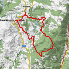
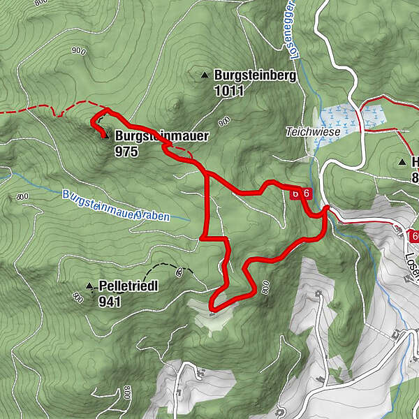
Path no. 17
- Difficulty
-
medium
- Rating
-
- Starting point
-
Country road between St. Oswald - Dorfstetten - Güterweg Undeutsch
- Route
-
Burgsteinmauer (975 m)1.9 km
- Best season
-
JanFebMarAprMayJunJulAugSepOctNovDec
- Description
-
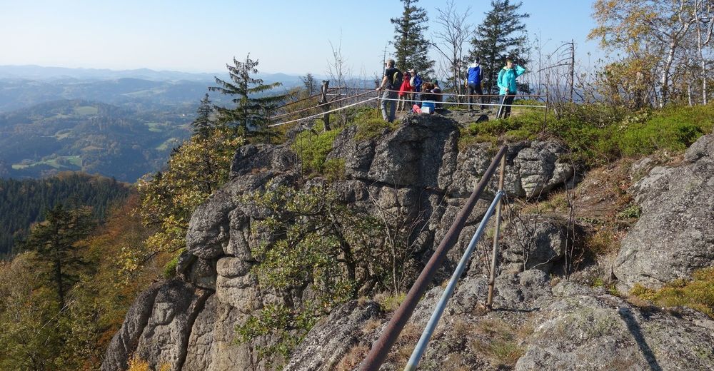
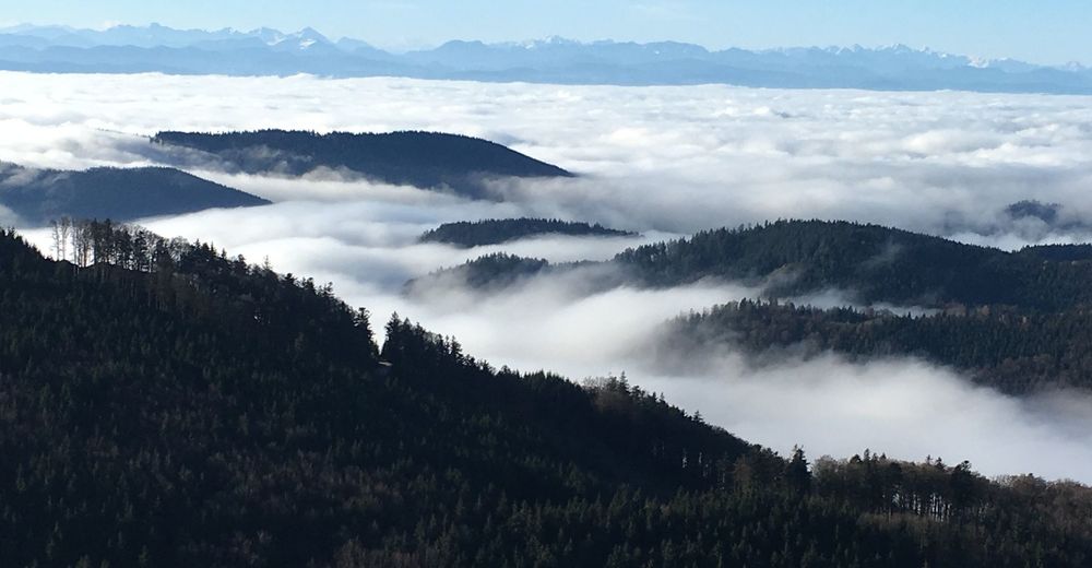
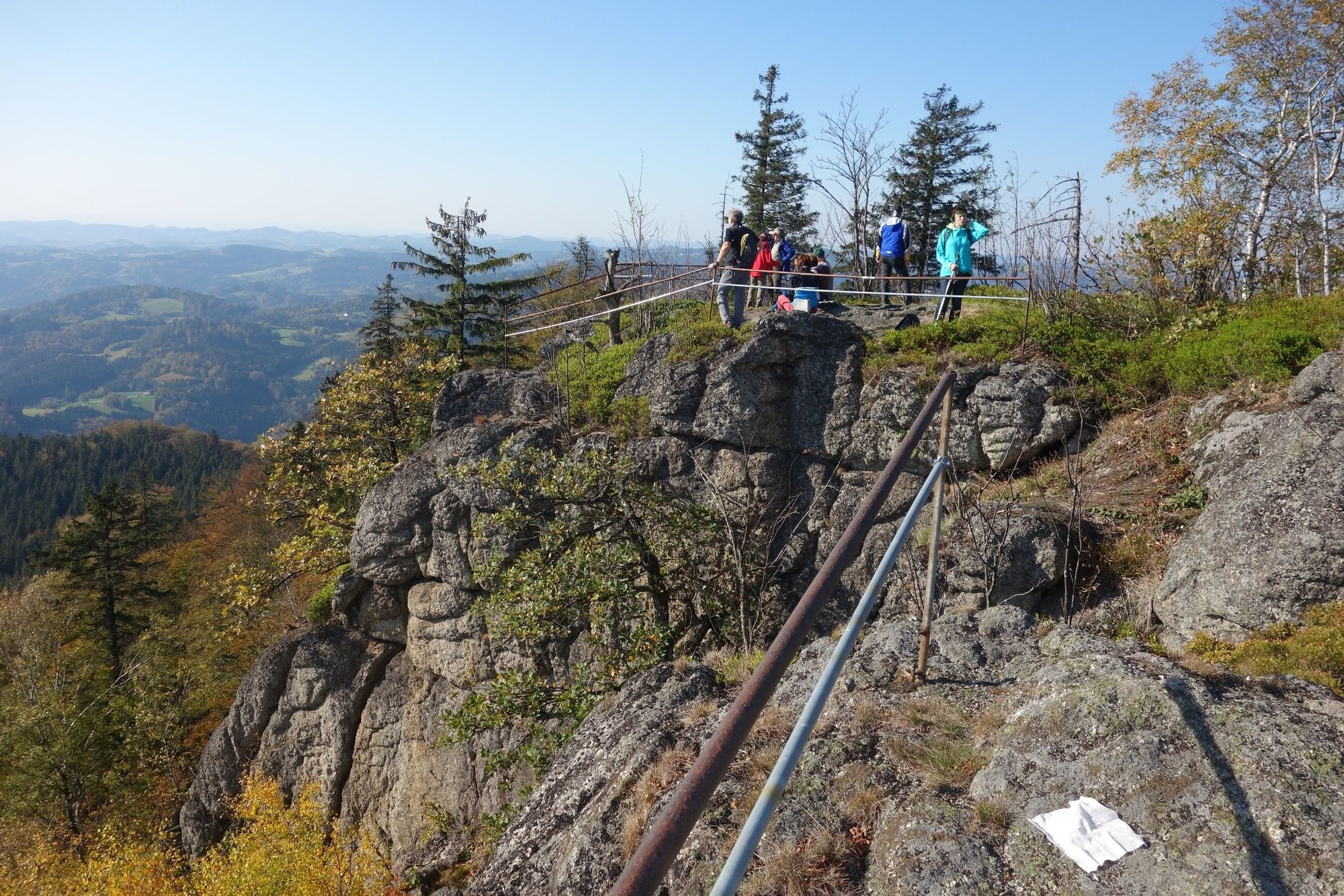
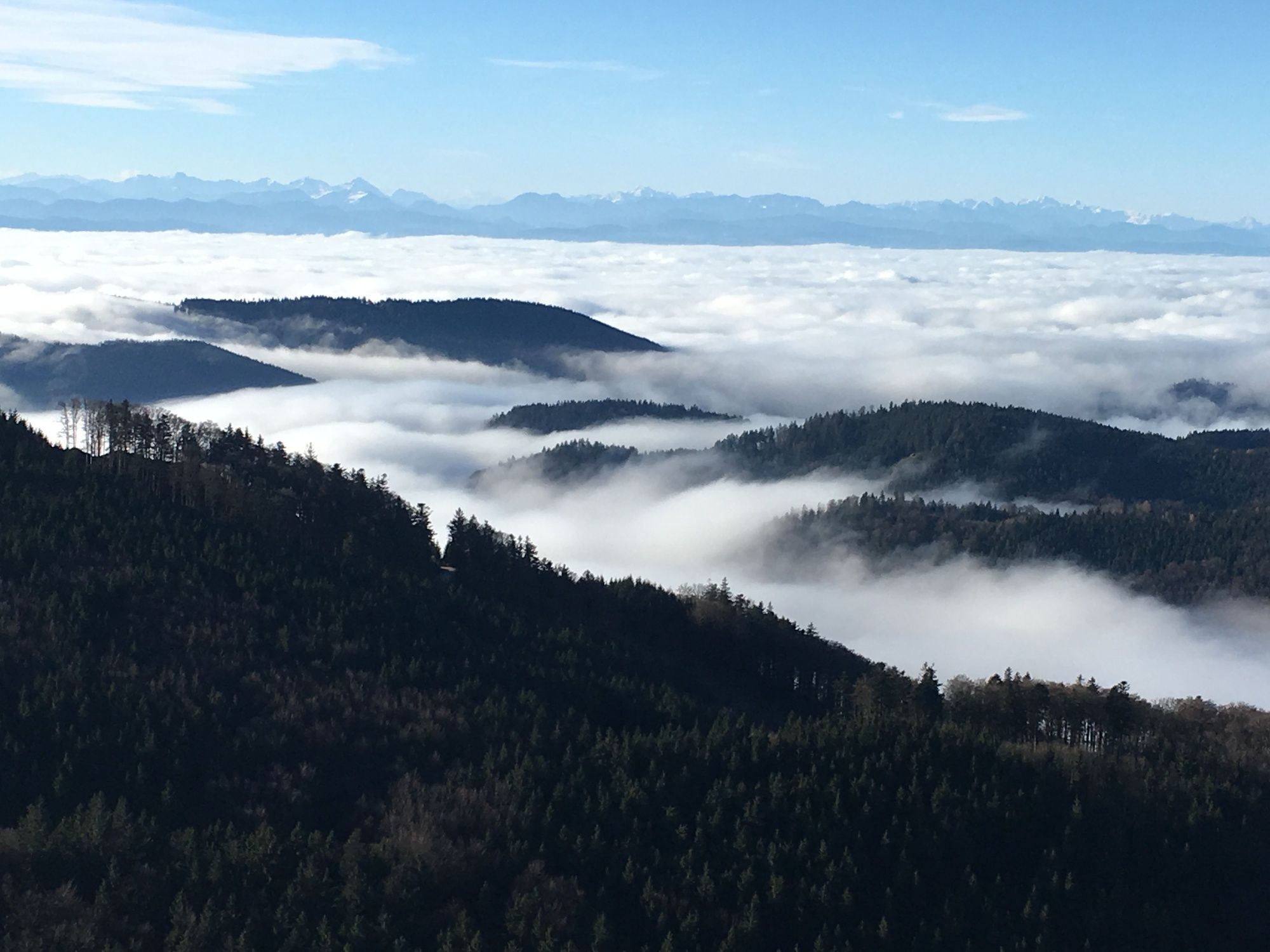
Secured vantage point with summit cross and summit book, magnificent alpine view.
- Directions
-
Start on the main road between St. Oswald - Dorfstetten at the beginning of the Unterdeutsch Güterweg (D7) and follow No. 17 to the right. Beautiful, somewhat steep forest path to the forest road, from there another 20 min to the castle stone wall. The climb up the Burgstein wall is steep and, depending on the weather, can also be slippery. But at the summit cross you are rewarded with a magnificent panoramic view as far as the Ötscher and Dachstein. Return along the Undeutsch Güterweg No. 17a to the Undeutsch vantage point (rest area with magnificent views). Then return to the car park.
- Highest point
- 965 m
- Endpoint
-
Country road between St. Oswald - Dorfstetten - Güterweg Undeutsch
- Height profile
-

- Additional information
-
Gemeinde St. Oswald
3684 St. Oswald, Untere Hauptstraße 3
(T) +43 7415 7291
(E) gde.stoswald@wvnet.at
(I) www.stoswald.com
(Webcam) http://www.stoswald.com/Aktuelles/WebcamTourismusbüro Ysper-Weitental
3683 Yspertal, Hauptstraße 9
(T) +43 7415 6767 25
(E) info.yw@waldviertel.atWaldviertel Tourismus
3910 Zwettl, Sparkassenplatz 1/2/2
(T) +43 2822 54109
(E) info@waldviertel.at
(I) www.waldviertel.at - Directions
-
Approach from the A1 Westautobahn via Ybbs an der Donau either via the B 36 via Yspertal to St.Oswald or via Ybbs along the Danube west at Ysperdorf, towards Yspertal via Fell to St.Oswald.
- Parking
-
Free parking in front of the primary schools or the building yard. E-fuelling station at the car park "Leithenweg" free of charge.
- Author
-
The tour Castle stone wall 975m - Variant a is used by outdooractive.com provided.


General info
-
Donau Niederösterreich
2286
-
Südliches Waldviertel
935
-
St. Oswald
264