- Brief description
-
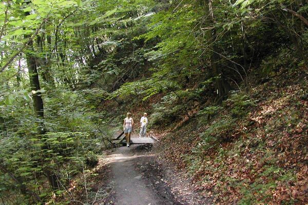
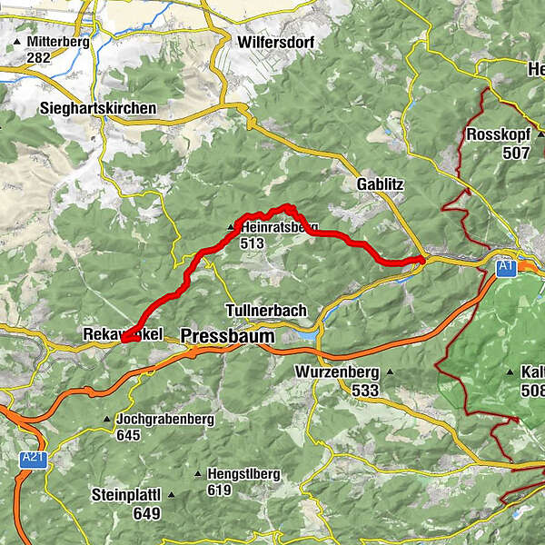
The Troppberg Panoramic Route leads through a true natural jewel: One of the 36 core zones of the Vienna Woods Biosphere Reserve. The 542 m high Troppberg offers a wonderful view which stretches from Vienna and Tulln, across to Wachau, and over to the Alpine foothills, the Schneeberg and the Ötscher. The route from the Troppberg down to Purkersdorf leads along a small section of the Jakobsweg trail.
- Difficulty
-
easy
- Rating
-
- Starting point
-
Stop Station Rekawinkel
- Route
-
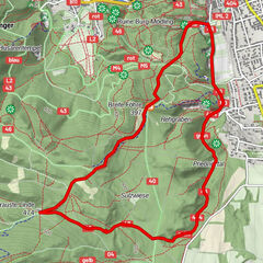
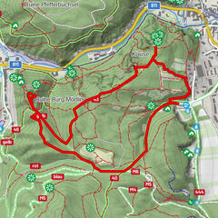
Rekawinkel0.0 kmGasthaus Mayer0.3 kmRekawinkel0.6 kmSt.-Antonius-Kapelle0.8 kmGroßer Stiefelberg (497 m)3.0 kmRauchengern4.9 kmHinterer Steinberg (442 m)5.6 kmGasthaus Mirli6.4 kmStrohzogl7.1 kmRieger Wienerwaldhof (472 m)7.6 kmTroppberg (542 m)10.1 kmBuchberg (440 m)13.3 kmKranawetten15.5 kmPurkersdorf (248 m)16.7 km
- Best season
-
JanFebMarAprMayJunJulAugSepOctNovDec
- Description
-
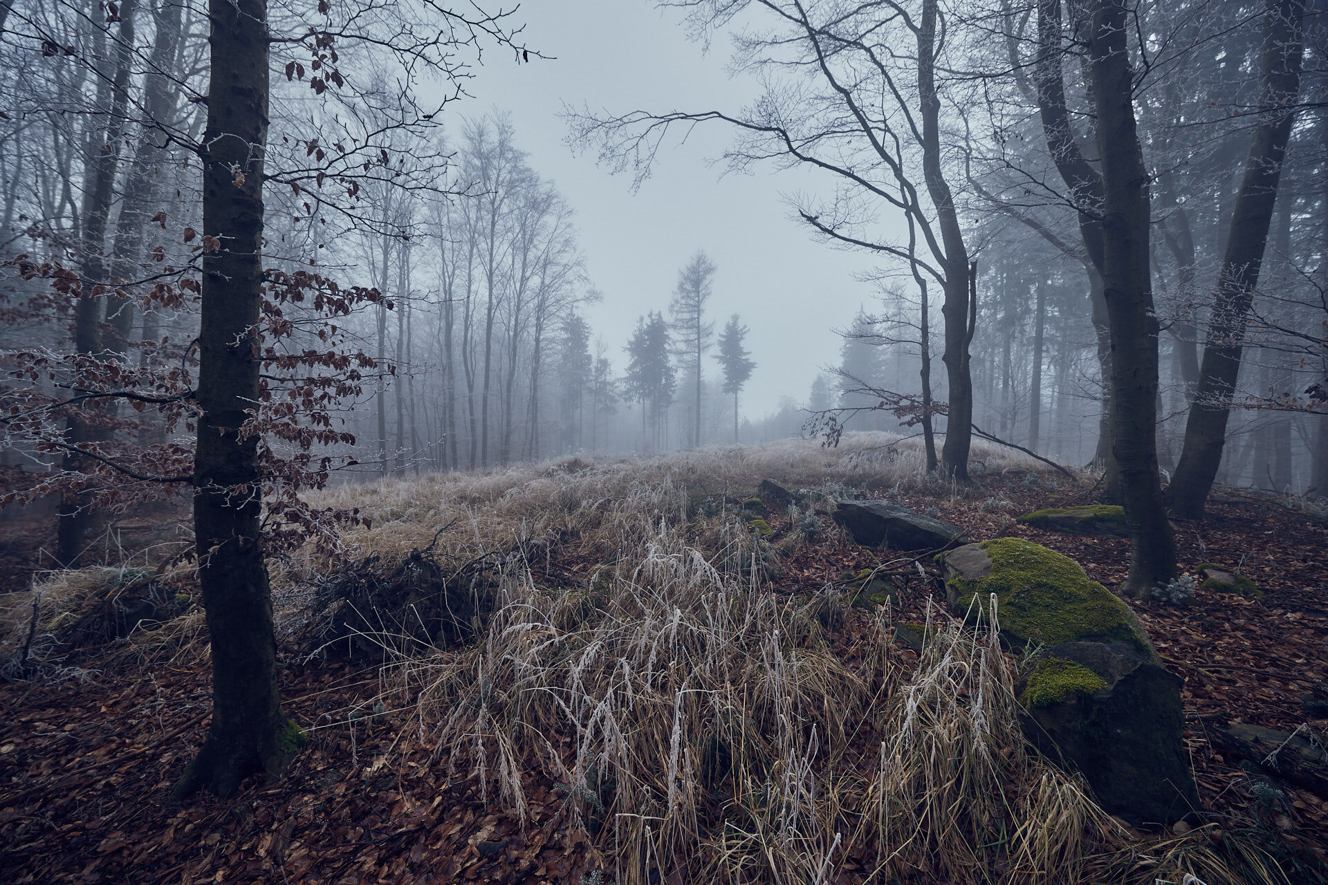
Tip/Fun-Fact: We will hike through one of the 37 core zones of the Vienna Woods Biosphere Reserve (BPWW). Nature rules here. Ancient trees and deadwood offer a habitat for countless species, which is otherwise hard to find.
- Directions
-
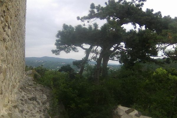
The route is marked as “Weitwanderweg 04” (Long Distance Hiking Route No. 04 – WWW 04) between the railway station in Rekawinkel and the Troppberg. From the car park, we will head west for approx. 400 metres, along Bundesstrasse to the town limits, and then through the residential area, before turning right and entering the forest. In Rauchengern, we will cross the country road. As well as the red long-distance route markers, blue ones will start to appear. Once we have passed the Gasthaus Mirli inn and the Wienerwaldhof Rieger restaurant, we will reach the Troppberg in around 3 hours (542 m). From the large intersection close to the summit, we will take the steep
route (blue) for 5 minutes, until we reach the Troppbergwarte lookout post, with its 24 m high platform. We will then head back to to the large intersection close to the summit, and follow the green hiking route past the Buchberg and Kranawetten (410 m) to Purkersdorf central railway station.
- Highest point
- 529 m
- Endpoint
-
Stop Station Purkersdorf Zentrum
- Height profile
-

- Equipment
-
sturdy shoes, water, rain protection
- Tips
-
Rest points Gasthaus Mayer zu den 5 Starken Gasthaus Mirli Hotel Wienerwaldhof Rieger
Updated on: 05.11.2020
- Public transportation
-
Arrival with public transport
Start point: by bus to the stop "Rekawinkel"
End point: by bus to the stop "Purkersdorf Zentrum"
- Parking
-
Parking facilities
- P+R Rekawinkel
- P+R Purkersdorf

- Author
-
The tour Troppberg Panoramic Route is used by outdooractive.com provided.


General info
-
Wienerwald
4206
-
Kamptal - Wagram - Tullner Donauraum
1494
-
Tullnerbach
890