© Mostviertel Tourismus / weinfranz.at

© Mostviertel Tourismus / zunder zwo

© Mostviertel Tourismus / zunder zwo

© Mostviertel Tourismus / zunder zwo

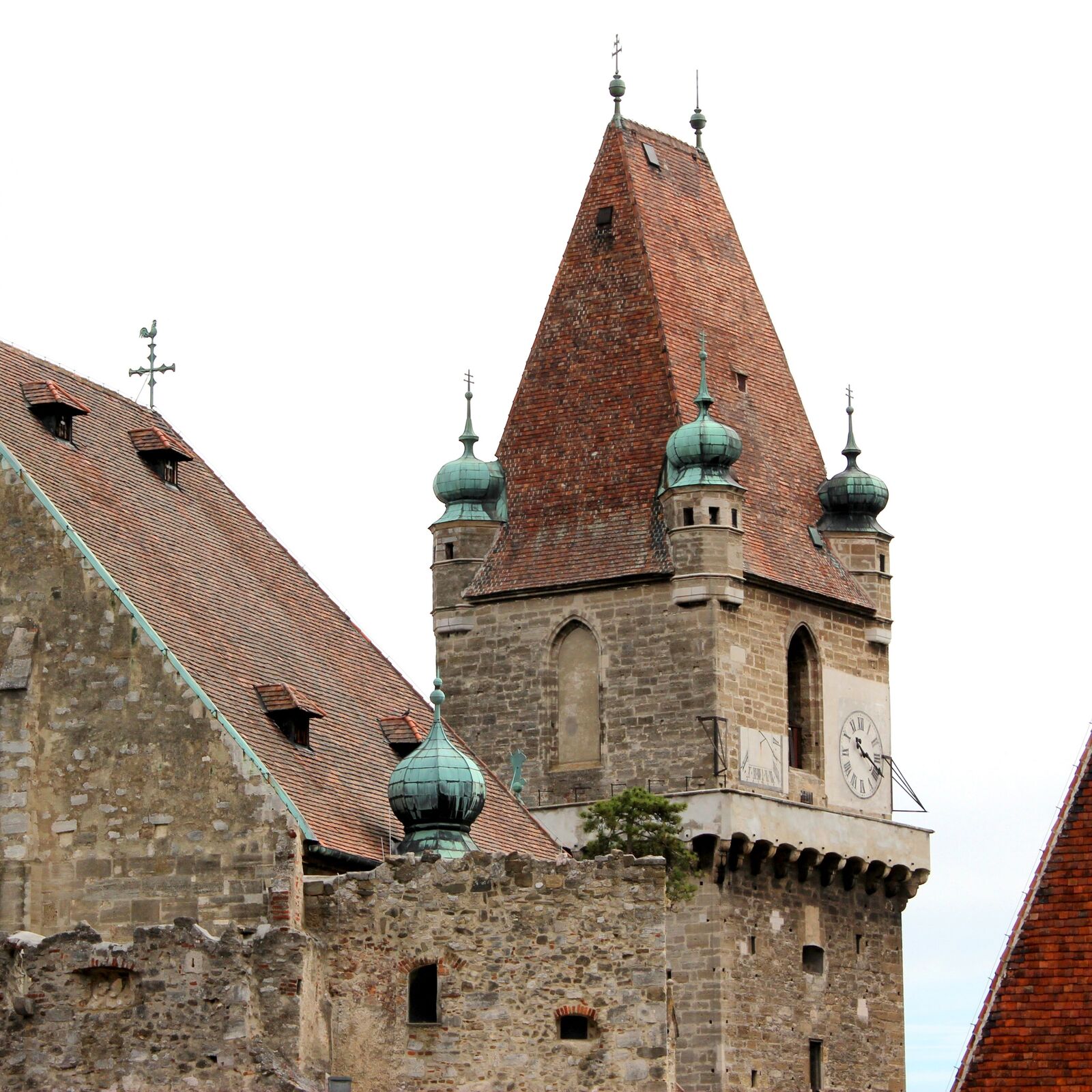
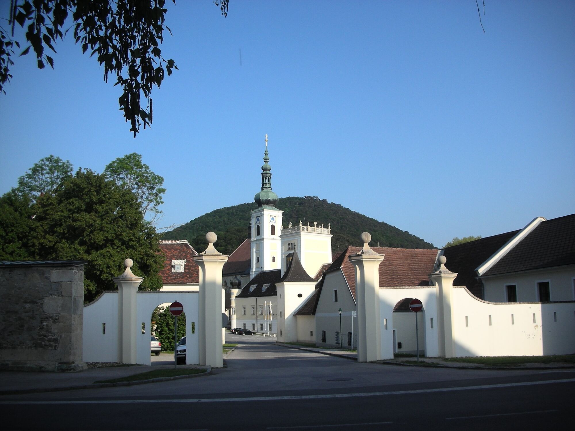
© Unbekannt - Heiligenkreuz
- Brief description
-
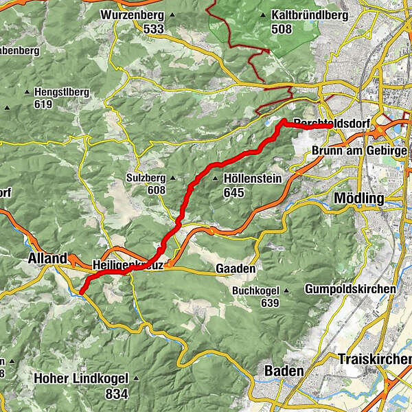
Perchtoldsdorf (ab Pfarrkirche) oder Wien-Rodaun (Straßenbahnlinie 60) – Parapluieberg (Franz Ferdinand-Schutzhaus) – Teufelsteiner-/Kammersteinerhütte – Kugelwiese – Seewiese – Wildegg – Sittendorf – Heiligenkreuz – Mayerling
- Difficulty
-
medium
- Rating
-
- Route
-
Pfarrkirche St. AugustinPerchtoldsdorf0.0 kmSaugrabenloch2.0 kmFranz-Ferdinand-Schutzhaus2.5 kmTeufelsklippenstollen2.5 kmHinterer Föhrenberg (581 m)3.2 kmKammersteinerhütte3.3 kmGasthaus zum Salzstanglwirt auf der Kugelwiese4.1 kmGroßer Sattel (543 m)4.6 kmRastplatz Seewiese6.0 kmHochstraße VI6.6 kmHochstraße VII6.7 kmKreuzsattel (592 m)8.1 kmSittendorf10.9 kmMeierei Füllenberg12.3 kmFüllenberg13.0 kmXIIII Statio14.5 kmXI Statio14.5 kmXIII Statio14.5 kmX Statio14.5 kmKalvarienberg (346 m)14.5 kmXII Statio14.5 kmIX Statio14.5 kmVIII Statio14.6 kmVII Statio14.7 kmVI Statio14.7 kmV Statio14.7 kmIIII Statio14.7 kmIII Statio14.8 kmII Statio14.8 kmI Statio14.8 kmKellerstüberl14.9 kmKlostergasthof14.9 kmHeiligenkreuz15.1 kmKerzengrotte15.1 kmLourdesgrotte15.1 kmSchüttkastenhöhle15.1 kmSagbründl15.2 kmAllander Höhe (423 m)16.7 kmMayerling18.0 km
- Best season
-
JanFebMarAprMayJunJulAugSepOctNovDec
- Highest point
- 591 m
- Endpoint
-
Mayerling
- Height profile
-

-

-
AuthorThe tour Wr. Wallfahrerweg: Etappe 1/5: Perchtoldsdorf - Mayerling is used by outdooractive.com provided.
GPS Downloads


General info
Refreshment stop
Cultural/Historical
Other tours in the regions
-
Wienerwald
4200
-
Wien und Umgebung
2469
-
Kaltenleutgeben
1106