
- Brief description
-
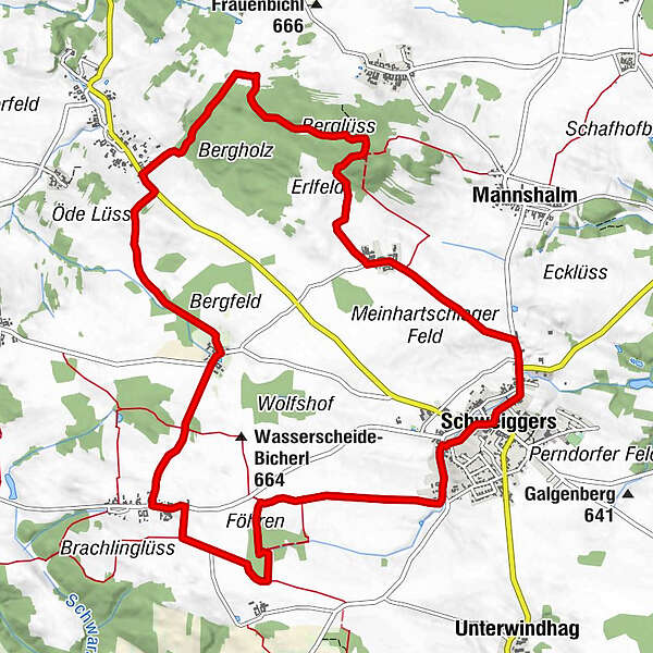
Schweiggers - Schwarzenbach - Großreichenbach - Meinhartschlag - Schweiggers
- Route
-
SchweiggersHarry's ThayaquellenhofGasthaus Swidger0.0 kmVeranstaltungssaal0.1 kmFöhren2.6 kmThaya-Quelle2.8 kmSchwarzenbach4.3 kmFuchslöcher5.0 kmBrunnhöf5.6 kmGroßreichenbach7.5 kmBerglüss9.7 kmMeinhartschlag11.4 kmhl. Ägydius13.2 kmHausgärten13.3 kmSchweiggers13.4 kmHarry's Thayaquellenhof13.4 km
- Best season
-
JanFebMarAprMayJunJulAugSepOctNovDec
- Highest point
- 700 m
- Endpoint
-
Schweiggers
- Height profile
-

- Author
-
The tour Thayaquelle-Strecke is used by outdooractive.com provided.
GPS Downloads


Other tours in the regions
-
Waldviertel
169
-
Oberes Waldviertel
67
-
Schweiggers
19