© Wienerwald Tourismus GmbH / Markus Frühmann

- Brief description
-
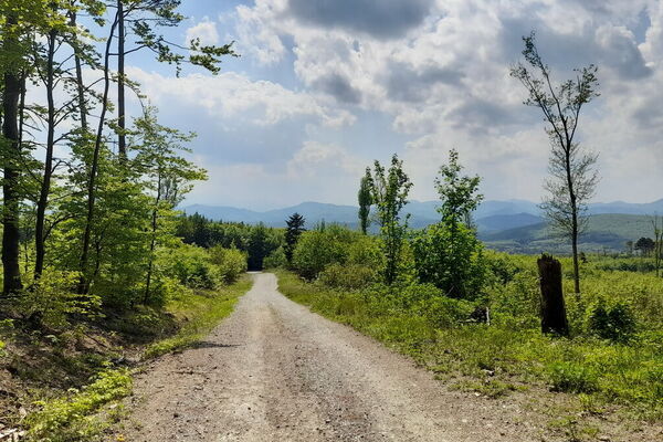
Ein angenehmer, leichter und familienfreundlicher Radweg für Zwischendurch.
- Difficulty
-
easy
- Rating
-
- Route
-
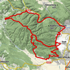
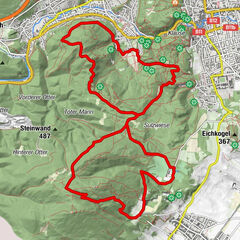
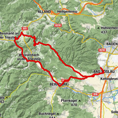
MödlingBreite Föhre0.0 kmRichardhof1.9 kmRastplatz Zwirnereck5.7 kmBreite Föhre10.5 kmMödling10.5 km
- Best season
-
JanFebMarAprMayJunJulAugSepOctNovDec
- Highest point
- 413 m
- Endpoint
-
Veigl-Hütte
- Height profile
-

- Author
-
The tour Beethovenweg is used by outdooractive.com provided.
GPS Downloads


General info
Refreshment stop
Other tours in the regions
-
Wienerwald
291
-
Wien und Umgebung
206
-
Gumpoldskirchen
107