

- Brief description
-
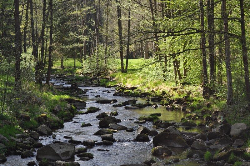
The cross-border long-distance hiking trail leads on four stages from the source of the Lainsitz River in Karlstift to the small town of Chlum in the Czech Republic.
- Difficulty
-
medium
- Rating
-
- Starting point
-
Karlstift - at the Lainsitz spring
- Route
-
Lainsitzursprung0.0 kmDreifaltigkeitskapelle0.5 kmEichelberg (1,054 m)0.5 kmPfarrkirche St. Karl Borromäus1.4 kmKarlstift1.5 kmGasthof Zeiler1.8 kmKirschbaumleiten4.1 kmSteinplötzen7.7 kmFiedlwiesen9.0 kmEisenwerk10.0 kmAngelbach11.9 kmSteinbach16.9 kmOberlainsitz17.6 kmZeil20.1 kmGasthof Weninger20.4 kmSt. Martin20.4 kmRoßbruck22.2 kmSchöllbüchl23.0 kmAnger23.9 kmLangfeld25.0 kmSchützenberg25.7 kmHolzhackerquelle Johannesbründl26.7 kmWeitra28.2 kmUlrichs31.0 kmMalerwinkel46.9 kmGmünd47.2 kmGrillenstein47.2 kmBrunngraben47.8 kmJausenstation Schutzhaus47.9 kmHubertuskapelle47.9 kmLatschenhütte48.5 kmGroßeibenstein48.8 kmGasthaus Gruböck48.8 kmKleineibenstein49.8 kmWaldhäuseln52.6 kmZum gekreuzigten Heiland54.1 kmSteinbach54.2 kmGasthof Pension Renate Krupik54.2 kmAlt-Nagelberg (508 m)57.4 kmHolzschlag58.3 kmBrand (540 m)60.1 kmGopprechts65.7 kmSchönauhäuser65.8 kmReichenbach67.8 kmHöllstein-Graselhöhle70.1 kmLitschau73.2 kmLitschau73.3 kmPfarrkirche Litschau hl. Michael73.3 kmBruno's Bierinsel73.4 kmGasthof Kaufmann73.5 kmPraschlhöhle77.3 kmLitschauerhöhle77.4 kmGrabenloch77.4 kmBlockhöhle77.4 kmBlockhöhle II77.4 kmBlockhöhle III77.5 kmJosefsthal79.0 km
- Description
-
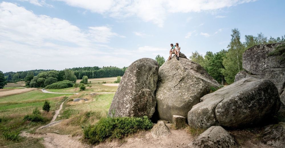
The long-distance hiking trail is divided into 4 daily stages. Along the route there are numerous nature trails, nature parks and lookout towers with a far-reaching view over the region. Furthermore, historic towns and villages are hiked through, including Weitra, Gmünd and Litschau. In addition, hikers have the opportunity to visit medieval castles, craft workshops and natural monuments, for example the Blockheide in Gmünd with its bizarre stone formations.
- Directions
-
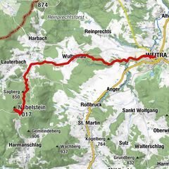
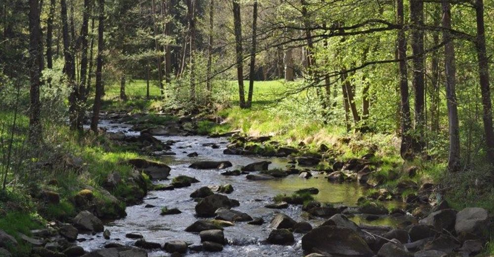
Stage I/1a: Lainsitz spring - Weitra via Sankt Martin (28.5 km) The trail along the Lainsitz begins at the beautifully designed spring in the form of a small chapel. Our path runs through the municipality of Karlstift and leads to the Lainsitz after six kilometres. Soon after, the trail divides into two alternative routes. The main route continues into the beautiful valley and via the municipality of St. Martin to the historic town of Weitra.
Alternative: Stage I/1b: Lainsitzquelle - Weitra via Nebelstein (27 km). The second alternative leads to the highest point of the entire trail, the Nebelstein (1017 m). At the end of this stage you hike through the beautiful Gabrielental and finally reach the stage destination Weitra.
Stage I/2: Weitra - Gmünd (19.6 km) This stage runs through forests, meadows and fields without any great differences in altitude. You also pass some fish ponds typical of the Waldviertel.
A few kilometres before the largest town on the Austrian side - Gmünd - the route runs across a wide mountain plain, rich in water bodies and at the border of the mountain plain near Gmünd past large stone boulders, which lie singly or heaped together for the area of the "Waldviertel".The historical core of Gmünd with its small, very beautiful town hall and the famous façades of some Renaissance houses offers an experience for followers of classical architecture. The waterfall formed by the Lainsitz river in the middle of the town, directly at the border crossing to České Velenice, is also interesting.
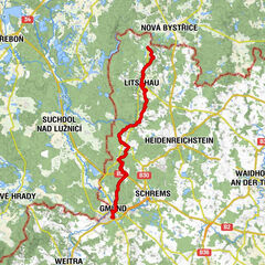
Stage I/3: Gmünd (Blockheide) - Litschau (25.2 km) From Gmünd the route leads northwards through a gently undulating landscape with many beautiful forests parallel to the Czech border. In the village of Brand there is a beautiful pond with a large swimming pool. For some, the landscape will probably remind them of the Czech Canada at Nová Bystřice, where both landscapes merge.
Stage I/4: Litschau - Chlum (border crossing) (12.8 km) In the picturesque town of Litschau, below the old castle, the trail turns northwest. The route leads through a valley, past the recreational "Herrenteich" pond, climbs up through forests, crosses the border and after three kilometres reaches the destination of Section I., the small town of Chlum u Třeboně.
Although we moved away from the Lainsitz in Gmünd, we did not leave its catchment area. The Reissbach flows through Litschau. The route of the entire "Junge Lainsitz" section basically runs through mountainous terrain - in the only place on the route, in Gmünd, the trail drops slightly below 500 m altitude.
- Highest point
- 1,033 m
- Endpoint
-
Chlum (CZ)
- Height profile
-

- Equipment
-
Sturdy shoes, functional clothing, sun and rain protection, map material, telescopic poles if necessary, first aid kit (blister plasters), sufficient food (snack, muesli bars, fruit, water).
Please do not leave any rubbish in the grounds!
- Safety instructions
-
When choosing the route, make sure it suits your physical condition. Check whether the catering establishments you want to visit on the way are open. Pack your mobile phone and maps in your backpack.
For cross-border tours, please always carry a passport or identity card.
- Tips
-
At the end of the second section of the trail, a visit to the lookout tower in the Blockheide Gmünd is tempting. From here, hikers can enjoy a view far across the borderland to the Czech Republic.
- Additional information
- Directions
-
Linz - via Freistadt - Sandl to Karlstift
Vienna - A22 to Stockerau - S5 to Krems - B37 to Rastenfeld - B38 via Zwettl - Groß Gerungs - Langschlag to Karlstift

- Author
-
The tour The path along the Lainsitz is used by outdooractive.com provided.


General info
-
Waldviertel
1776
-
Oberes Waldviertel
614
-
Gmünd im Waldviertel
130