Nibelungengau long distance trail 7: Pöchlarn - Krummnussbaum


- Brief description
-
Enjoy the wonderful views of the hilly and wooded north shore of the Danube. Basilica Maria Taferl and castle Artstetten stand out majestically.
- Difficulty
-
easy
- Rating
-
- Starting point
-
Pöchlarn, Nibelung monument
- Route
-
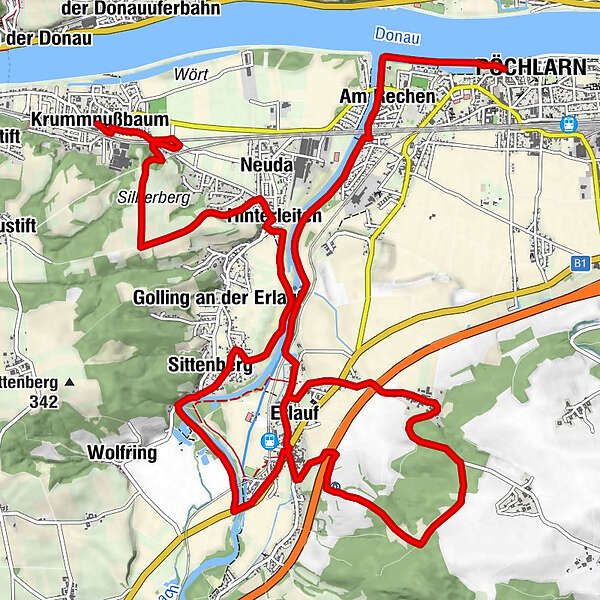
PöchlarnAm Rechen1.1 kmBrunn an der Erlauf1.7 kmHinterleiten2.6 kmOfling3.9 kmErlauf5.1 kmHarlanden6.6 kmLandgasthof s´Mostlandl10.3 kmErlauf10.3 kmPizzeria-Gasthaus Schauer10.3 kmhl. Johannes von Nepomuk10.5 kmSittenberg12.5 kmGolling an der Erlauf13.0 kmHinterleiten14.7 kmNeuda14.9 kmKrummnußbaum18.1 km
- Best season
-
JanFebMarAprMayJunJulAugSepOctNovDec
- Description
-
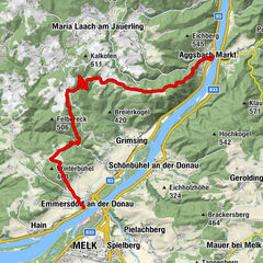
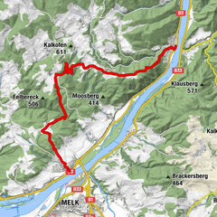
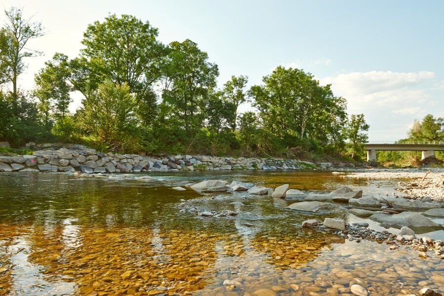
The tour starts at the Nibelung monument in Pöchlarn and leads upstream along the Danube until the Erlauf river. The way leads along the shore of the Erlauf and on the cycle path. Through a wooded area on an asphalt road you pass the residential area until you reach the center of the village Erlauf. Now you cross the bridge and walk along the Erlauf river until Golling. Via some hills with great views the way leads down to Krummnussbaum.
The Nibelungengau long distance trail is split up into 8 stages and can be passed through in both directions. Signs along the way will help you to find the right direction.
- Directions
-
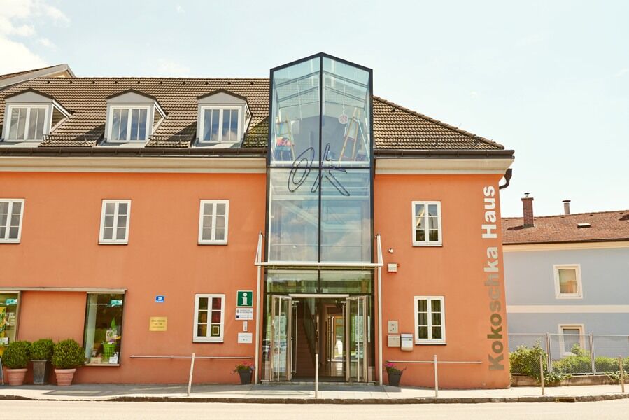
The tour starts at the panorama panel at the Nibelung monument in Pöchlarn. One of the most famous Austrian artists of the 20th century Oskar Kokoschka (1886-1980), who was born in the Lawer Austrian city of Pöchlarn was painter, poet and graphic artist. Kokoschka museum which is located in his house of birth displays about 100 artworks of this great expressionist. The way leads upstream along the Danube river until the river Erlauf. Afterwards the way leads downstream along the shore of the Erlauf and on the cycle path and through a wooded area. On an asphalt road you pass through the residencial area in Erlauf along the „Schulstraße“ (school street) until the center to church square. Now the way leads over the „Erlaufbrücke“ (bridge), on mixed ground along the Erlauf until Golling. Via some hills with a great view of Maria Taferl, Pöchlarn, Artstetten and Melk the way leads down at „Silberberg“ (hill) to the panorama panel in Krummnussbaum.
- Highest point
- 346 m
- Endpoint
-
Krummnussbaum, fire department
- Height profile
-

- Equipment
-
For great memories of your hiking experience and to enjoy the surrounding nature, please consider to take some general gear which is listed here: Equipment list
- Safety instructions
-
Please pay attention to following tips and hints, in order to enjoy your hiking trip.
- Stay on the marked trails.
- Wear hiking boots for your safety.
- Use walking sticks to find balance.
- It is always good to have a rainjacket with you.
- Don't forget your trail map.
- Make sure to have enough drinking water.
- Don't litter!
- No open fire!
- Please respect the sensitive habitats of flora and fauna.
We also like to point out, that it is forbidden to ride a horse or a mountain bike along wood trails or private forest roads. - Tips
-
For easy and convenient organization of the tours its good to have the Wachau-Nibelungengau-Kremstal application. Just download for Android or iPhone.
- Additional information
-
Tips and hints for excursions along the way:
Museum of Oskar Kokoschka in Pöchlarn, nibelung monument in Pöchlarn, city museum of Pöchlarn located in the Welserturm (tower), peace museum in Erlauf, crooked walnut trees in Krummnussbaum, Danube port in KrummnussbaumRestaurants and Cafes along the way are in:
Pöchlarn, Erlauf, Golling and KrummnussbaumMore sights in the area Nibelungengau:
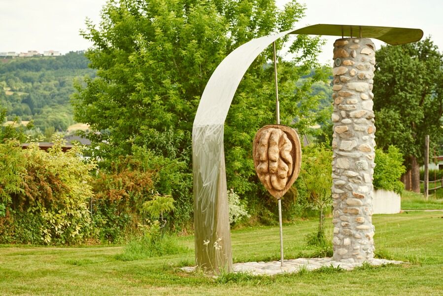
Power station Ybbs-Persenbeug, castle in Leiben, castle in Artstetten and basilica in Maria TaferlEvery year at the first Saturday in October the Nut-festival takes place in Krummnussbaum. The village transforms itself into a colorful festival area with delicious and funny offers around the nut.
- Directions
-
Highway A1 until exit Pöchlarn, then take the second exit at the roundabout, and after about 2 kilometers you are in the center of town.
Approaching from Krems or Grein via B3 at Klein-Pöchlarn you cross the Danube bridge. At the roundabout after the bridge you take the first exit direction Pöchlarn. - Public transportation
- Parking
-
In Pöchlarn in the city center or at the parking lot in front of the Nibelung monument and in Krummnussbaum in the center.
- Author
-
The tour Nibelungengau long distance trail 7: Pöchlarn - Krummnussbaum is used by outdooractive.com provided.


General info
-
Mostviertel
2451
-
Südliches Waldviertel
935
-
Erlauf
228