Kremstal-Danube Long Distance Trail 11: Stratzing – Droß


- Brief description
-
On the Stratzing - Droß stage, one eye-catcher follows the next. From lush vineyards to picturesque castles and imposing churches – amazement is guaranteed here.
- Difficulty
-
easy
- Rating
-
- Starting point
-
Stratzing, Municipal office
- Route
-
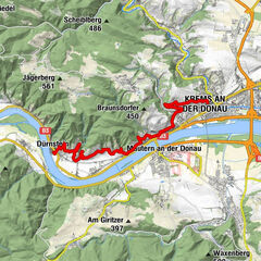
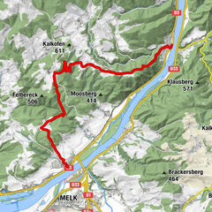
Pfarrkirche hl. Nikolaus0.2 kmStratzing0.2 kmPriel2.1 kmZum alten Bierkeller3.2 kmHeuriger Nigl Ingeborg3.5 kmDroß3.5 km
- Best season
-
JanFebMarAprMayJunJulAugSepOctNovDec
- Description
-
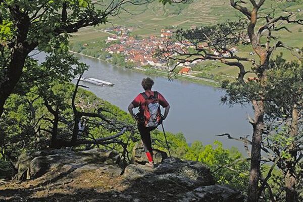
The stage starts in the wine village of Stratzing on a high plateau between the Danube, Krems River and Kamp. The Stratzinger Kellergasse and the local Eiszeitweg already invite you to take your first worthwhile diversions there. The route then leads through extensive vineyards and a shady woodland along the Stratzingbach stream. Thus, we first go to Priel, then on to our destination in Droß. After the fantastic landscapes on the way, the Fatima pilgrimage church and the Renaissance castle Droß are also real eye-catchers. In the castle chapel of St. George, you can also marvel at some of the oldest frescoes in Austria. With these incredible impressions, the hike worth seeing finally comes to an end.
- Directions
-
From the Stratzinger Municipal Office, we walk a short distance down the Untere Hauptstraße, where we then turn right into Hollerzeile. Passing the parish church of St. Nicholas, we come to the cemetery, keep left, and after about 200 m, we arrive at the playground. We continue straight ahead, past the Sunogeln and Hochsatzen vineyards, hike through a shady section of forest along the Stratzingbach stream and then arrive in the village of Priel. Turn right at the main road and cross it to the north until you reach the horse paddock. Once there, turn right and immediately left again. Arriving at the main street of Droß, we reach Schlossstraße in a north-westerly direction and then the municipal office as our destination.
- Highest point
- 401 m
- Endpoint
-
Droß, Municipal office
- Height profile
-

- Equipment
-
Sturdy hiking shoes, rain protection, sufficient food and drink, as well as a hiking map Kremstal-Donau and possibly a wine tavern calendar.
- Safety instructions
-
Please note the following tips and advice to ensure that your hiking holiday is a beautiful experience:
Stay on the marked trails and wear mountain/hiking boots. Please do not leave your rubbish along the path. Carry enough food (water/snacks) with you. Take the hiking map with you or use the free hiking app. Respect the sensitive habitats of flora and fauna. - Tips
-
The Wallfahrtskirche zu Unserer Lieben Frau von Fatima in Droß (Pilgrimage Church of Our Lady of Fatima in Droß) commemorates the apparition of the Virgin Mary in Fatima in 1917.
Schlosskapelle St. Georg is a small Romanesque building from the middle of the 12th century with some of the oldest frescoes in Austria. The key for this can be collected from the Droß municipal office during opening hours.
- Additional information
- Directions
-
From Vienna: via A22 and S5, B 37 to Droß
From the west: A1 and S33, B37 to Droß
- Public transportation
- Parking
-
Stratzing, Hauptstraße


- Author
-
The tour Kremstal-Danube Long Distance Trail 11: Stratzing – Droß is used by outdooractive.com provided.


General info
-
Donau Niederösterreich
2289
-
Kamptal - Manhartsberg
1158
-
Stratzing
641