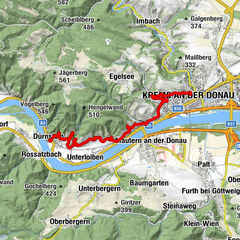
Wachau World Heritage Trail 03: Weißenkirchen - Spitz


- Brief description
-
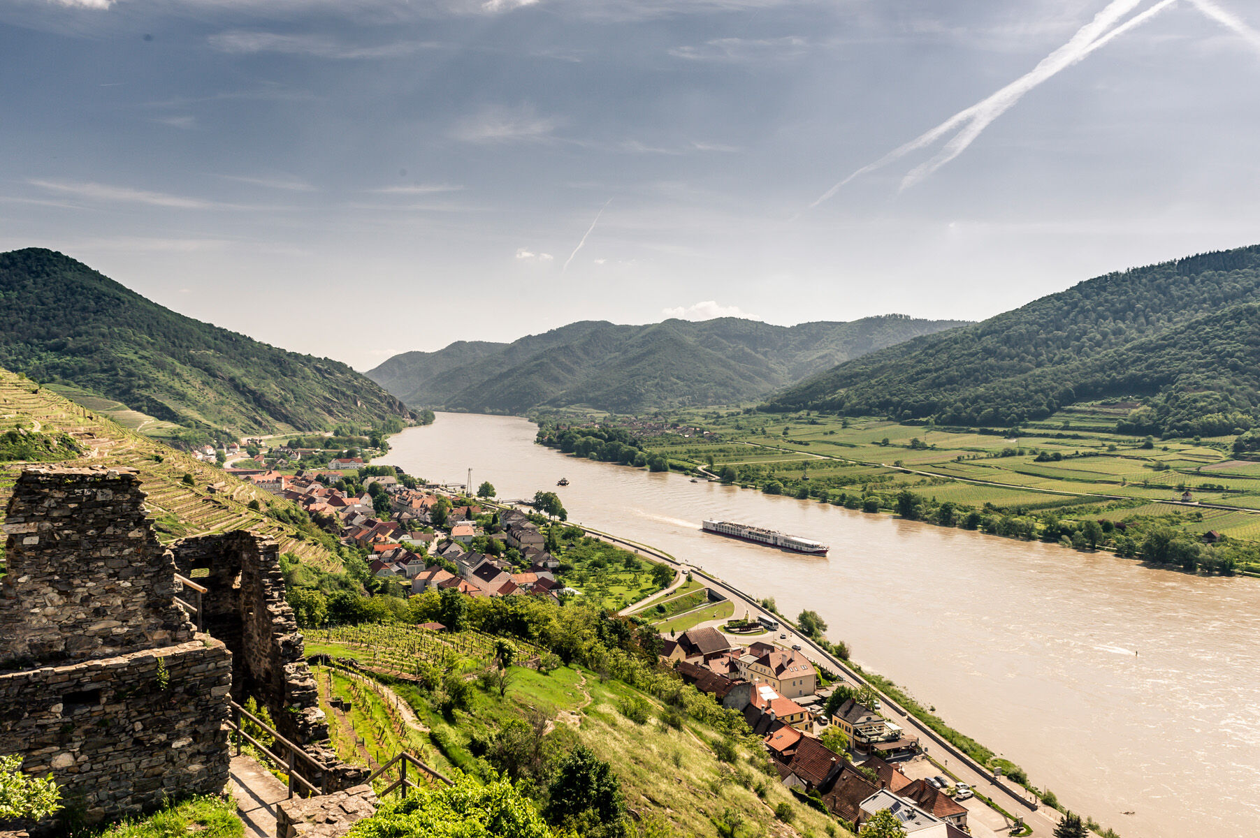
From Weißenkirchen to Spitz your way leads through the impressive heart oft he Wachau stone terraces and vineyards. The wine growers villages of Weißenkirchen and Spitz invite you to rest and enjoy the wine of the area. Nature lovers will be thrilled seeing the nature monument at „Michaelerberg“ (hill).
- Difficulty
-
medium
- Rating
-
- Starting point
-
Weißenkirchen, Marktplatz (market square)
- Route
-
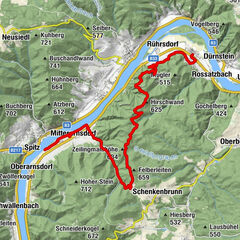
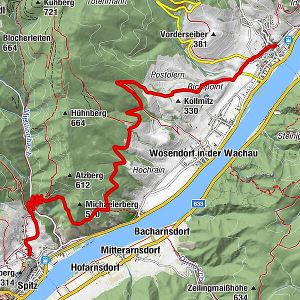
Pfarrkirche WeißenkirchenWeißenkirchen0.0 kmSchacht7.9 kmehem. Sondierstollen8.0 kmBergwerkstollen8.0 kmPfarrkirche hl. Mauritius10.5 km
- Best season
-
JanFebMarAprMayJunJulAugSepOctNovDec
- Description
-
Wachau World Heritage Trail: from Weißenkirchen to Spitz
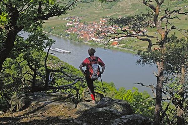
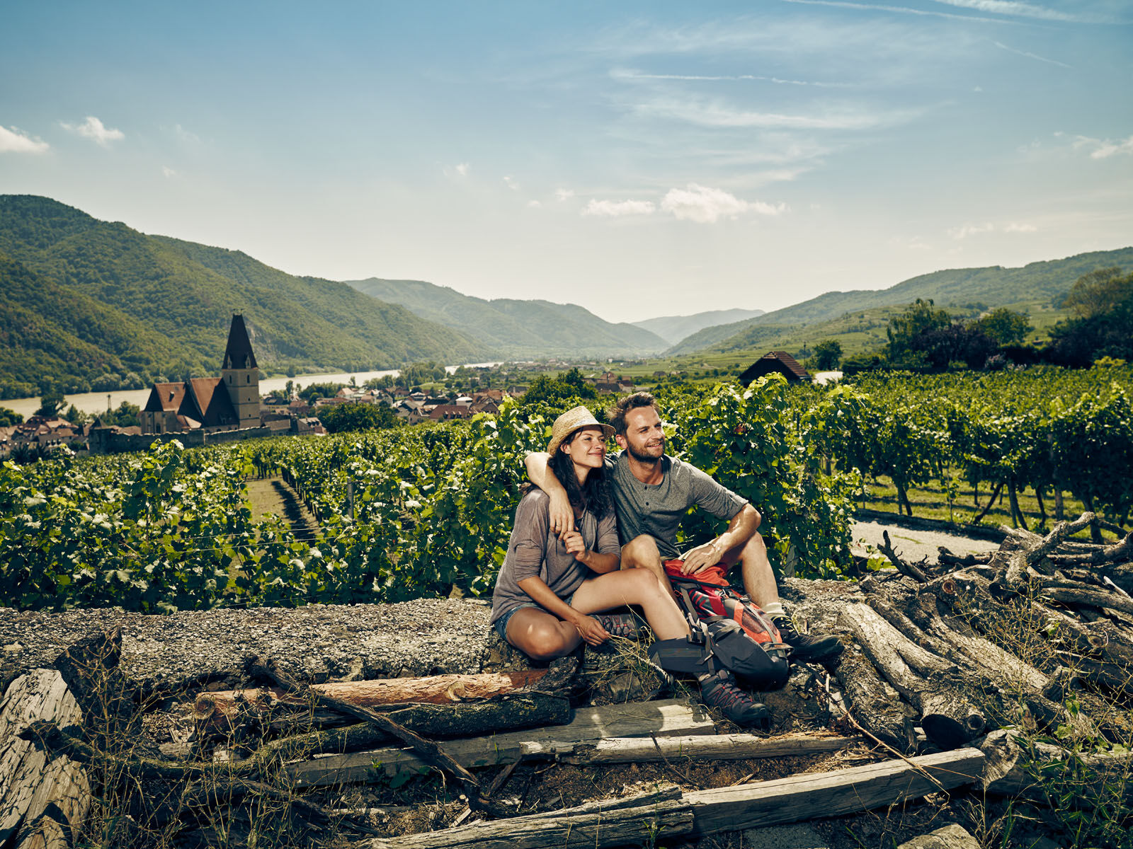
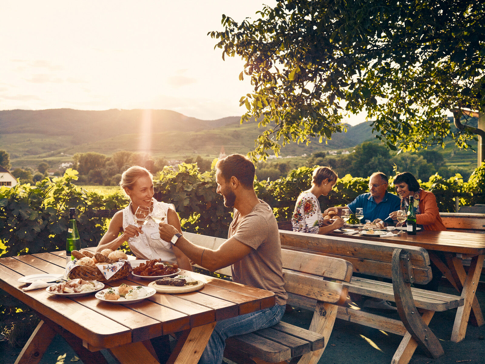
This stage leads through unique vineyards. High above the Danube you find the biggest cohesive wine growing area of the Wachau including famous vineyards like „Kollmitz,Kollmütz,Hochrain“ with stunning views. Above of St. Michael you walk through romantic dry grasslands, woods and miraculous rock landscapes and marvelous views are guaranteed. Through the red gate you enter the wine village Spitz. In the historic wine villages of Spitz and Weißenkirchen dozens of taverns, restaurants and cafes are welcoming you.
- Directions
-
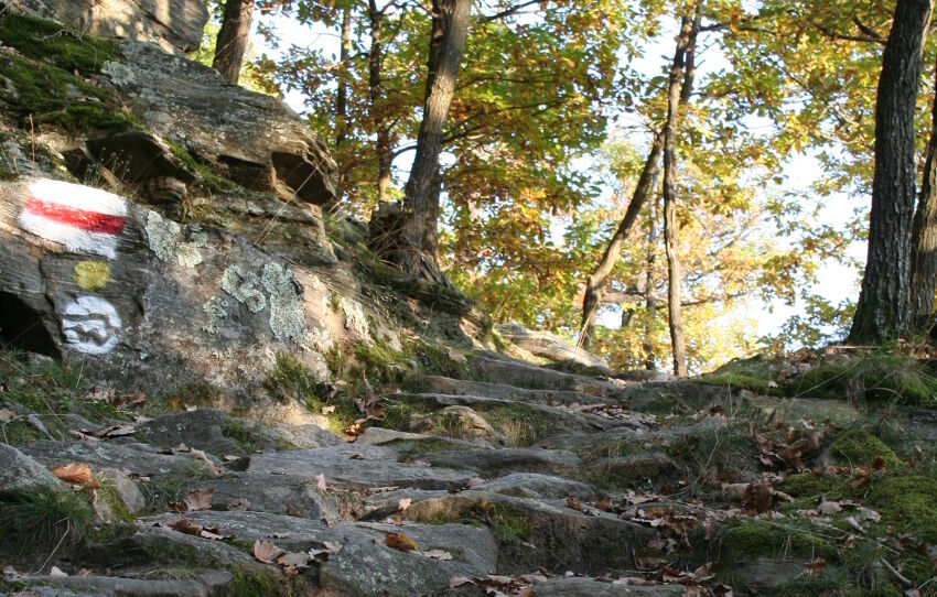
From market square in Weißenkirchen the castle stairs at Bachstraße (creek road) lead up left to the castle quarter, one of the oldest settlements in the Wachau with gothic harvest courts and several taverns (stamp station tavern family Rosenberger). At the end of castle quarter you walk downward into the „Lichtgartl“ (name of a former vineyard could be translated with light garden) and reach the vineyards. You cross Seiberstraße (street) and get to a vineyard called „Ritzling“. Now the way turns right passing vineyard „Postaller“ up tot he famous vineyard „Kollmitz“. At this point its possible to hike down to Wösendorf and Joching. The main route continues right along the panoramic way leading into the Buchenwald (beech wood). So after a few minutes you leave the vinyeards and enter a beech wood. After the wood loop you will enter the vineyards again at Geißberg (hill) and finally reach a panoramic trail above the well known vineyards „Hochrain, Höll and Kollmütz“.
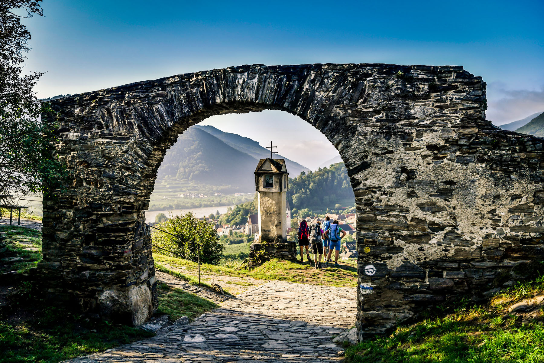
At the end oft he vineyards you enter the wood, walking to the view point and nature monument „Michaelerberg“ (hill), where you find a descent way to St. Michael (20 min descent time). Michaelerberg was an old „Hutweide“ (grassland for animals watched by a shepherd) and belongs to the most biodiverse meadows along the Danube. Bizarre rock and stone formations make the Michaelerberg so special. After a short rest including great views you follow the panoramic trail St. Michael through an untouched oak and hornbeam forest down to Mieslingtal (valley). At the creek you walk right and soon you cross the Mieslingbach (creek) and walking uphill you reach legendary red gate, the rest of the former defensive wall of Spitz. You walk through the gate entering the vineyards of Spitz and via a historic connecting path straight down to Spitz. Passing the famous vineyards „Rotes Tor“, „Singerriedel“ and „Axpoint“ after about 10 minutes picturesque church square of Spitz is in sight which marks the end of this stage.
- Highest point
- 432 m
- Endpoint
-
Spitz, Kirchenplatz (church square)
- Height profile
-

- Equipment
-
Hiking boots, raincoat, enough to eat and drink, a trail map and maybe a list of open taverns. You can find an equipmentlist on www.welterbesteig.at section service/tips.
- Safety instructions
-
There are no restaurants along the way and also no water source.
In case of an emergency call the mountain rescue Wachau: 140
- Tips
-
Its worth visiting the „nature park BIOthek-Wachau“ in Spitz run by the owners of the biological businesses in the Wachau area. Its located in a winery of the 16th century near church square. Opening times: end of April until end of October every Friday, Saturday and Sunday, www.naturpark-jauerling.at.
- Additional information
-
Best of Wachau: The most famous and recommendable restaurants and accommodations in the Wachau „UNESCO-World-Heritage“ you find here atwww.bestof-wachau.at.
You can find more information about restaurants and accommodations at www.welterbesteig.at. Please note the shortened opening times of restaurants in Spitz and Weißenkirchen in winter. More information about the winter opening times at or www.spitz-wachau.at.
You can find taverns in Weißenkirchen and Spitz. Several taverns are open during winter time. Please see the current calendar for opening hours (Heurigenkalender) at www.welterbesteig.at.
For easy and convenient organization of the tours its good to have the Wachau-Nibelungengau-Kremstal application. Just download for Android or iPhone.
- Directions
-
Highway A1 until intersection St.Pölten, following S33 and B3 via Krems to Weißenkirchen or Spitz.
- Public transportation
-
The villages can be reached 7 days a week by public transportation (bus or train). Its possible to get back tot he start of the tour.
On the north shore (Bus WL 715 from trainstation Krems via Dürnstein-Weißenkirchen-Spitz-Aggsbach Markt-Emmersdorf-Melk trainstation) hourly buses depart 7 days a week. On the south shore (Bus WL 720: from trainstation Krems via Mautern-Rossatz-Arnsdörfer-Aggsbach Dorf-Schönbühel-Melk trainstation) buses are departing every two hours. Spitzer Graben (WL 718 connection between Spitz and Mühldorf) operates from Spitz departing every two hours. Info at: www.vor.at.
At the nature park Jauerling bus (WL 722, www.naturpark-jauerling.at) and to Göttweiger Berg (hill) buses (WL 723) operate on weekends and public holidays as shuttle bus service with fixed tours and have to be called one hour prior of departure. Phone: 0043 810 810 278 to make reservation and more info at www.vor.at.
Wachautrain operates on weekends and public holidays (3 times a day). More information: www.noevog.at
Stations for the bike rent system „nextbike“ (1€ per hour) are located in Weißenkirchen and Spitz. More information: www.nextbike.at
Timetable ferry Weißenkirchen to St.Lorenz: March to November. The ferry is not operating during winter time.
Timetable ferry Spitz to Arnsdorf: March to October. The ferry is not operating on weekends during winter time. More information here.
- Parking
-
Parking along the waterfront or at the trainstation Weißenkirchen or at the trainstation or at the castle in Spitz.
- Author
-
The tour Wachau World Heritage Trail 03: Weißenkirchen - Spitz is used by outdooractive.com provided.


General info
-
Donau Niederösterreich
2289
-
Dunkelsteinerwald
1373
-
Spitz an der Donau
605