Danube Cycle Path, stage 5, north bank: Emmersdorf - Krems


- Brief description
-
Through the enchanted garden to a romantic landscape
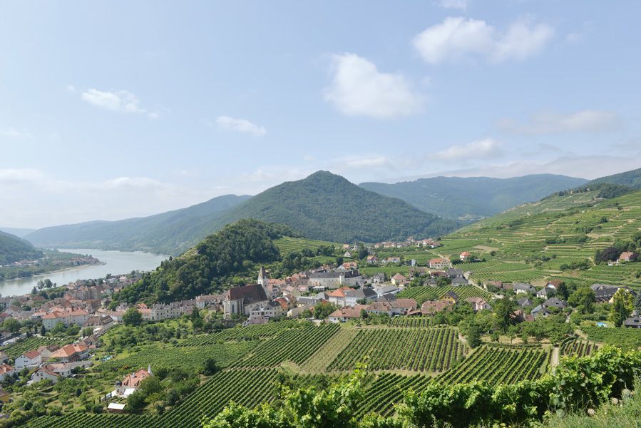
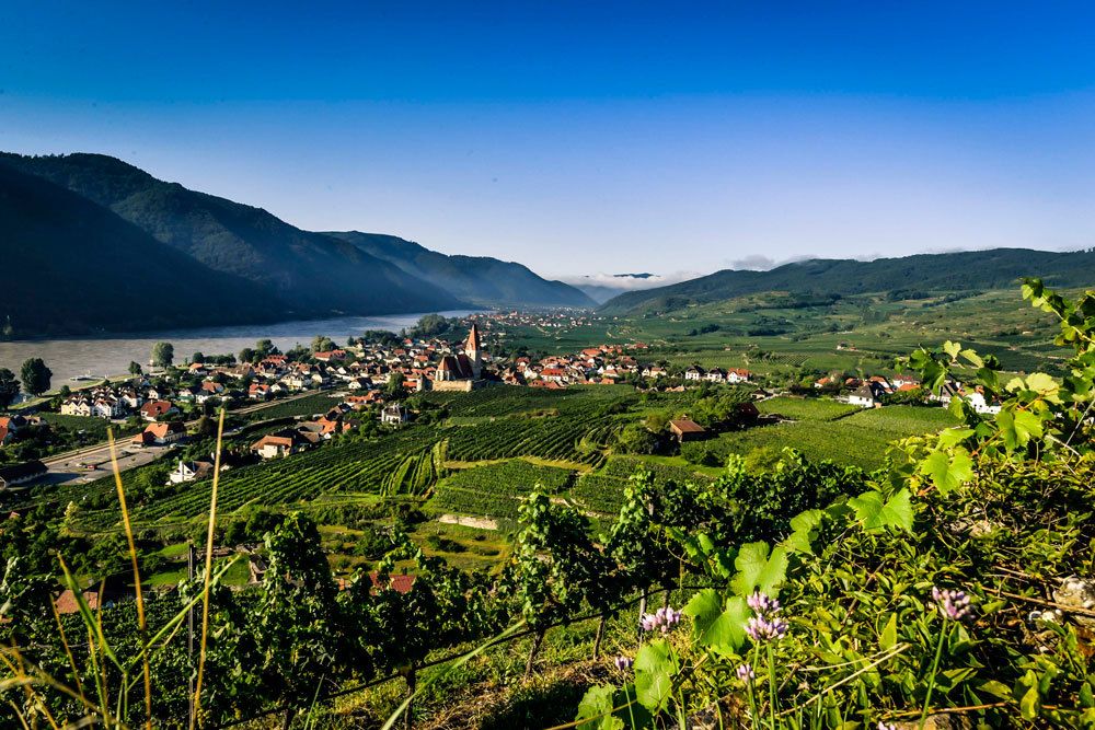
The tour takes you via the Danube Bike Path from the Danube town of Emmersdorf through the Wachau, a landscape shaped by human hand, and beyond to Krems, a statutory city on the Danube, i.e. it has the authority of both a city and a district. On your ride through the Wachau, a UNESCO World Heritage landscape, you pass through Aggsbach, Spitz and Weissenkirchen, among other towns, before arriving at your destination: Krems, a center of commerce and culture.
IMPORTANT NOTE:
From February 2020 until the end of 2021, the Danube Cycle Trail will be diverted in the Höhe Ringstraße area of Krems, due to necessary pipeline works. Please follow the diversion signposts in the Krems city area.
Due to construction works on the bridge between Mautern and Stein (the Mauterner Brücke), there will be restrictions for cyclists, starting immediately! We recommend allowing enough time to cross the Danube elsewhere.
- Difficulty
-
medium
- Rating
-
- Starting point
-
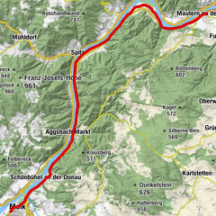
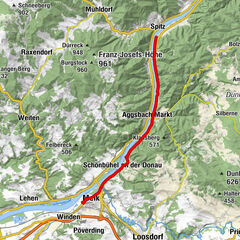
Emmersdorf
- Route
-
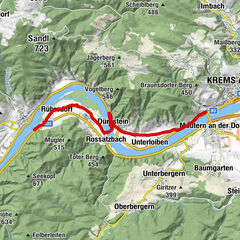
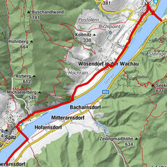
Magdalenenkapelle0.1 kmHotel & Restaurant Donauhof0.1 kmEmmersdorf an der Donau0.2 kmSchallemmersdorf1.7 kmWeissis Gaststubn2.4 kmGrimsing3.1 kmAggsbach Markt7.6 kmGasthof-Pension Zum Kranz7.7 kmGroisbach10.4 kmWillendorf in der Wachau11.1 kmRudis Heuriger11.2 kmGasthof zur Venus11.2 kmSchwallenbach12.5 kmFilialkirche hl. Sigismund12.9 kmOberarnsdorf14.3 kmSpitz15.7 kmSpitz a.d. Donau16.3 kmFelsdach16.9 kmMarterlhöhle17.0 kmMitterarnsdorf17.6 kmWehrkirche St. Michael17.9 kmSankt Michael18.0 kmPfarrkirche Wösendorf19.5 kmWösendorf in der Wachau19.6 kmJoching20.5 kmWeißenkirchen21.8 kmPfarrkirche Weißenkirchen22.2 kmDürnstein27.3 kmKunigunden Kirche27.6 kmKarner27.6 kmOberloiben28.8 kmPfarrkirche Unterloiben29.3 kmUnterloiben29.3 kmRothenhof30.7 kmSt. Matthias31.7 kmFörthof31.9 kmStein-Mautern32.1 kmStein an der Donau32.9 kmKrems an der Donau34.0 km
- Best season
-
JanFebMarAprMayJunJulAugSepOctNovDec
- Description
-
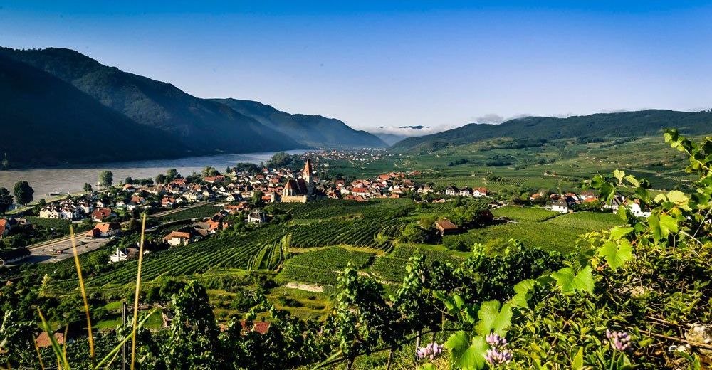
On leaving Emmersdorf you find out why the Wachau is a UNESCO World Heritage landscape in an impressive way: You can see mighty cliffs arise out of steep forested slopes, vineyards gently curving their way through the landscape, waves of the Danube playing on sandy beaches, ruins full of history, old villages and hospitable inns lining your way.
In the ancient village of Aggsbach you have an excellent view to the ruins of Aggstein Fortress on the other side of the river. Legend has it that terrible robber-knights met their fate in justice here. Willendorf became famous through an important archaeological find: the Venus of Willendorf. This little sculpture of a woman reminds us that this area has been populated for 50,000 years. The sculpture is now displayed in the Museum of Natural History in Vienna.
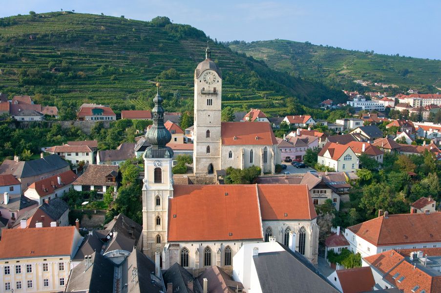
In Schwallenbach the Middle Ages are kept alive by several historical buildings. Shortly before reaching Spitz, you will spot a bizarre rock formation: the Devil’s Wall. Legend has it that the devil wanted to dam up the water of the Danube with this wall. In Spitz you are enticed to take “culture break” by old winemakers’ houses, 16th c estates, a Late Gothic church, the Hinterhaus ruins and the navigation museum.
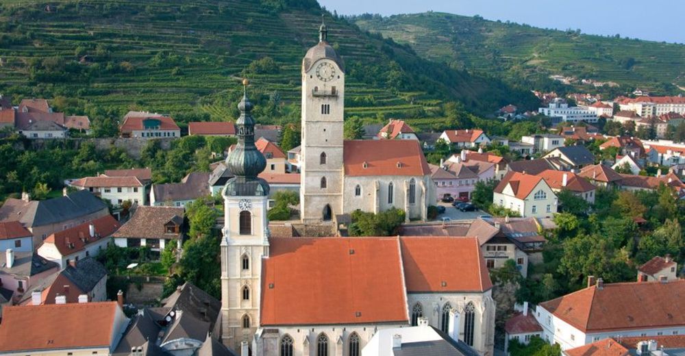
You see (stone) rabbits “running” along the roof ridge of the fortified St. Michael’s Church (Weissenkirchen municipality) – they were once allegedly driven up there during a snowy winter. In the local Wachau Museum you can gaze at the elaborate Goldhauben traditional costumes. In Wösendorf, the main attraction is the Late Baroque parish church with its altarpieces by Kremser Schmidt (Martin Johann Schmidt, 1718 – 1801).
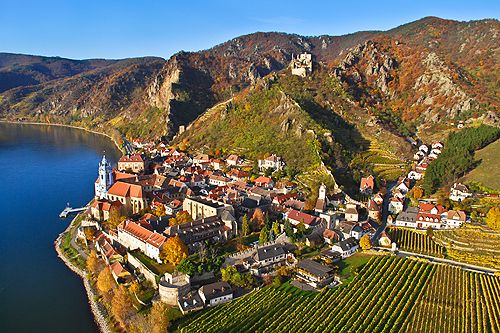
Dürnstein is right on the Danube and surrounded by lovely vineyards, wooded slopes and rock formations, It is one of Austria’s most popular holiday destinations. The blue tower of Dürnstein Abbey can be seen far and wide and Richard the Lionhearted was once kept prisoner in the castle (now ruins). Soon after passing by the wine town of Unterloiben, you arrive in Krems, the final destination of this stage.
- Directions
-
Emmersdorf an der Donau - Aggsbach - Spitz - Weissenkirchen in der Wachau - Dürnstein - Krems an der Donau
Route description:
You start your tour in Emmersdorf an der Donau, also called "the gateway to the Wachau." As the name suggests, the Wachau begins here. You move through it along the north bank of the Danube. While on the tour you cover a large part of the route on the B3, leaving the road only on a few occasions.
Passing steep hills and small villages you make your way to Aggsbach, home to the Aggstein ruins. Friends of castles will be impressed by these ruins, whose roots go back to the 12th c. At Willendorf in der Wachau you get off the B3 and continue on the L7140 to just before Schwallenbach. Then you cycle on the Danube road till you reach the wonderfully scenic Wachau.
Shortly after Spitz, you leave the B-3 to pass through Wösendorf and Weissenkirchen. Subsequently you reach the epitome of the Wachau’s stunning scenery, the small town of Dürnstein. The natural characteristics of the Wachau are in full evidence: the lush green hills with their steep slopes covered by countless vineyards. In combination with the Danube and the right light, this sight is perfect for landscape painting. Culture and history buffs will love this city two, with tlhe Dürnstein ruins and Dürnstein Abbey, which has existed since 1372. Its blue-and-white tower is considered the landmark of the city.
After Dürnstein, you leave the Danube for a while and pass through some fields. Shortly after Unterloiben, you return to the B3 and continue along the Danube. From there it is only a few kilometers to Krems an der Donau.
Krems offers an abundance of attractions. Still on the fringes of the Wachau, you can admire the beautiful landscape here and explore the city itself. The historical center is impressive and listed as part of the Wachau, a UNESCO World Heritage landscape. Particularly noteworthy is the town's landmark, the Steiner Tor (gate). In addition, there are countless churches, gates, buildings and museums to explore in this city so rich in culture. Even connoisseurs feel right at home here. With the many vineyards, wine-growing is not only of economic importance, but is also a vital part of the city. It is a worthy destination and a wonderful conclusion to this beautiful and enjoyable entertaining tour.
- Highest point
- 223 m
- Endpoint
-
Krems
- Height profile
-

- Directions
-
Take the B3 to Emmersdorf an der Donau
- Public transportation
-
There are several bus connections serving Emmersdorf.
- Parking
-
Hotel Donauhof in Emmersdorf
- Author
-
The tour Danube Cycle Path, stage 5, north bank: Emmersdorf - Krems is used by outdooractive.com provided.