Sections: Brunnen - Rigi-Scheidegg | Schwyzer Valley & Summit Tour


- Brief description
-
Brunnen - Urmiberg - Gottertli - Gaetterlipass - Rigi Burggeist - Rigi Scheidegg
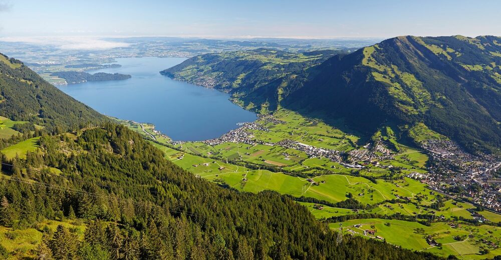
After enjoyed the lake promenade at the beginning of this hike, you will soon head uphill towards Urmiberg, where you can admire the fountains and Lake Uri from above. Then it goes steadily towards the Rigi-Scheidegg, don't miss the vista point 'Gottertli' when possible.
- Difficulty
-
medium
- Rating
-
- Starting point
-
Brunnen
- Route
-
Brunnen0.0 kmBundeskapelle0.0 kmLandungssteg SGV Brunnen0.0 kmRubisacher1.9 kmSchwärteren2.3 kmHerrenmatt2.7 kmLaurentius-Kapelle Wylen2.9 kmWylen2.9 kmSchwand6.8 kmZum Gätterlipass10.4 kmBurggeist13.0 kmRigi Scheidegg (1,648 m)14.0 km
- Best season
-
JanFebMarAprMayJunJulAugSepOctNovDec
- Description
-
At the beginning of the approximately 2 ½-hour hike, you stroll leisurely along the lake promenade of Brunnen, before going uphill. Don't underestimate this steep climb towards Urmiberg. Once at the top, the fabulous view of the Schwyzer basin and Lake Uri will open up for you.
The small detour to Gottertli you should definitely make into your plan. From the Gottertli, the small and the big myths as well as the lakes of Zug and Lauerz are spectacular to see. Once you have reached the Gaetterlipass, continue uphill towards Rigi Burggeist. About 30 minutes later you will reach the destination. A fantastic 360 ° panoramic view of the Rigi Scheidegg Arche as well as refreshing food and drink in the mountain inns make up for the hiking exertions. The Kraebel cable car takes you via Rigi Bahnen to Goldau, where there are SBB connections to all directions.
For your information
You can find the current operating status of the railways and hiking trails here.
In order to let our next generation also be inspired from the Queen of the Mountains, may we ask you to dispose of your own waste at Rigi Stations. Thank you.
- Directions
-
Brunnen (436 m) - Urmiberg (1196 m) - Gottertli (1395 m) - Gätterlipass (1195 m) - Rigi Burggeist (1551 m) - Rigi Scheidegg (1656 m)
- Highest point
- 1,637 m
- Endpoint
-
Rigi-Scheidegg
- Height profile
-
 © outdooractive.com
 - Equipment
-
Good profiled hiking boots or trekking shoes, rain jacket, drink, food and walking sticks, when possible.
- Tips
-
On the vista point Gottertli I really enjoy the fantastic view to Lake Uri and the Alps.
- Directions
-
A4 highway - exit Brunnen - direction village centre of Brunnen
- Public transportation
- Parking
-
Car parks are avaliable in the following places: next to Municipal building, in the village center or next to the sports field on the Gersauerstrasse (Fees apply).


- Author
-
The tour Sections: Brunnen - Rigi-Scheidegg | Schwyzer Valley & Summit Tour is used by outdooractive.com provided.


General info
-
Schwyz
1747
-
Erlebnisregion Mythen
872
-
Lauerz
426