
- Brief description
-
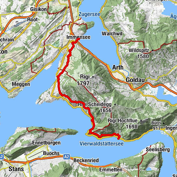
Immensee - Kuessnacht - Greppen - Weggis - Vitznau - Gersau
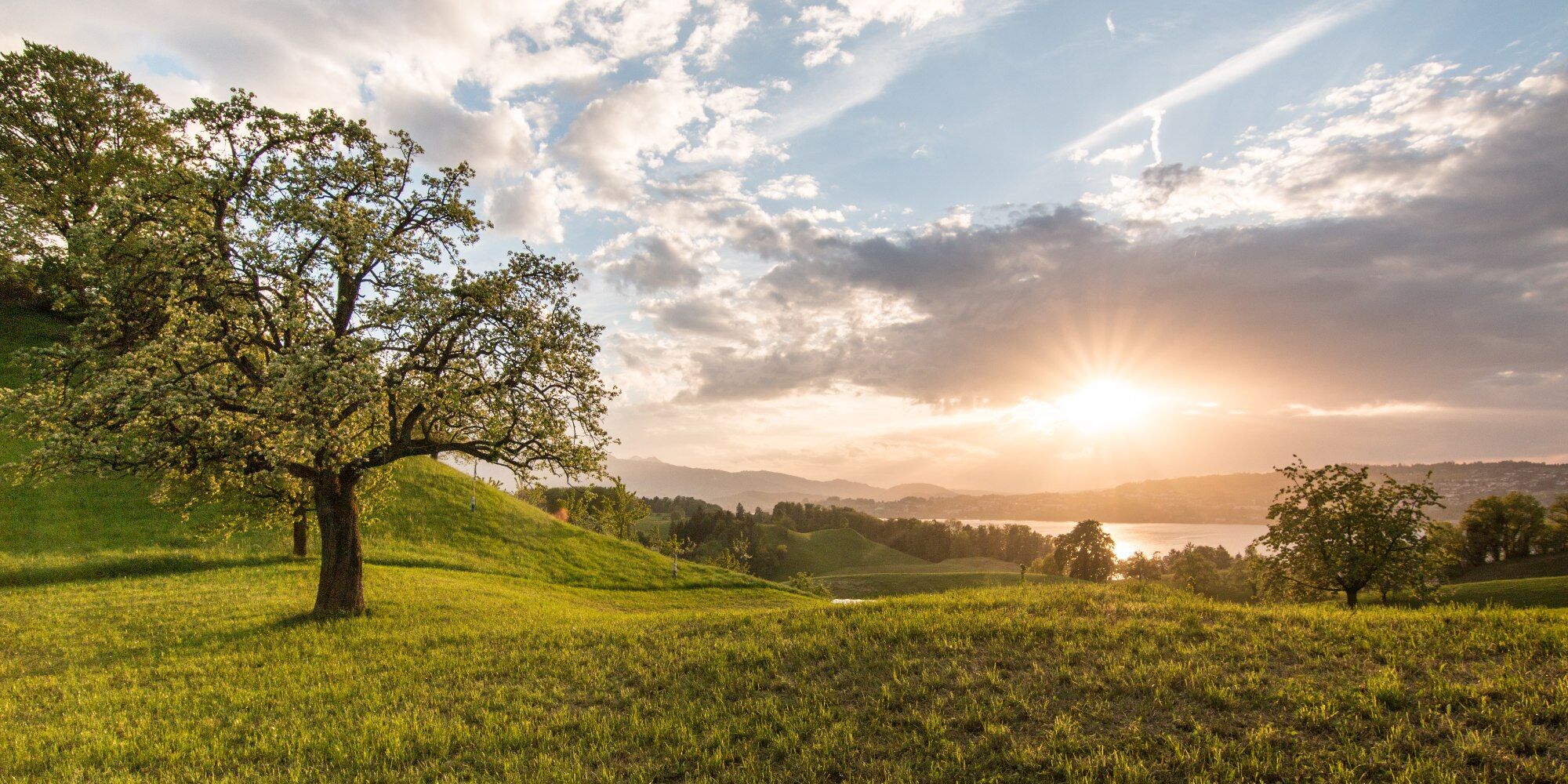
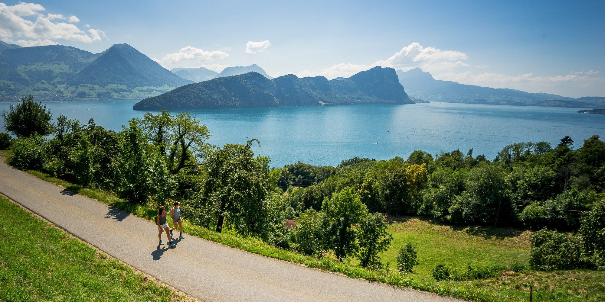
Spring hike with panoramic views at the foot of the Rigi. The hiking trail leads along Lake Lucerne through mostly agricultural areas.
- Difficulty
-
difficult
- Rating
-
- Starting point
-
Immensee
- Route
-
Seerestaurant zum Schlüssel0.0 kmImmensee0.1 kmSt. Sebastian0.2 kmIndian Restaurant0.3 kmBijou0.4 kmBetlehem0.7 kmTellskapelle1.0 kmKüssnacht2.4 kmGreppen6.9 kmTeufibalm13.9 kmRütli15.4 kmRestaurant Rütli15.4 kmVitznau (1,025 m)15.5 kmSt. Hieronymus15.6 kmVitznau15.8 kmGartenwirtschaft Kuorez18.4 kmGersau22.2 km
- Best season
-
JanFebMarAprMayJunJulAugSepOctNovDec
- Description
-
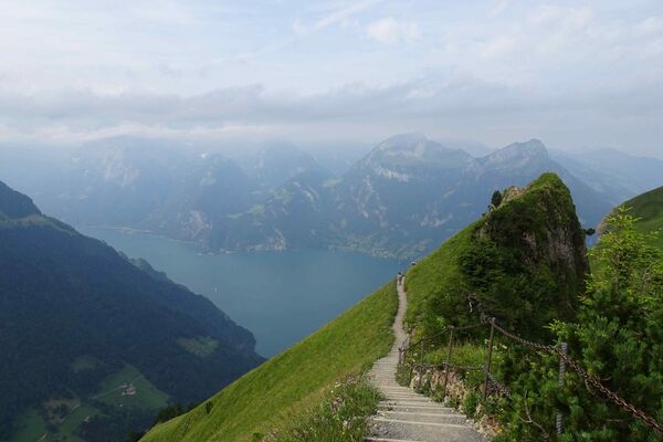
Discover the unique hiking trail with a wonderful panorama from Immensee to Gersau. The Rigi Lehner's path combines history, landscape, botany and much more. Your tour starts steeped in history by walking along the Hohlen Gasse in Immensee and reach a bit later at the castle ruins of the Gesslerburg in Küssnacht. The unique landscape reveals itself to you all the way to Gersau. On the way you will spot many lovely flowers and a recultivated chestnut forest from Greppen. Arrived in Vitznau, you will be admired by the vintage railway culture at the Rigi Railways. At the end of the hike, a nature trail leads down into the historical "Altfrye Republik Gersau".
For your information
You can find the current operating status of the railways and hiking trails here.
In order to let our next generation also be inspired from the Queen of the Mountains, may we ask you to dispose of your own waste at Rigi Stations. Thank you.
- Directions
-
Immensee (415 m) - Hohle Gasse (518 m) - Kuessnacht (534 m) - Alpenhof (555 m) - Greppen (447 m) - Weggis Oberdorf (547 m) - Vitznau Oberwilen (675 m) - Vitznau (435 m) Menschenacher (740 m) - Gersau (435 m
- Highest point
- 772 m
- Endpoint
-
Gersau
- Height profile
-
 © outdooractive.com
 - Equipment
-
High profiled hiking boots or trakking boots, rain jacket, drink, food and walking sticks when possible.
- Tips
-
I would like to recommend the historic Hohle Gasse and the Gesslerburg which can be found just right at the beginning of the hiking trail.
- Additional information
-
You can hike the Rigi Lehner's path in several sections (from Greppen or from Weggis).
- Directions
-
A4 highway, exit Küssnacht, direction Vitznau - Weggis.
However, we recommend you to arrive by public transportations instead of cars: just lean back, enjoy and do something good for the environment.
- Public transportation
- Parking
-
In Immensee you will find parking spaces for a fee.
- Author
-
The tour The Rigi Lehner's Path is used by outdooractive.com provided.


General info
-
Nidwalden
1832
-
Rigi - Berg und See
908
-
Naturgebiet Rigi
305