
- Brief description
-
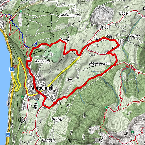
Morschach offers a panoramic trail around the village, which always offers exciting insights into nature. The landscape can be experienced impressively in a confined space.
- Difficulty
-
medium
- Rating
-
- Starting point
-
Morschach
- Route
-
MorschachAxenstein0.6 kmRüti2.7 kmFyrabigbeizli Nägelisgärtli3.2 kmNägelisgärtli3.2 kmRied3.4 kmLourdesgrotte5.2 kmMorschach5.6 km
- Best season
-
JanFebMarAprMayJunJulAugSepOctNovDec
- Description
-
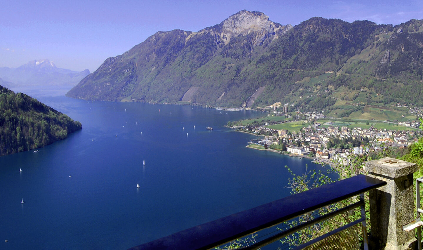
In the village centre of Morschach we begin the circular hike around the village of Morschach, which first takes us along the "Swiss Path" towards Axenstein. Passing the old track of the electric rack railway, which brought noble guests from Brunnen to the Morschach Grandhotels between 1905 and 1969, we reach the uniquely beautiful panoramic terrace at Axenstein. After an extensive view of Lake Lucerne, we walk along the golf course past the restaurant, which is open to everyone, and on the left, shortly before the Schwyzerhöchi, we see a unique Druidenstein, a so-called granite foundling, which was transported there in the last ice age. From the Schwyzerhöchi we hike on to the Ferienhof Rüti. Here the valley basin of Schwyz lies at our feet and we enjoy a clear view of the Schwyz landmark: the small and large Mythen, with its steep cliffs. Via the car park of the cable car Morschach-Stoos and past the Nägelisgärtli we reach the highest point of our 2- to 3-hour hike and walk on a narrow path along the edge of the forest towards Dägenbalm. On the way back we go directly over the steep Dägenbalm road down to Morschach or make a small detour to the Lourdes grotto. This quiet place invites you to linger and relax before we walk back to Morschach. In and around the village there are many possibilities to continue the hike.
- Directions
-
From the village centre in the direction of Axenstein to Wilgis and Schwyzerhöhe. Continue towards Nägelisgärtli, Ried to Dägenbalm and from there back to the village centre.
- Highest point
- 842 m
- Endpoint
-
Morschach
- Height profile
-
 © outdooractive.com
 - Equipment
-
Hiking boots with good profile or trekking boots, rain jacket, drink, food, possibly sticks.
- Tips
-
Visit of the Swiss Holiday Park.


- Author
-
The tour Circular hike on the panorama trail Morschach is used by outdooractive.com provided.


General info
-
Schwyz
1749
-
Mythenregion
897
-
Morschach
427