
- Brief description
-
Rigi Kaltbad – Rotstock – Rigi Staffel
From Rigi Kaltbald there is a fairly steep ascent to Rotstock where you can enjoy a fantastic panoramic view. From Rostock there is a short descent to Rigi Staffel.
- Difficulty
-
easy
- Rating
-
- Starting point
-
Rigi Kaltbad
- Route
-
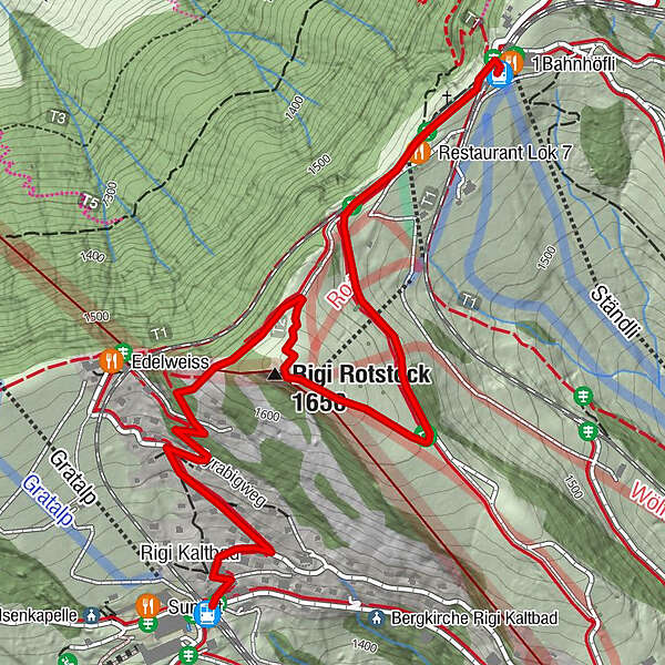
Rigi Kaltbad-First (1,440 m)Rigi Kaltbad0.1 kmRigi Rotstock (1,650 m)1.3 kmRigi Staffel (1,604 m)2.5 km
- Best season
-
JanFebMarAprMayJunJulAugSepOctNovDec
- Description
-
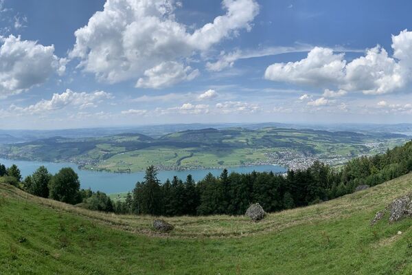
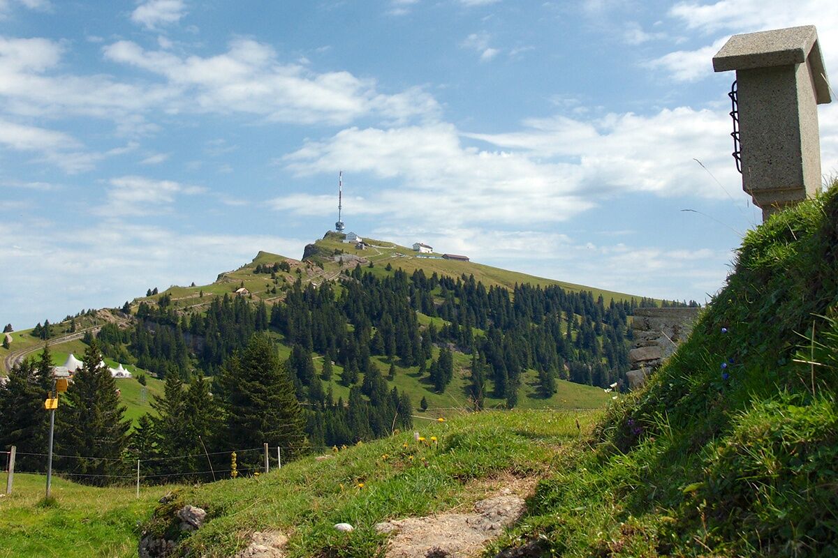
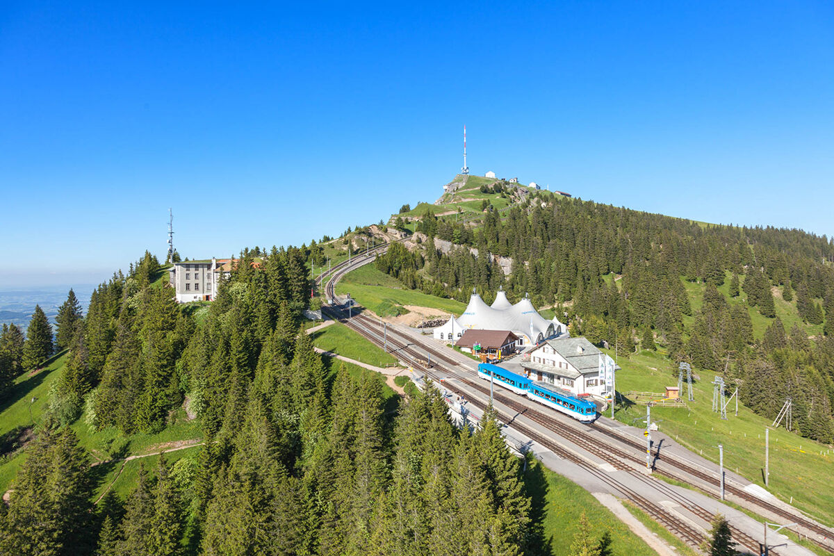
A short but worthwhile trail for a quick trip to the top. The Rotstock (1659 metres a.s.l.) features a sublime 360° panoramic view that many visitors find more captivating than the lookout at Rigi Kulm. In addition to the alpine scenery and view of the Swiss plateau, you can also see the part of the summit with the two railways lines – which from this height looks like a model train set. The ascent from Kaltbad takes you through a shady mountain forest and is dotted with 14 wayside crosses. On the Rotstock, there are places to sit and take a break among the flower-filled meadows. A short downhill section then takes you to Staffel, where the railway lines from Vitznau and Goldau meet.
For your information
In order to let our next generation also could enjoy the beauty of the Rigi, we would like to ask you to dispose of your own waste in the waste bins which are located at all of the stations of RIGI BAHNEN AG. Thank you.
- Directions
-
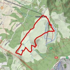
Rigi Kaltbad (1436 m) – Rotstock (1659 m) – Rigi Staffel (1604 m)
- Highest point
- 1,645 m
- Endpoint
-
Rigi Staffel
- Height profile
-
 © outdooractive.com
 - Tips
-
Enjoy a fine picnic on the benches at the Rotstock viewing point and watch the two cogwheel railways in action.
- Directions
-
Vitznau: A4 exit Küssnacht am Rigi, follow the signs to Weggis or Vitznau
- Public transportation
- Parking
-
There are plenty parking spaces avaliable at the valley stations of RIGI BAHNEN AG. Fees apply.
However, we recommend public transport instead of cars: lean back, be stress-free and do something good for the environment.
-

-
AuthorThe tour Path of Rigi Bildstöckli is used by outdooractive.com provided.


General info
-
Nidwalden
1833
-
Rigi - Berg und See
905
-
Naturgebiet Rigi
304