
- Brief description
-
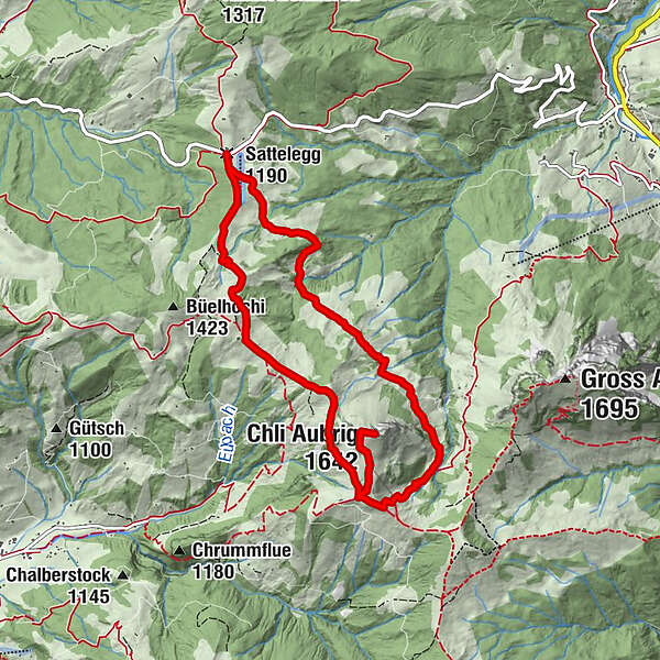
Von der Sattelegg im Wägital führt diese schöne Bergwander Route auf den Gipfel des Chli Aubrig und über den Wanderweg wieder zurück zum Ausgangspunkt.
- Difficulty
-
medium
- Rating
-
- Route
-
Bergrestaurant Sattelegg (1,200 m)Muttergottes- und Bruderklausenkapelle0.2 kmWildegg3.5 kmChli Aubrig (1,642 m)4.2 kmBergrestaurant Sattelegg (1,200 m)9.4 kmSattelegg (1,190 m)9.4 km
- Best season
-
JanFebMarAprMayJunJulAugSepOctNovDec
- Highest point
- 1,641 m
- Endpoint
-
Sattelegg
- Height profile
-
 © outdooractive.com
- Author
-
The tour Sattelegg - Chli Aubrig is used by outdooractive.com provided.
GPS Downloads


General info
A lot of view
Other tours in the regions
-
Schwyz
1745
-
Einsiedeln-Ybrig-Zürichsee
867
-
Wägital
157