- Difficulty
-
medium
- Rating
-
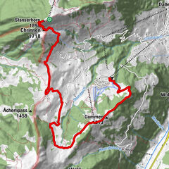
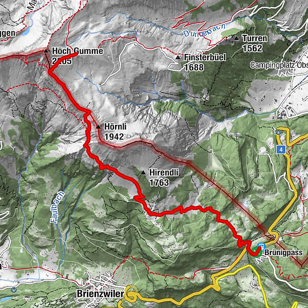
- Route
-
Salewang2.2 kmSchäri5.5 kmBrünigpass7.1 kmBrünig7.2 kmBrünigpass (1,005 m)7.3 kmPasshöhe 10137.4 km
- Best season
-
JanFebMarAprMayJunJulAugSepOctNovDec
- Highest point
- 2,035 m
- Height profile
-
 © outdooractive.com
-

-
AuthorThe tour Obwaldner Höhenweg: Etappe 3 is used by outdooractive.com provided.
GPS Downloads


Other tours in the regions
-
Obwalden
2039
-
Brienzersee
1081
-
Brienzwiler
305