


- Brief description
-
The hike to the Meiggelenstock is varied, but still requires fitness and mountain experience.
- Difficulty
-
difficult
- Rating
-
- Starting point
-
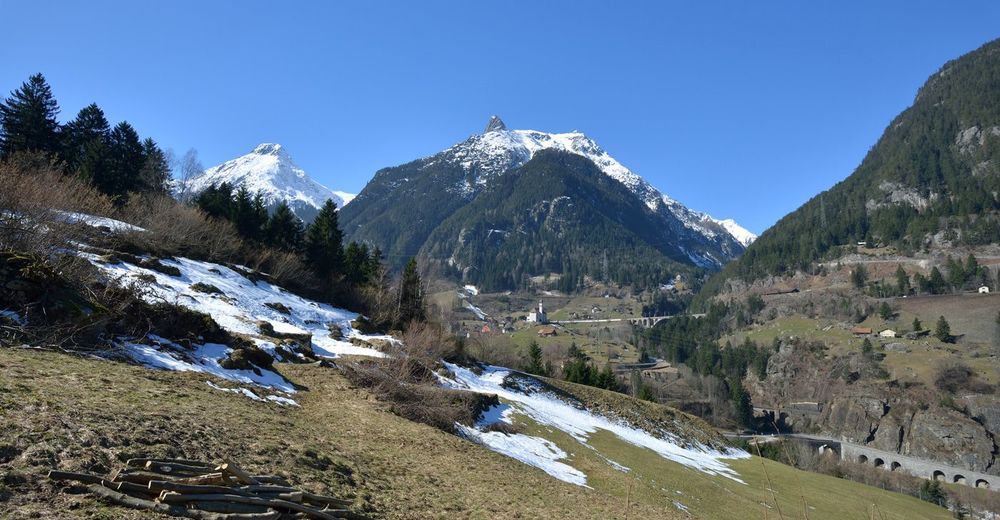
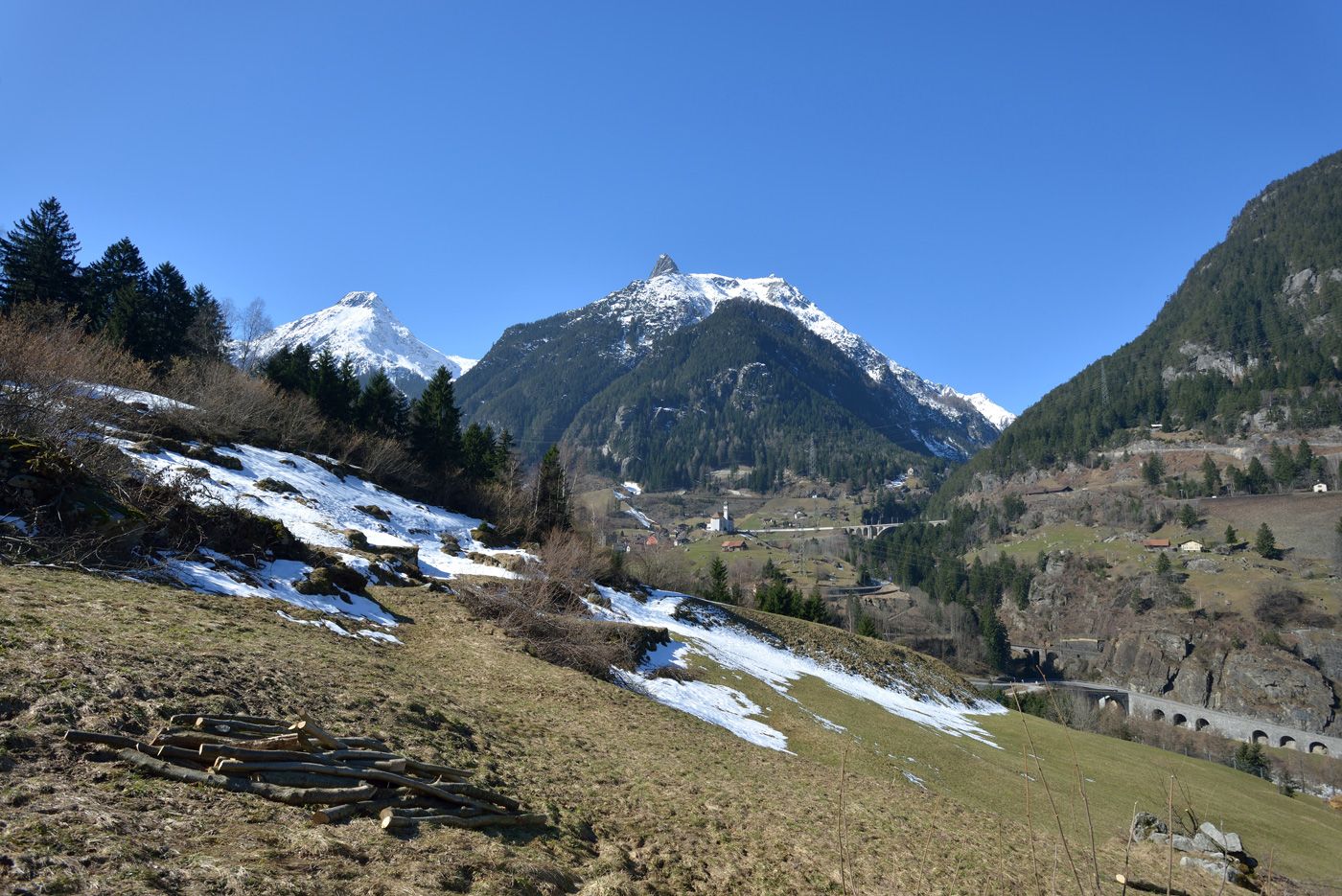
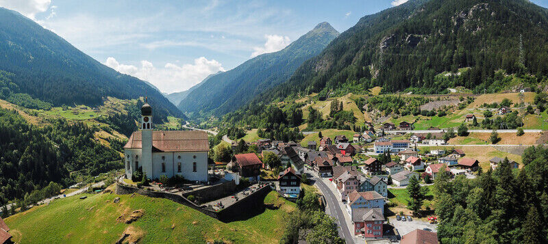
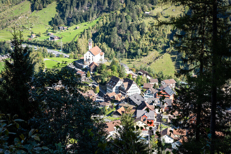
Wassen
- Route
-
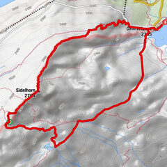
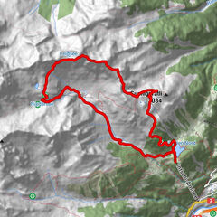
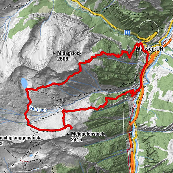
Wassen UR (930 m)Wattingen1.2 kmBruggegg1.8 kmFarneren Quelle4.2 kmJagdhütte Riederen (1,850 m)12.2 kmWassen UR (930 m)15.6 km
- Best season
-
JanFebMarAprMayJunJulAugSepOctNovDec
- Description
-
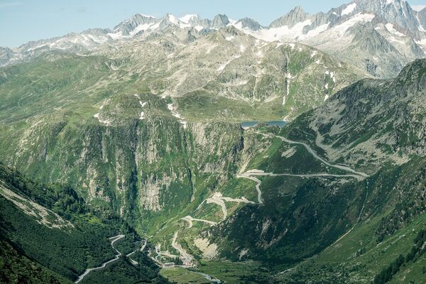
The hiking trail leads from the former Wassen train station through the protection forest, beyond the forest line and further up to the Meiggelenstock. Having reached the summit, hikers are rewarded with a magnificent view of the Uri Oberland. The return route leads past Lake Chli, through the protection forest above Wassen, and then back to the starting point.
- Directions
-
The hike starts at the Wattingen stop, behind Wassen. Rüti is reached by passing through a dense and shady spruce forest. It has clearings as well as elder bushes and is full of raspberries. After passing beyond the forest line, the route leads to Rorgrund at 1939 m via Farneren.
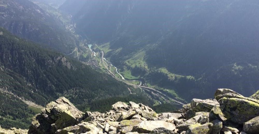
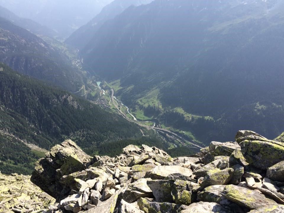
The valley widens and the steep climb through short grass and scree leads walkers to the path that comes from the Bandlückli and Salbit hut SAC. The final few metres to the summit are fairly steep. The view is overwhelming; it extends from the Gemsstock past the Rienzenstock and Bristenstock to the Kleine Windgälle in the northwest, which towers over the Reuss valley. The Höreli above Wassen completes the vista to the north.
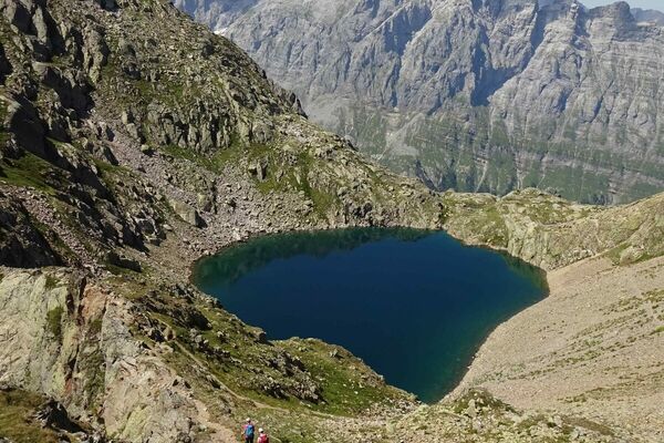
After the short descent to the Rorplatte plateau, the hiking trail leads over granite cliffs abraded by the glacier and lots of brooks at approx. 2200 m to the north side of the wide mountain basin. The Langsee is reached via a short escarpment and, further up, also the Gross See. Together with the Chil See, these lakes form a mystical landscape in a barren and rocky terrain.
From the Gross See, hikers can walk down to Rorgrund and, on the left side of the valley, directly to Wassen. The path is steep, but easy to walk on.
- Highest point
- 2,363 m
- Endpoint
-
Wassen
- Height profile
-
 © outdooractive.com
 - Equipment
-
Clothing appropriate for the weather
Sturdy footwear
Hiking poles are recommended
Binoculars
Camera
Daypack
- Author
-
The tour Meiggelenstock is used by outdooractive.com provided.


General info
-
Uri
1544
-
Andermatt
527
-
Silenen – Amsteg – Bristen
133