


- Brief description
-
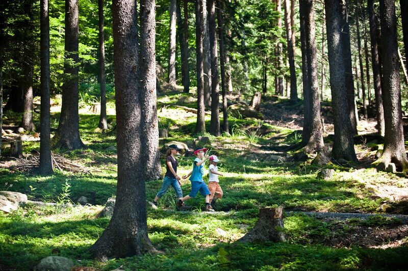
Experience the railway engineering achievements of the Gotthard mountain route on foot in canton Uri's Reuss valley. Packed with noteworthy sights and new rail experiences with every step you take.
- Difficulty
-
medium
- Rating
-
- Starting point
-
Train station Göschenen
- Route
-
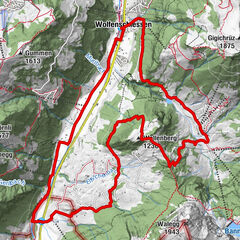
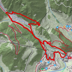
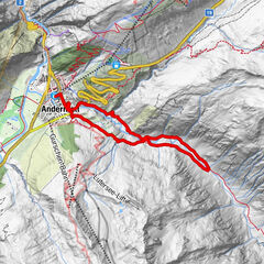
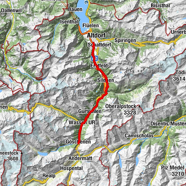
Göschenen (1,111 m)0.0 kmHinter Neiselen2.9 kmVorder Neiselen3.3 kmVorder Neiselen3.5 kmWattingen3.5 kmWassen UR (930 m)4.7 kmBeinhauskapelle4.9 kmPfaffensprung6.7 kmHäggrigen7.6 kmWiler8.6 kmGurtnellen (928 m)8.9 kmUnteraa9.2 kmMeitschligen12.3 kmKohlplatz15.6 kmMühlemätteli15.7 kmHirschen16.1 kmStern Post16.1 kmReussboden16.2 kmAmsteg16.3 km14-Nothelfer-Kapelle17.3 kmKatholische Kirche St. Albin19.3 kmSilenen (510 m)19.3 kmKapelle Rietli20.3 kmJagdmattkapelle23.6 kmErstfeld (475 m)24.2 kmAttinghausen (468 m)29.5 km
- Best season
-
JanFebMarAprMayJunJulAugSepOctNovDec
- Description
-
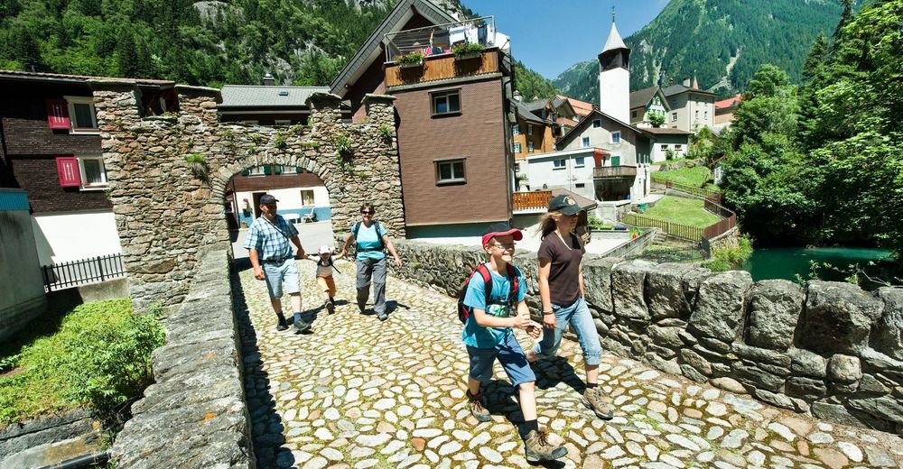
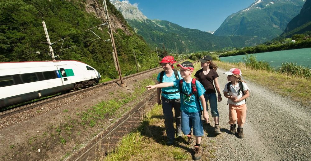
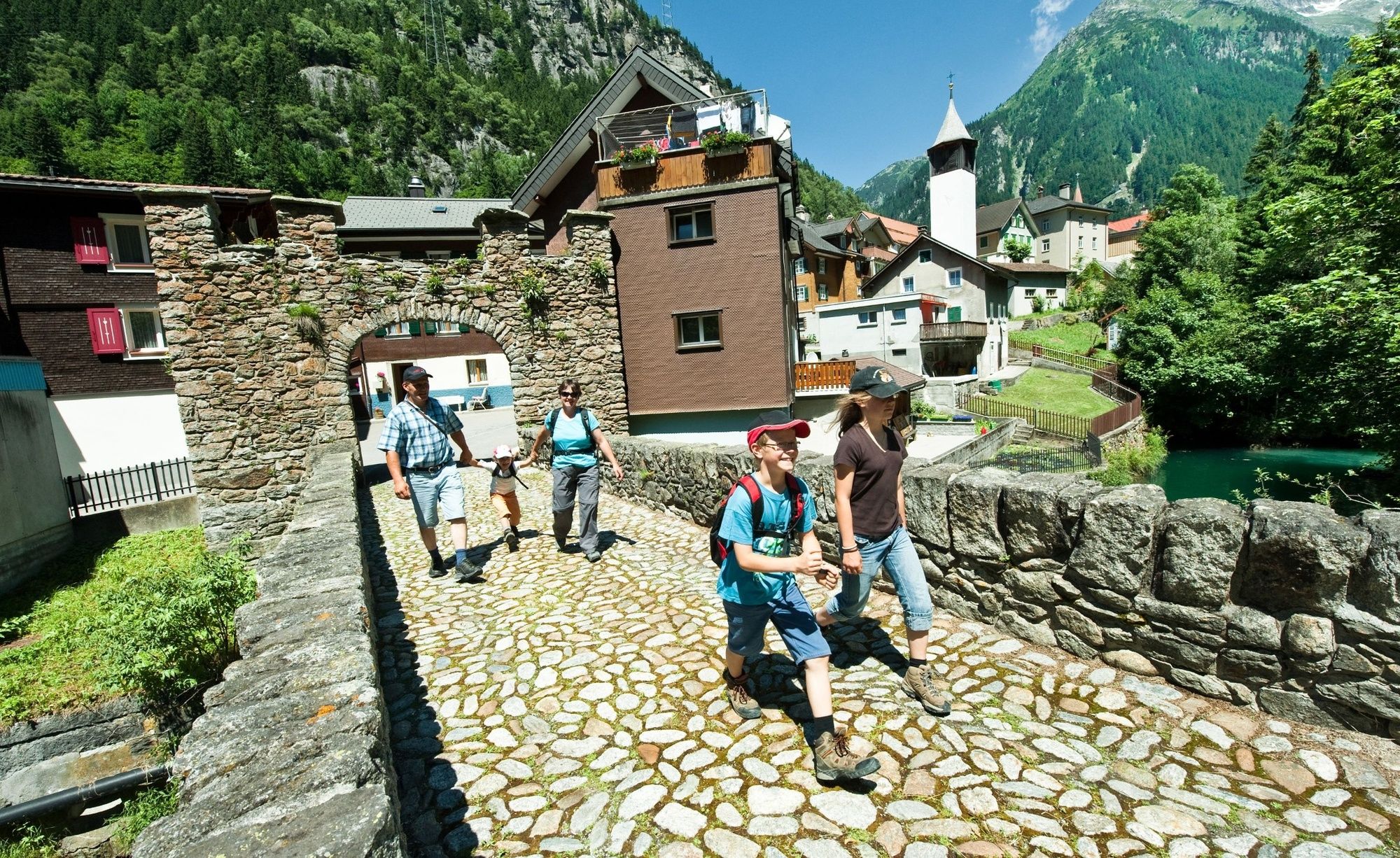
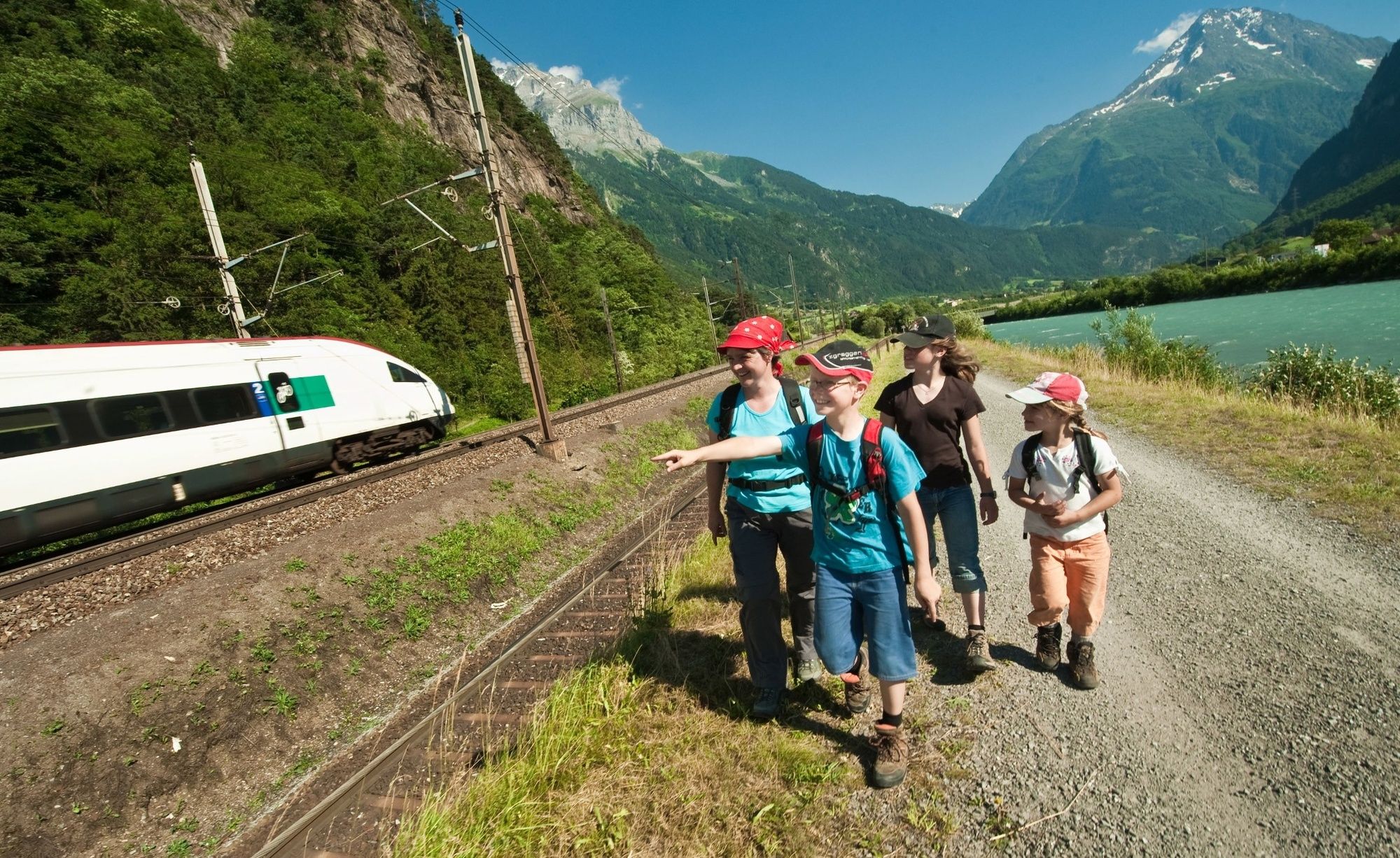
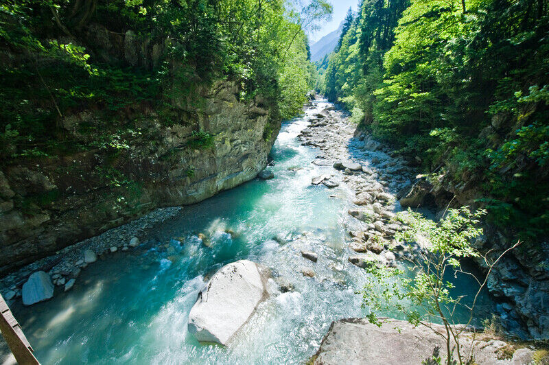
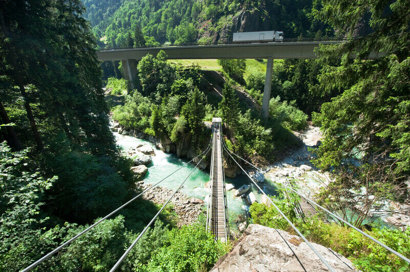
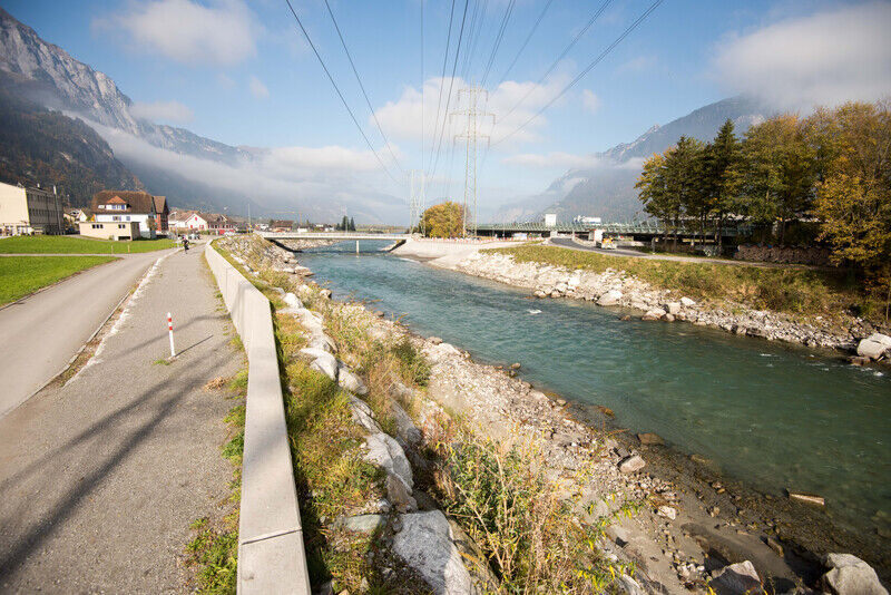
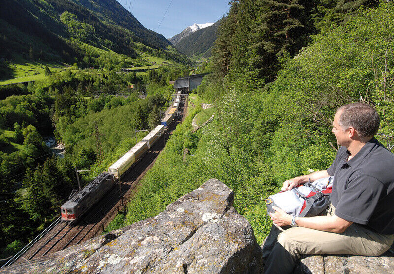
An impressive mountain landscape awaits hikers in the Reuss valley between Göschenen and Altdorf. Lots of historically significant objects can be seen and admired along the 32-kilometre Gottardo hiking trail. Information panels have been placed along the entire route. Along the first few kilometres, you will learn interesting facts and surprising information about the history of the Gotthard railway line. The viewing platform next to Wassen's little church is perfect for watching trains as they make their way up the narrow valley with the help of helical tunnels. Between Gurtnellen and Amsteg, hikers will cross the Felliboden suspension bridge. Along the route from Amsteg to the railway village of Erstfeld, you can marvel at the highest bridge constructed for the Swiss Federal Railways and, without realising it, walk over the former bunker for the Swiss Federal Council. The new eight-kilometre section that leads hikers to the train station in Altdorf and which is also a celebration of new modes of transport, starts in Erstfeld.
- Directions
-
Göschenen – Wassen – Pfaffensprung – Gurtnellen – Ried – Amsteg – Silenen – Erstfeld - Altdorf
- Highest point
- 1,104 m
- Endpoint
-
Tell monument Altdorf
- Height profile
-
 © outdooractive.com
 - Equipment
-
Clothing appropriate for the weather
Sturdy footwear
Hiking poles are recommended
Binoculars
Camera
Daypack - Safety instructions
-
Winter closure:
The Gottardo hiking trail north is closed between Göschenen and Wassen during the winter months. On this section there are two bridges which are dismantled during the winter months to protect them from avalanches.
In winter, the Gottardo Hiking Trail North is only accessible from Wassen to Altdorf as long as there is no snow. The starting point in Wassen can be reached by bus of the Auto AG Uri every hour from the railway station Göschenen. The entire Gottardo hiking trail south can also be walked during the winter months.
- Additional information
- Author
-
The tour Gottardo Hiking Trail is used by outdooractive.com provided.


General info
-
Uri
1542
-
Urner Unterland
858
-
Silenen – Amsteg – Bristen
133