- Brief description
-
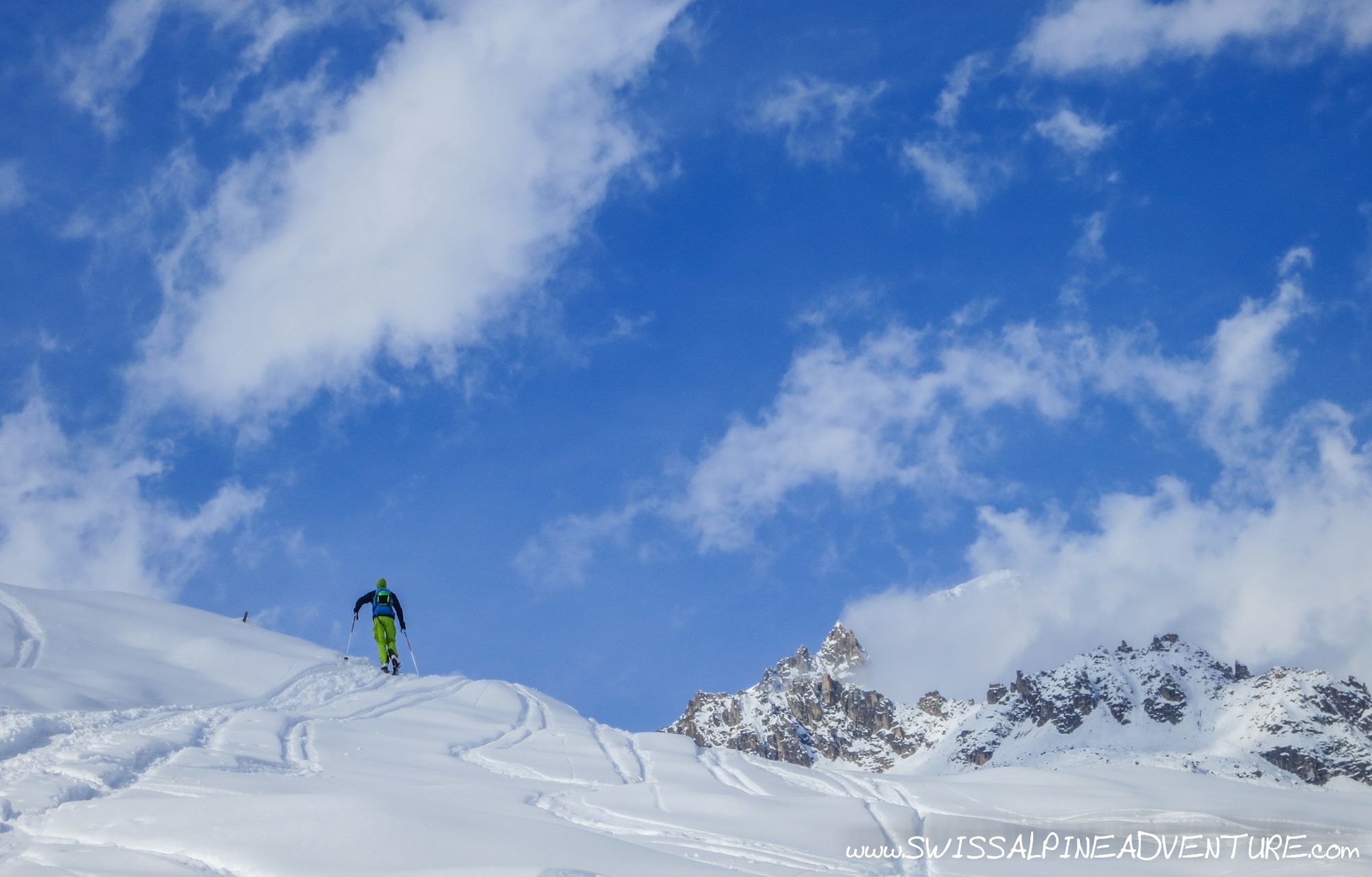
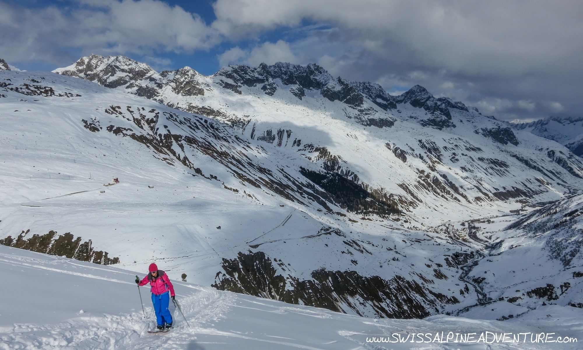
Technically a relatively easy tour with some beautiful scenery and in good snow conditions a nice descent. Very popular so can be very tracked out on a sunny mid winter weekend.
- Difficulty
-
medium
- Rating
-
- Starting point
-
Realp
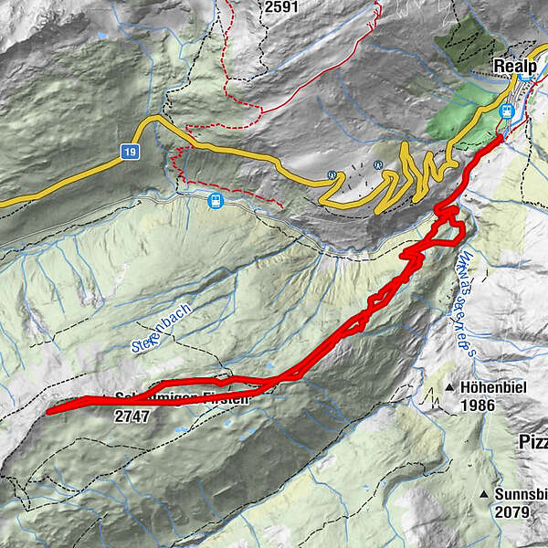
- Route
-
Witenwasserntal0.6 kmWitenwasserntal12.9 km
- Best season
-
AugSepOctNovDecJanFebMarAprMayJunJul
- Description
-
This is a relatively snow safe tour in the central Swiss mountains. The main ascent is on a relatively flat ridge which is almost always under 30deg which provides a relatively safe route. Due to the fact that it is very popular there is also often a skin track in relatively quickly after a new snow fall. The down side is that it is also very quickly tracked out on the descent. Nevertheless it is a very enjoyable tour from a scenery point of view and on a good day can provide some superb ski touring conditions.
- Directions
-
From the FDB building follow the access road for Wittenwassertal which follows the steam train railway line back the valley for approximately 1.5km until the road crosses the river and climbs towards Laubgädem. After the first 90deg turn in the road you can follow the hiking signs up through the open forest to the little Alp at Laubgädem. Keep ascending to the ridge just above Mäder roughly where the hiking trail goes and on the ridge ascend in roughly a south westerly direction to Unter Deieren and passing south of the hut at point 2367.
At this point follow the flat shoulder up towards Lägenden Firsten and then through the shallow gullz up to Schattmigen Firsten. From here ascent to the ridge of the Stotzigen Firsten. In poor conditions a boot pack may be required here.
The safest descent is following the ascent route back down to Realp. Other descents to the North/North east may be possible depending on the avalanche/snow conditions.
- Highest point
- 2,728 m
- Endpoint
-
Stotzigen First
- Exposition
- Height profile
-
 © outdooractive.com
 - Equipment
-
Avalanche transceiver, shovel and probe are minimum requirements for this tour.
- Safety instructions
-
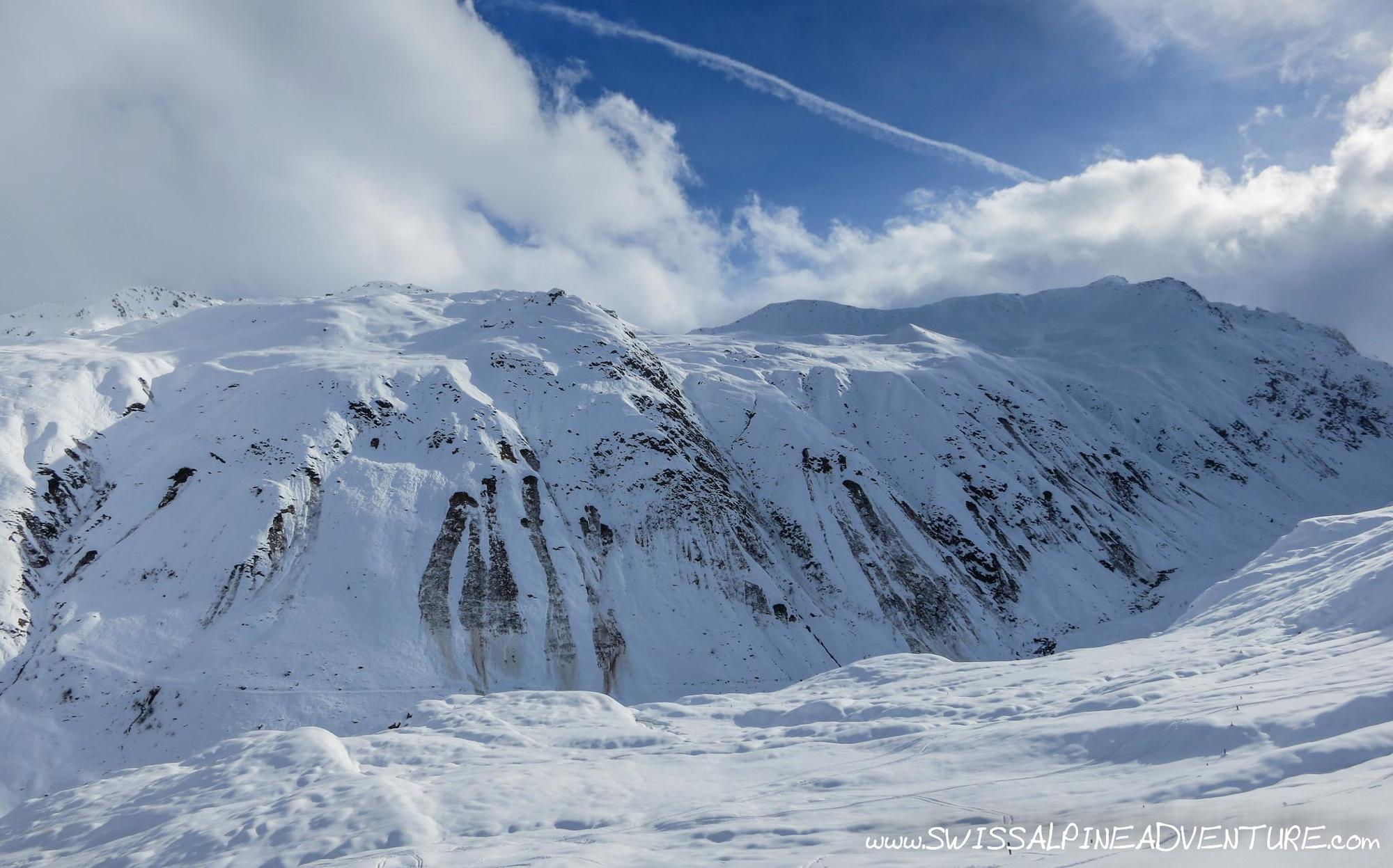
Any descents into the Garschental should only be done in safe conditions and with great care.
- Tips
-
The described route is the safest flattest option. Steeper descents into the Garschental can perhaps be attempted if the snow conditions are stable enough. If this is the case exiting the Valley along the railway lines may be very critical due to steep slopes above on both sides. This should only be attempted by those with lots of experience in estimating avalanche risk.
- Additional information
- Directions
-
From Central Switzerland A2 to exit Göschenen. Exit and drive past Andermatt to Hospental. Turn right at the roundabout in Hospental and keep going to Realp.
Coming from Wallis/Obergoms in winter you will have to load your car on the train in Oberwald.
- Public transportation
-
The Matterhorn-Gothard-Bahn serves Realp via Andermatt or Brig.
- Parking
-
Parking is available near the train station in Realp.


-

-
AuthorThe tour Stotzigen First is used by outdooractive.com provided.