- Brief description
-
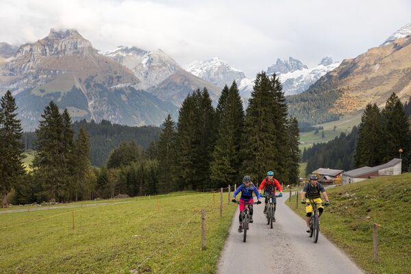
Nice tour from Grafenort to Engelberg along the Engelberger Aa.
- Difficulty
-
easy
- Rating
-
- Starting point
-
Train Station Grafenort
- Route
-
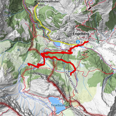
GrafenortTalstation Obermatt3.3 kmTalstation Obermatt3.7 kmUnter Schluchen8.4 kmKapelle St. Jakob im Espen9.3 kmEvang.-ref. Kirche Engelberg9.8 kmEngelberg (1,000 m)10.0 kmEngelberg (1,002 m)10.2 km
- Best season
-
JanFebMarAprMayJunJulAugSepOctNovDec
- Description
-
Start is at the manor house Grafenort right next to the train station Grafenort. On a gravel road it goes first still flat before the way leads into a rather wide hiking trail to Obermatt. Passing the small reservoir Obermatt after that the steeper ascent comes to Engelberg. The tour is a very good alternative to the main road and leads mostly through the forest.
- Directions
-
Grafenort-Obermatt-Oertigen-Engelberg
- Highest point
- 1,023 m
- Endpoint
-
Train Station Engelberg
- Height profile
-
 © outdooractive.com
 - Equipment
-
Engelberg’s bike shops have a wide range of bikes and cycling accessories for sale or hire. It’s also worth stopping by if your bike is in need of repairs or replacement parts.
- Tips
-
There are several barbecue areas on the tour.
- Additional information
- Directions
-
Mit dem Auto fahren Sie auf der A2 (Basel-Gotthard) bis Stans Süd, dann auf der Hauptstrasse 20 km nach Engelberg. Engelberg liegt 30 Minuten von Luzern, 1 Stunde und 15 Minuten von Basel, Zürich oder Bern.
- Public transportation
-
Nationale und internationale Verbindungen (ab Zürich Flughafen Verbindungen im Halbstundentakt mit ca. 1h Fahrzeit) bis Luzern. Danach mit der Zentralbahn in 43 Minuten durch eine abwechslungsreiche Landschaft und Schluchten hinauf nach Engelberg.
- Parking
-
Parkplätze stehen in Engelberg und Grafenort kostenpflichtig zur Verfügung.


-

-
AuthorThe tour Aaschlucht E-Biketour is used by outdooractive.com provided.