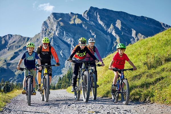

- Brief description
-
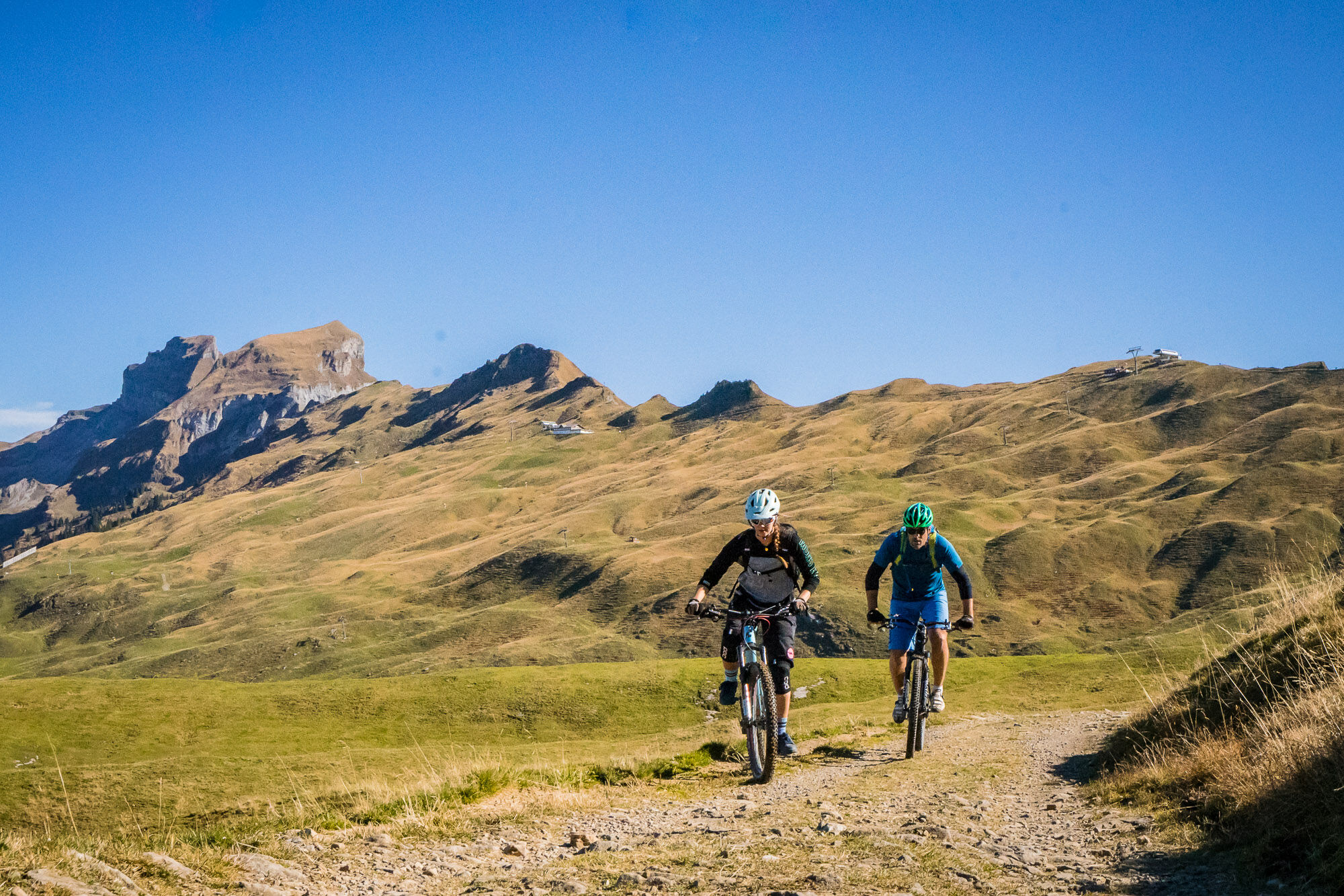
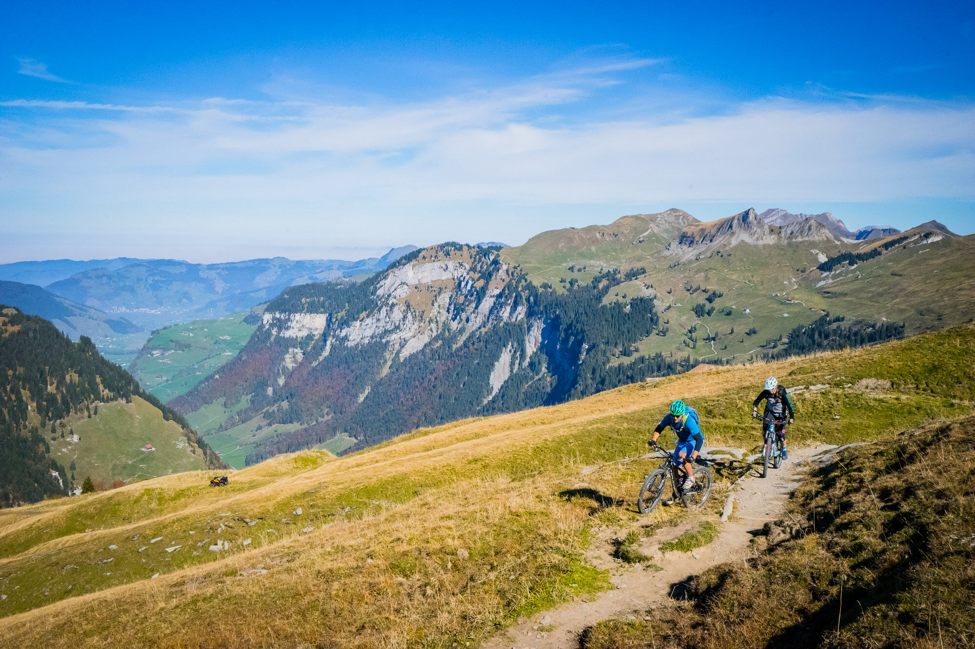
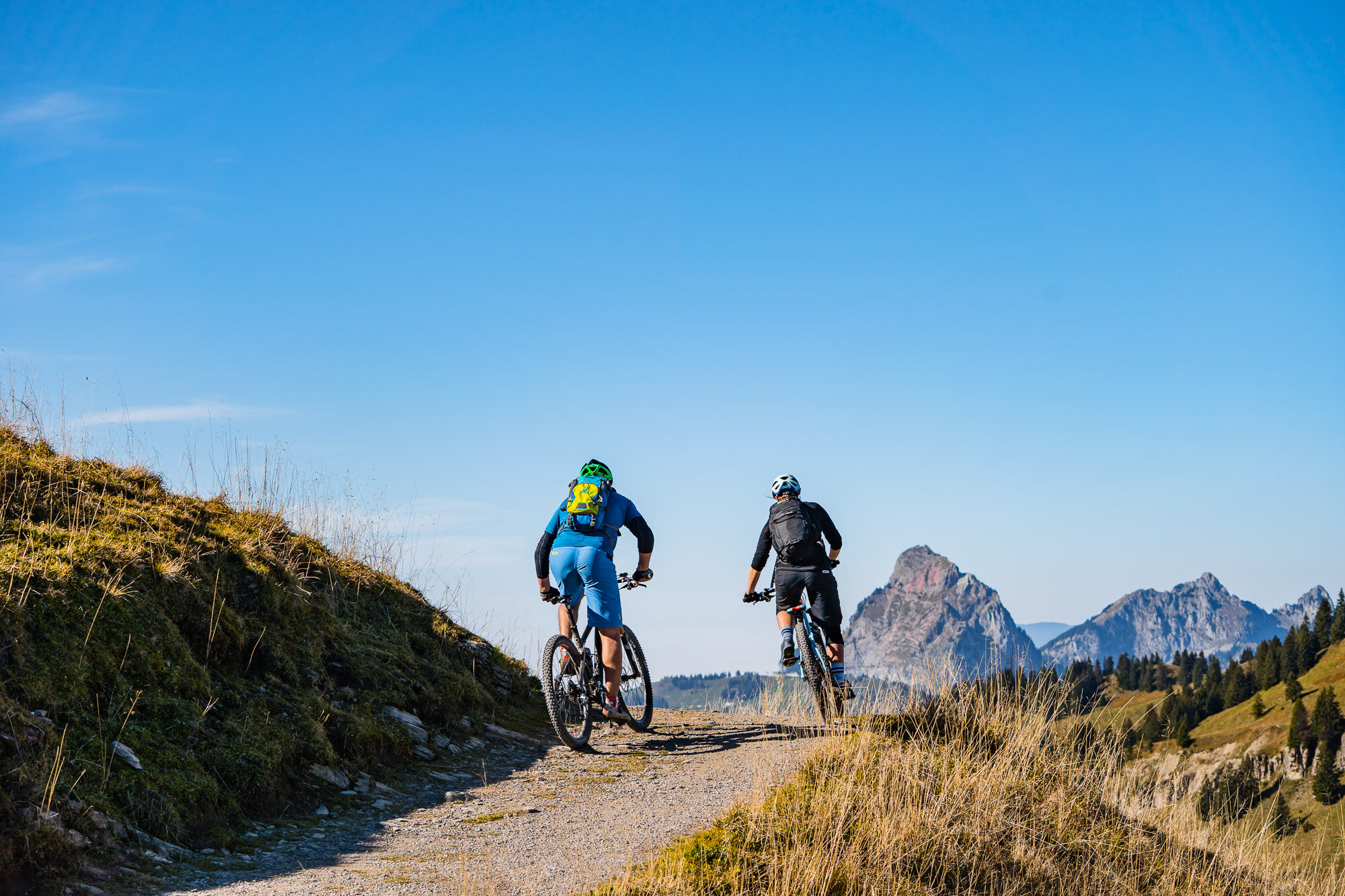
The first mountain bike - cableway tour in Central Switzerland offers a unique mountain panorama with flowing single trails and varied gastronomy.
- Difficulty
-
medium
- Rating
-
- Starting point
-
Rotenfluebahn lower terminus in Rickenbach / SZ or Laucheren Hoch-Ybrig lower terminus in Oberiberg / SZ
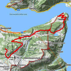
- Route
-
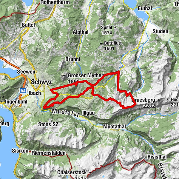
Snackbar 13ni0.0 kmLaucheren0.1 kmFuederegg3.3 kmBärghus4.4 kmSternen6.0 kmChli Stärnen (1,856 m)6.0 kmWilde Maa6.5 kmSpirstock (1,771 m)8.7 kmLaucherenchappelen9.2 kmSternenegg11.2 kmAltberg12.3 kmPasshöhe Ibergeregg13.5 kmIbergeregg (1,406 m)13.5 kmGrossenboden (1,295 m)14.3 kmGrossenboden14.7 kmSchnapshütte14.7 kmHandgruobi15.9 kmBerggasthaus Hand16.0 kmRüti18.0 kmUf Ibrig18.7 kmKapelle Aufiberg18.7 kmRestaurant Aufiberg18.8 kmGibel19.6 kmGibeli20.0 kmPerfiden24.3 kmSchwyz (516 m)24.8 kmRickenbach (586 m)24.8 kmTalstation Rotenfluebahn24.9 kmGeschloo25.3 kmAlgischit25.7 kmHuserenberg25.9 kmHungrigs26.3 kmMittelstation Rotenflue26.5 kmBergstation Rotenfluebahn27.6 kmGipfelstubli27.7 kmMüsliegg (1,427 m)29.0 kmAlpwirtschaft Zwäcken29.5 kmSonnenhütte30.5 kmSnackbar 13ni34.5 km
- Best season
-
JanFebMarAprMayJunJulAugSepOctNovDec
- Description
-
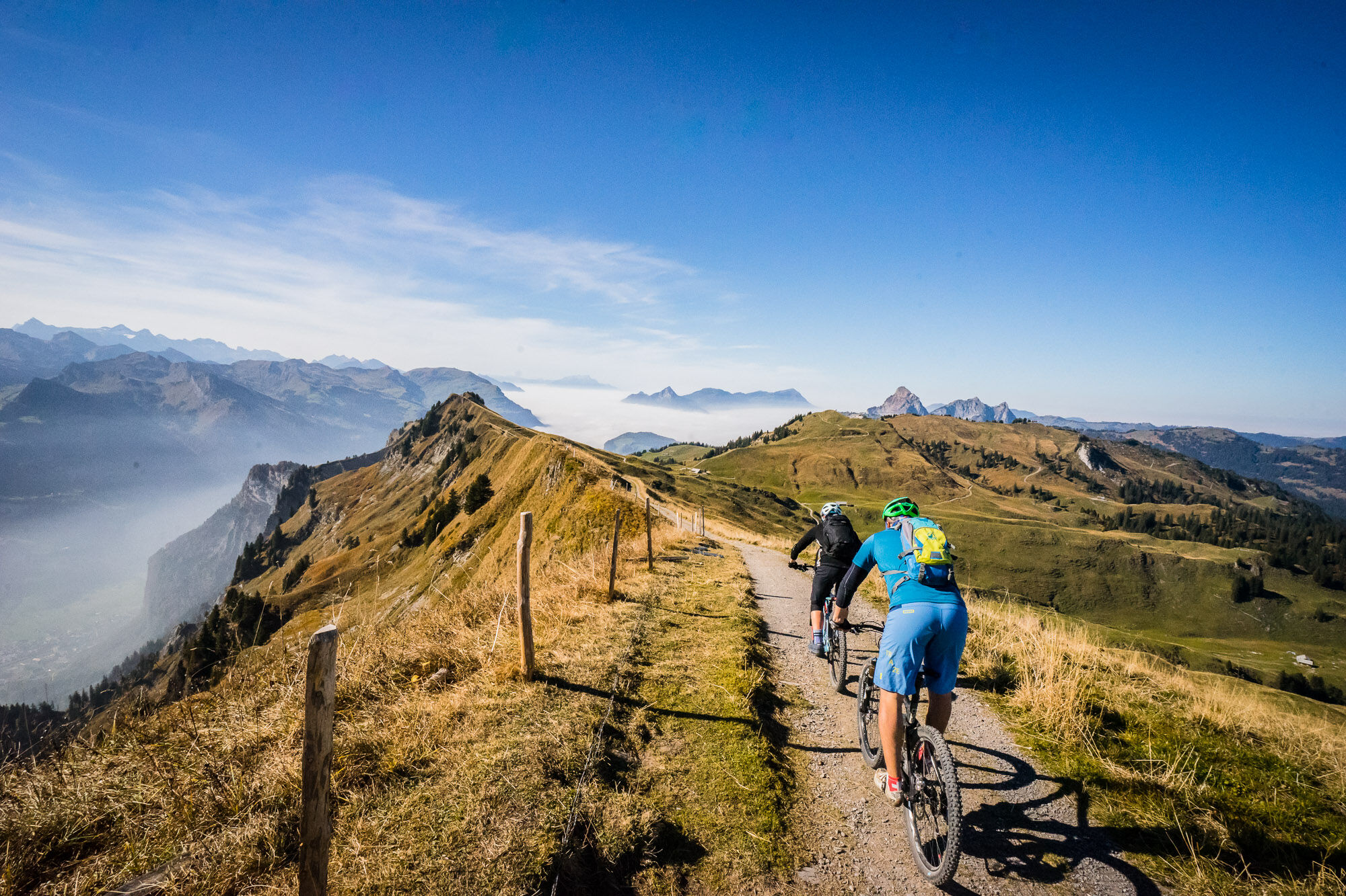
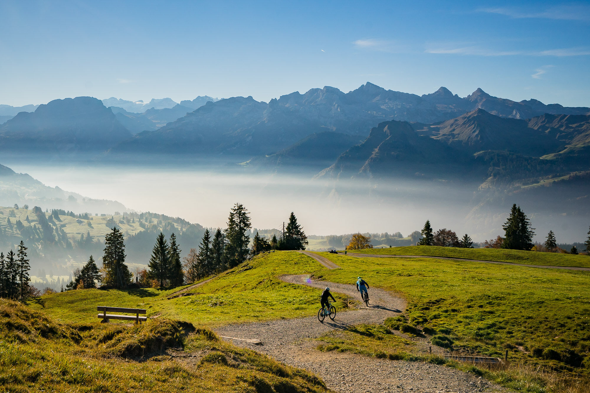
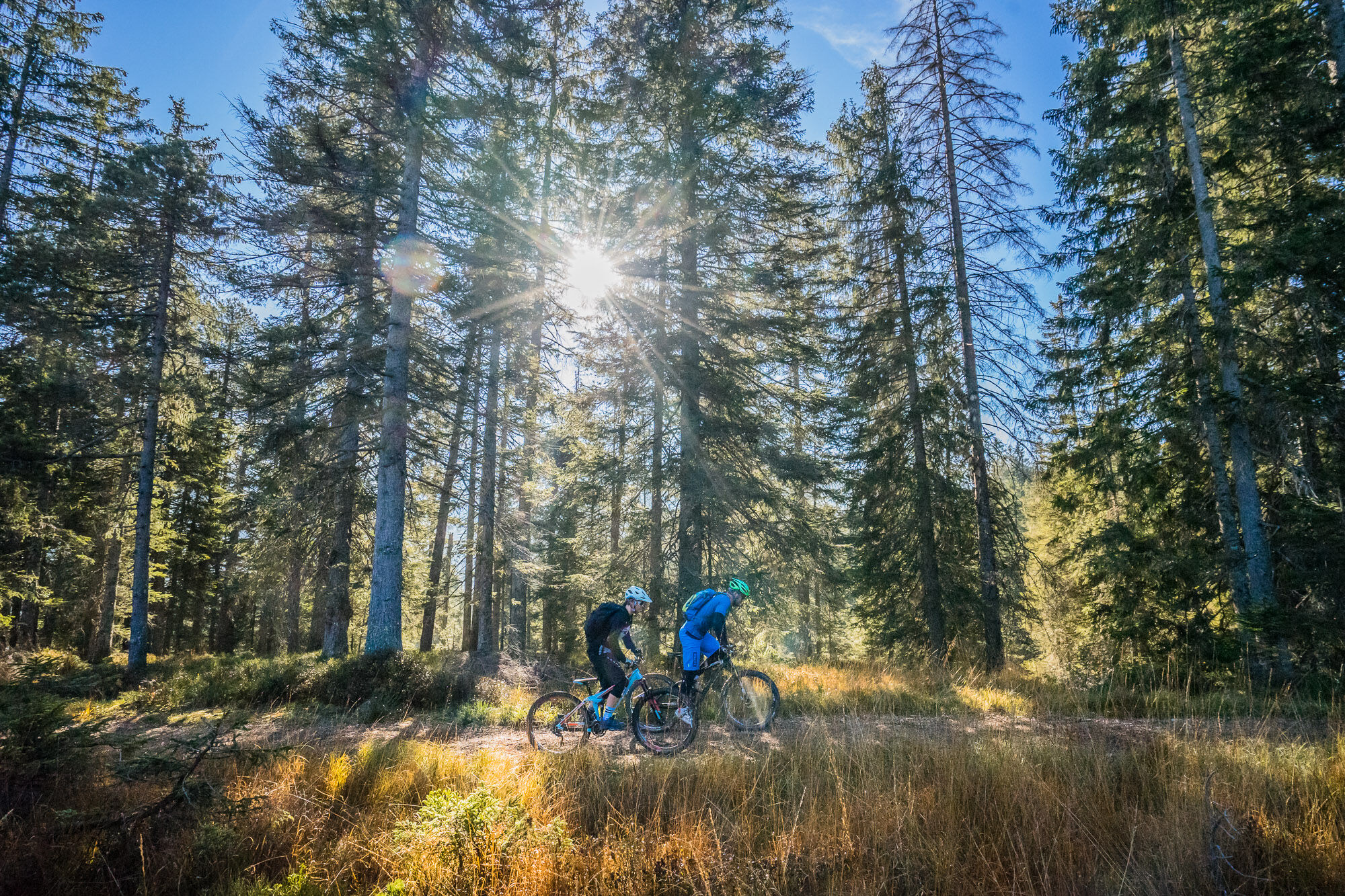
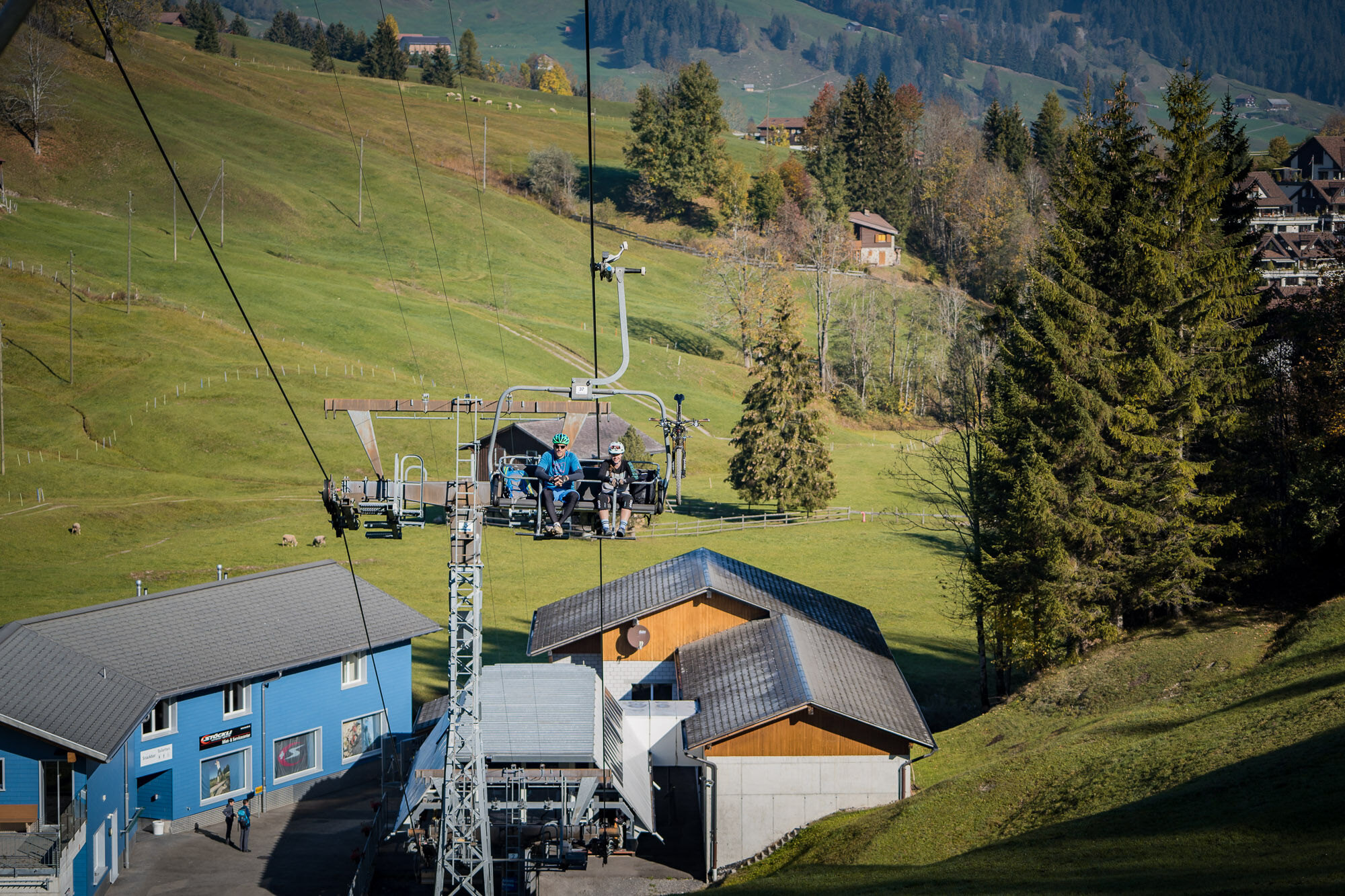
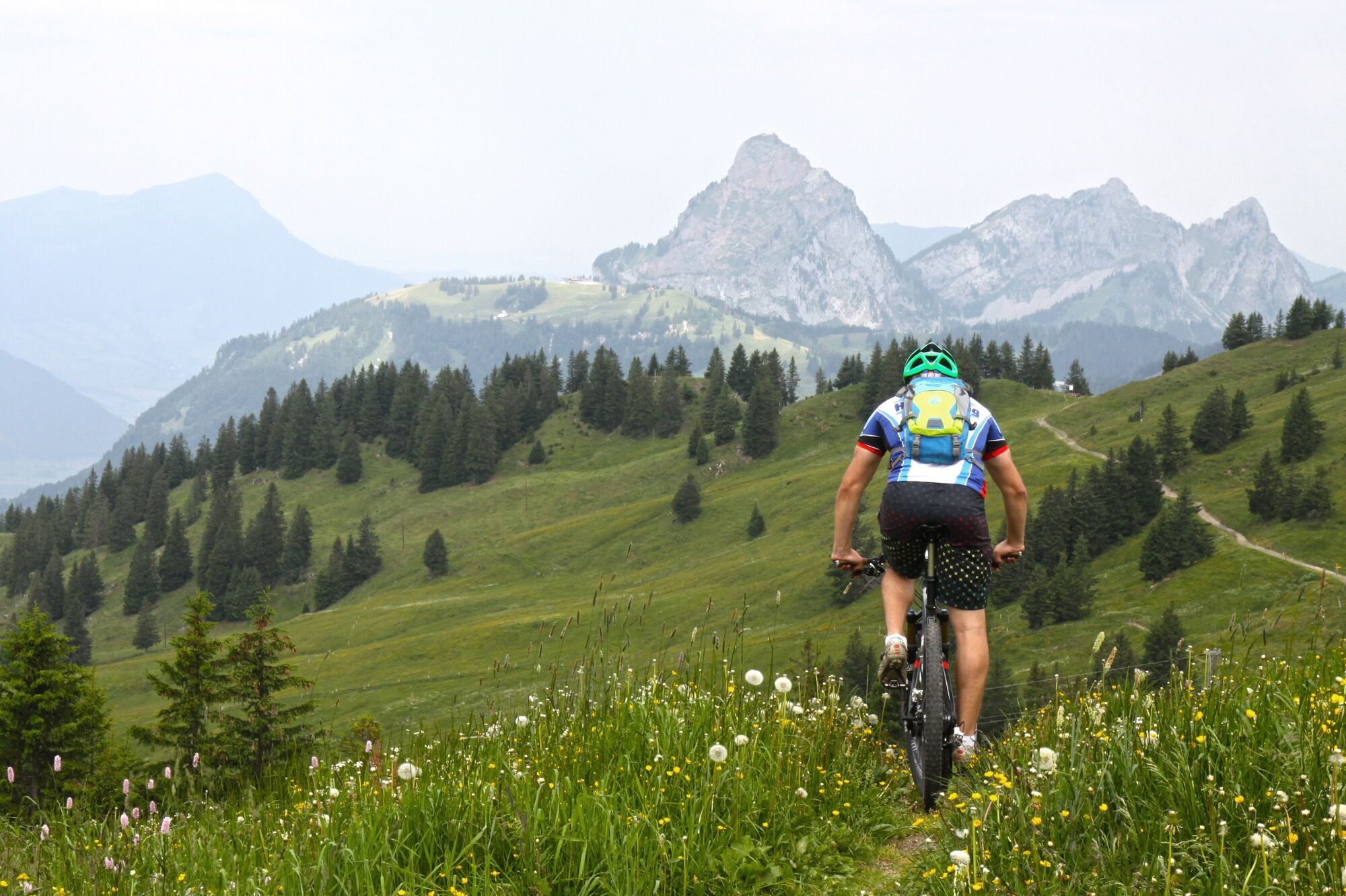
The Mythen region - Hoch-Ybrig cableway tour offers all-mountain, enduro and tour riders a great experience. No matter where you start, the cableway tour can be tailored to your preferences. Of the total of 1997 metres in elevation gain, 1691 metres are covered by the Rotenfluebahn gondola cableway (Mythen region) and Laucheren and Sternen chairlifts (Hoch-Ybrig). Sporty mountain bikers are free to pedal up instead! Less experienced single trail riders are also free to come down on asphalted roads where they exist. The cableways save a lot of time as well as energy. It means you have more time to enjoy the unique views from restaurant terraces – or go round a section twice.
- Directions
-
Starting point: Laucheren Hoch-Ybrig lower terminus, Oberiberg / SZ
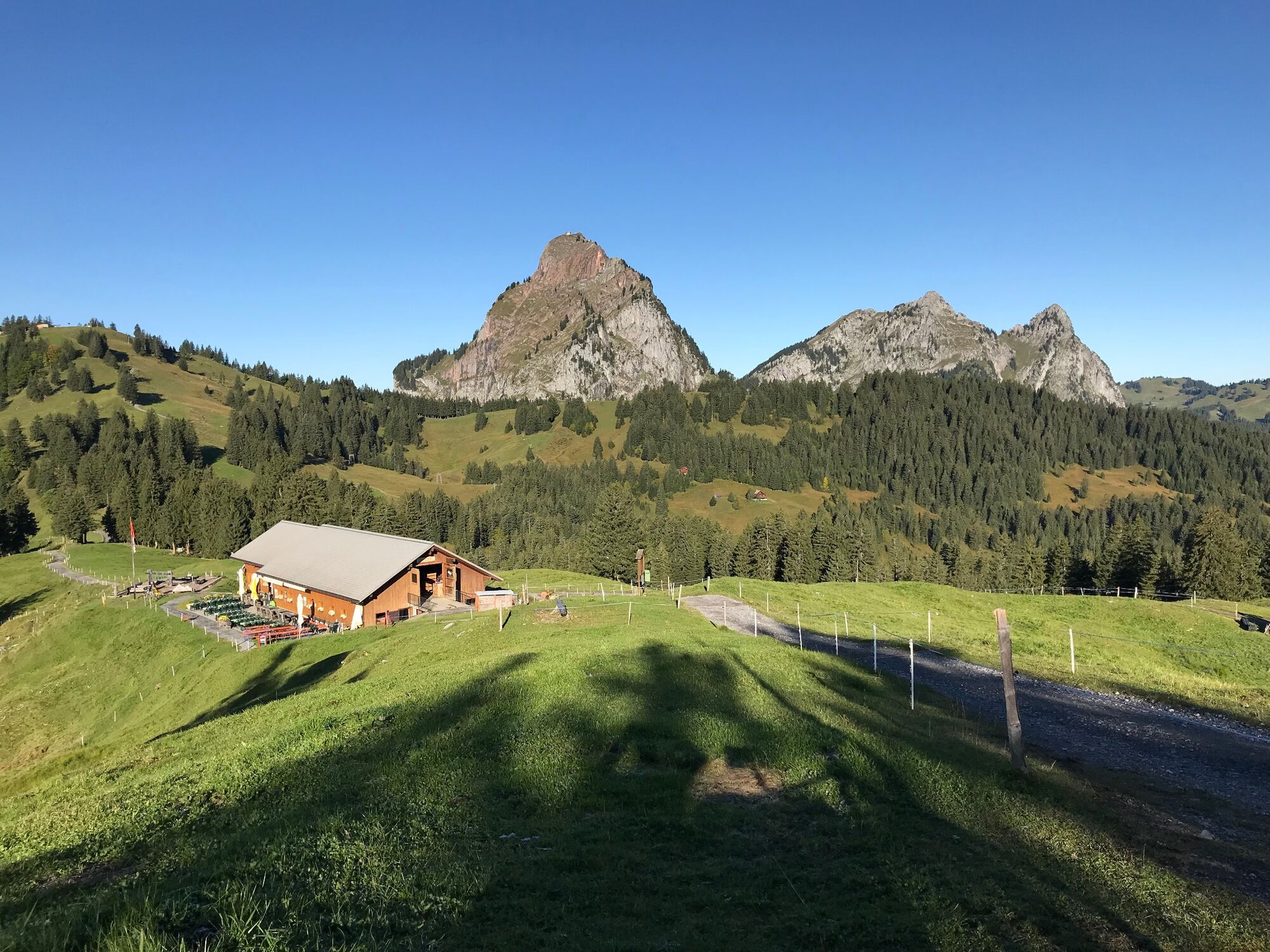
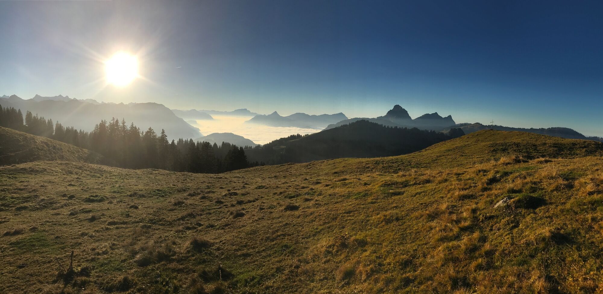
To take things easy, take the Laucheren chairlift to the Steinboden upper terminus. From Steinboden (Laucheren upper terminus) you follow the "Fuederegg" and "Seebli" footpath signs on a gravel path to Fuederegg. Once at Fuederegg, follow the "Seebli" and "Kl. Sternen" footpath signs on an asphalted road with a short descent and a short counter climb, past delightful Lake Seebli, to the lower terminus of the Sternen chairlift adjacent to the Seebli upper terminus. The Sternen chairlift takes you up to alt. 1809 m, the highest point of the tour. On arrival, follow the footpath signs to "Ibergeregg". In front of you lies a high-level trail offering an impressive panorama, before a short descent on a gravel road takes you to the signpost at Nühüttli (alt. 1662 m): follow the gravel road for about 240 m until you reach Nätschboden. At Nätschboden you can now follow the MTB waymarking "Hoch-Ybrig Bike 967" or footpath waymarking "Laucherenchappelen" and "Ibergeregg". After a short ascent you reach the Laucherenchappelen from where you continue straight on towards Ibergeregg (as per the footpath or MTB waymarking). Following the gravel path, the trail climbs slightly from Laucherenchappelen before descending rapidly to Sternenegg. At Sternenegg continue straight on (footpath waymarking "Ober Altberg" and "Ibergeregg" or MTB waymarking "Hoch-Ybrig Bike 967") before you reach a fork about 650 m later. Turn left and follow "Hoch-Ybrig Bike 967" or the footpath waymarking "Ober Altberg". Again 450 m later after a descent you arrive at the Ober Altberg alp (alt. 1433 m). Now follow the signs for "Ibergeregg" or "Hoch-Ybrig Bike 967" and turn right into a technical single trail which leads you to the Ibergeregg pass road. Continue along the pass road (approx. 360 m) up to the pass summit. Immediately before the pass summit, a signpost to "Grossenboden" and "Hand" on the left side of the road leads you on a single trail through some pristine moorland. Head downhill towards "Handgruobi", where the first part of the long downhill is completed at the restaurant at Hand. This is where you cross the Ibergeregg pass road and follow the footpath signs to "Uf Ibrig": the single trail fun continues. A scenically varied and wonderfully flowing section awaits. Following the signs for "Uf Ibrig", you reach a fork in the road via Chaisten 1.83 km later near Lothenbach (alt. 822 m). Turn left and follow the signs to "Uf Ibrig" until you arrive in Ufibrig. Following the road towards "Gibel" you reach the Chätziboden 290 m later, where you follow the footpath waymarking to "Gibelhorn" or the MTB waymarking "Schwyzer Tour 961". Another 640 m further on at Gibel, stay on the road and do NOT follow the footpath waymarking to "Gibelhorn", but the MTB waymarking "Schwyzer Tour 961". Follow the signage for approx. 3.3 km around the Gibelhorn on a wonderful forest trail until you reach another footpath sign. Here you can follow the footpath to Rickenbach (single trail) or continue on the MTB route "Schwyzer Tour 961", which leads you shortly afterwards on an asphalted road to Rickenbach. Following the single trail / footpath to Rickenbach, another 1.2 km later you reach an asphalted road, on which, 650 m later and partly through a residential quarter, you reach the Rotenfluebahn lower terminus in Rickenbach.
Summary:
Laucheren lower terminus – Steinboden – Fuederegg – Seebli – Sternen – Nühüttli – Nätschboden – Laucherenchappelen – Sternenegg – Ober Altberg – Ibergeregg – Grossenboden – Hand – Lothenbach – Uf Ibrig – Gibel – Richenbach – Rotenflue lower terminus
Starting point: Rotenfluebahn lower terminus in Rickenbach / SZ
The Rotenfluebahn cableway provides a labour-saving way of reaching the Rotenflue (alt. 1571 m). Enjoy the magnificent views of the Schwyz valley, Lake Lucerne and the striking alpine panorama. From the Rotenflue, follow the footpath signs for Ibergeregg for about 150 m before turning right on a short 340 m trail down, then sharp left. The slightly ascending trail takes you approx. 420 m later on to a point where you turn right straight down to Stägleren (take care: no waymarking!). From Stägleren you can now follow the footpath signs for Ibergeregg. On this unmade road, you pass the Müsliegg and Zwäcken to arrive at the car park at the Ibergeregg pass. Just before the car park, follow the footpath waymarking for Oberiberg. There follows an exciting, 1.8 km long single trail, which takes you to Hobacher. The fun continues as you follow the footpath signs to Oberiberg until you reach the Laucheren chairlift car park in Oberiberg 2 km later.
Summary:
Rotenflue lower terminus – Rotenflue – Stägleren – Müsliegg – Zwäcken – Ibergeregg – Hobacher – Laucheren lower terminus
Additional climbing
MTBers wishing to pedal off some additional metres can renounce the Laucheren chairlift in Oberiberg and tackle the steep ascent to Fuederegg on the Hoch-Ybrig. From the Laucheren car park take the road back towards the village of Oberiberg and then turn right towards Ibergeregg. 570 m later, turn left until you reach Fuederegg (alt. 400 m). If you still want more, forego the Sternen chairlift and continue climbing the road to Nätschboden. That puts a further 161 m of elevation gain under your belt. For additional metres, forego the Rotenfluebahn and climb the 806 metres from the Rotenflue lower terminus to the Ibergeregg (on the pass road).
Novice single trail riders
From the Ibergeregg you can also follow the pass road instead of the trail to Hand for the descent, which also brings you to Hand. Then follow either the route or the pass road down to the Rotenfluebahn lower terminus in Rickenbach / SZ. For the descent from the Ibergeregg to Oberiberg, you can take the Ibergeregg pass road again instead of the trail via Hobacher to reach the Laucheren chair lift car park in Oberiberg.
- Highest point
- 1,823 m
- Endpoint
-
At the starting point (round trip)
- Height profile
-
 © outdooractive.com
 - Equipment
-
The usual mountain bike equipment. A full-suspension MTB increases the fun factor on this route!
- Safety instructions
-
The route does not yet have any service points for bike repairs. You should therefore carry the appropriate kit for minor repairs. Accepted "trail tolerance" guidelines apply to the entire tour:
"Walkers and mountain bikers use the same paths without restrictions. This is made possible by a tolerant and considerate attitude on all sides. Mountain bikers slow down to walking pace when overtaking and stop when encountering walkers on narrow paths to make way for them. Mountain bikers brake carefully to avoid blocking the wheels and damaging the trails; they also do not leave the trails. Walkers accept mountain bikers as equal users of the path and give way wherever possible and reasonable."
- Tips
-
A ride on the Sternensauser zipline in Hoch-Ybrig offers an additional adrenaline kick!
- Additional information
-
If the weather looks uncertain, consult the cableways' websites www.hoch-ybrig.ch (visitor information: +41 55 414 17 56 or +41 55 414 60 60) and www.mythenregion.ch (+41 41 819 70 00) before setting off. When planning your trip, factor in the lunch breaks of the Hoch-Ybrig chairlifts.
You can purchase tickets for both areas' cableways at the lower termini of the Rickenfluebahn cableway in Rickenbach / SZ and Laucheren chairlift in Oberiberg / SZ. Cost: CHF 38 per person including bike transport. Children up to 16 pay CHF 14 per person including bike transport. This price includes one ascent on the Rotenfluebahn cableway and one on the Laucheren and Sternen chairlifts.
Annual ticket holders of one of the regions can also purchase a day ticket for the other region at either terminus at the regular rates (CHF 19 / CHF 7). Hoch-Ybrig annual ticket holders pay an additional CHF 10 for the transport of bikes on the Rotenfluebahn cableway.
- Directions
-
Start: Rotenfluebahn cableway Rickenbach/SZ
Take the A4 motorway to the Seewen/Schwyz exit. Then main road via Schwyz to Rickenbach and the Rotenfluebahn.
Start: Laucheren lower terminus, Hoch-Ybrig in Oberiberg/SZ
Take the A3 motorway from Zurich to the Richterswil exit (junction 37) or from Chur to the Schindellegi exit (junction 39). Then main road to Einsiedeln and Unteriberg. At Unteriberg turn left to Oberiberg for the Laucheren chairlift.
- Public transportation
-
- From Schwyz railway station: bus no. 3 (Auto Schwyz AG) to "Rickenbach, Dorf" (journey time: 14 min., every 20 min.)
- From Einsiedeln railway station: PostBus no. 555 to "Hoch-Ybrig Talstation Laucheren im Oberiberg" (journey time: 35 min., every hour)
- Parking
-
Rotenfluebahn:
Small fee-paying car park at the Rotenfluebahn. If full, see here: http://www.mythenregion.ch/sommer/info/anreise/parkplatz-rotenfluebahn/
Laucheren Hoch-Ybrig:
The large car park by the terminus is free for holders of a valid chairlift ticket.


- Author
-
The tour Mythen region - Hoch-Ybrig cableway tour is used by outdooractive.com provided.


Surfaces
General info
-
Schwyz
196
-
Mythenregion
101
-
Ibergeregg
28