
- Brief description
-
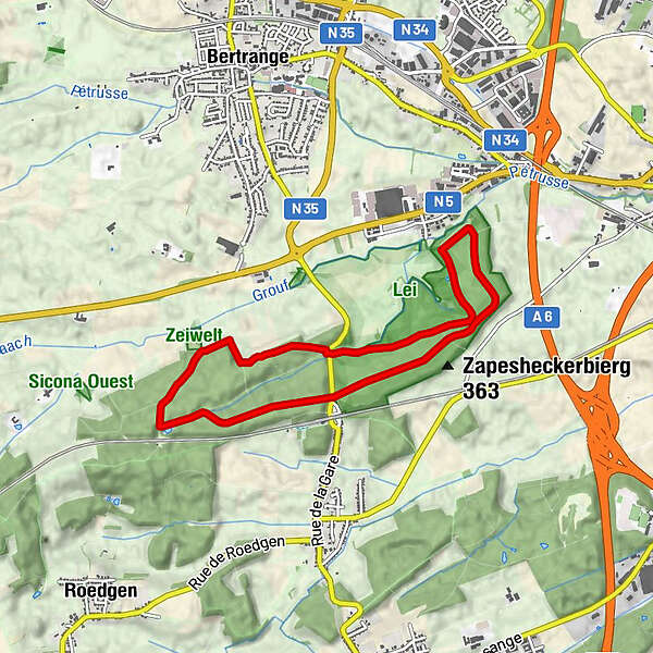
Circular walk Bertrange
- Difficulty
-
easy
- Rating
-
- Starting point
-
Bertrange-Leudelange road, car park at the edge of the forest
- Best season
-
JanFebMarAprMayJunJulAugSepOctNovDec
- Description
-
We walk in a long circuit through the community-owned forest Ënneschte Bësch. At the halfway point, we pass Leudelange station.
- Highest point
- 313 m
- Endpoint
-
Bertrange-Leudelange road, car park at the edge of the forest
- Height profile
-
 © outdooractive.com
 - Equipment
-
Sturdy shoes and some water.
- Additional information
- Parking
-
A parking place is located directly at the starting point.


- Author
-
The tour Auto-pédestre trail Bertrange is used by outdooractive.com provided.
GPS Downloads


Other tours in the regions