
- Brief description
-
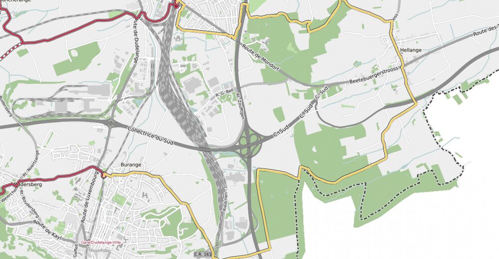
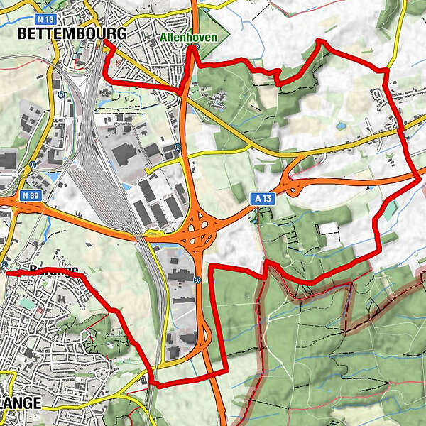
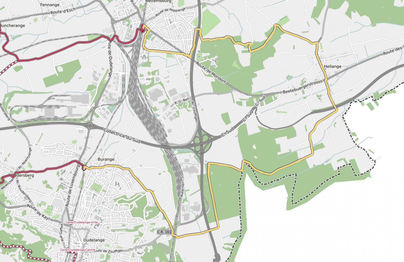
Hike between two train stations, from Bettembourg to Dudelange-Burange
- Difficulty
-
medium
- Rating
-
- Starting point
-
Bettembourg train station, Place de la gare, 3260 Bettembourg
- Route
-
BettemburgHellingen5.6 kmKaschthaus5.8 kmSaint-Willibrord5.8 kmBuringen13.8 kmDüdelingen14.1 km
- Best season
-
JanFebMarAprMayJunJulAugSepOctNovDec
- Description
-
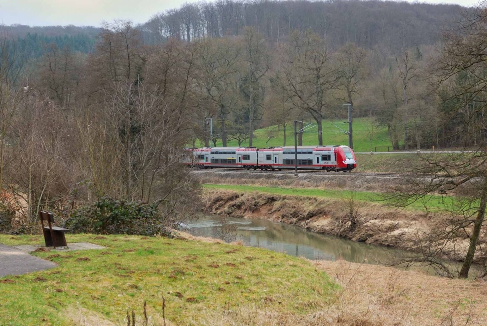
Right from the start, the route crosses the municipal park Jacquinot, following the nice Promenade du Soleil ("Sun promenade") set up on the tracks of the former regional railroad Bettembourg - Aspelt. Before reaching Hellange, the tour leads through a rural zone where the Bongert Altenhoven is located, one of the country's biggest orchards. The trail goes on via wooded area at the French border, then to Dudelange running alongsite the Parc Léi.
© CFL
- Directions
-
Please follow the signs saying "CFL". The way is signposted in both directions.
- Highest point
- 302 m
- Endpoint
-
Dudelange-Burange train station, 231 Route de Burange, 3429 Dudelange
- Height profile
-
 © outdooractive.com
 - Equipment
-
Please bring enough food and drinking water for the trip.
- Safety instructions
-
Please remember to wear sturdy shoes and appropriate clothing in the event of bad weather.
- Tips
-
In Bettembourg you can spend a wonderful day in the "Parc Merveilleux" zoo - ideal for families!
- Additional information
-
Phone: +352 2754 5991
Email: info@visitminett.lu
http://www.visitminett.lu - Public transportation
-
Start and destination are both at a train station
- Parking
-
Public parking available at the start
-

-
AuthorThe tour 21 Station to station Bettembourg - Dudelange-Burange is used by outdooractive.com provided.
GPS Downloads


General info
A lot of view
Other tours in the regions