
- Brief description
-
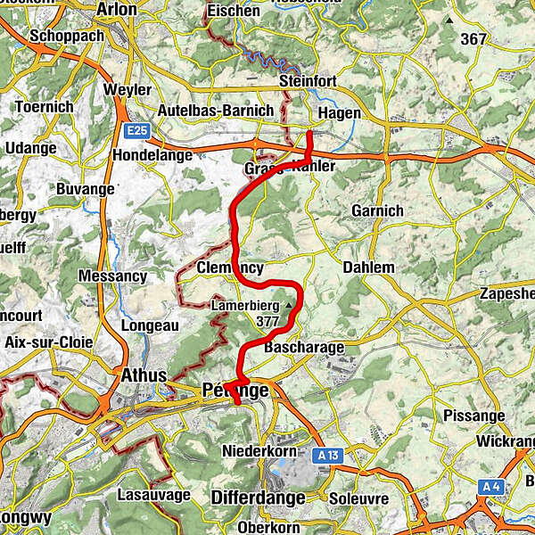
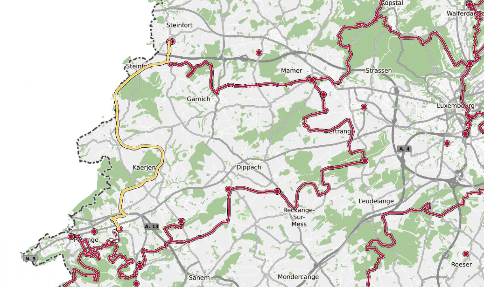
Hike between two train stations, from Pétange to Kleinbettingen
- Difficulty
-
medium
- Rating
-
- Starting point
-
Pétange train station, Avenue de la Gare, 4773 Pétange
- Route
-
PétangePetingen0.3 kmSaint-Hubert0.5 kmLinger1.9 kmSchack4.0 kmChapelle Saint-Maximin8.8 kmKüntzig9.3 kmGrass12.6 kmKahler15.0 kmKleinbettingen16.1 kmRestaurant Colles16.2 km
- Best season
-
JanFebMarAprMayJunJulAugSepOctNovDec
- Description
-
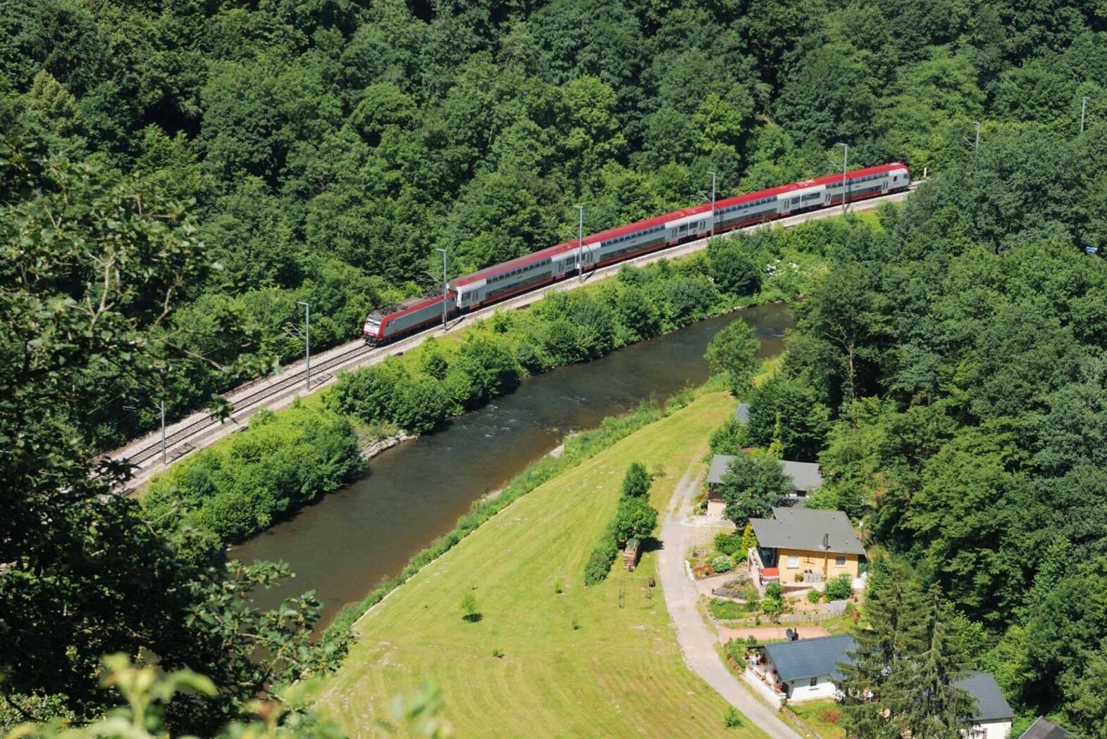
The tour starts with a section right through Pétange. Leaving the town, it follows the river course of the Chiers until reaching the national cycling route PC12 Piste cyclable de l'Attert. Some distance further down the road, it leaves Clemency on its left and follows the Belgian border line. Over fields, ramblers walk alongside forest edges, finally reaching the entrance of Kleinbettingen, on the road to Kahler. This is where hikers leave the cycling route, pass under the motorway and arrive at Kleinbettingen station.
Except for a short distance alongside the river Chiers at Pétange that can easily be bypassed, this trail is also accessible with prams, bicycles or similar vehicles.
© Editions Guy Binsfeld
- Directions
-
Please follow the signs saying "CFL"
Attention: The path can be walked in both directions and is signposted accordingly in both directions.
- Highest point
- 346 m
- Endpoint
-
Kleinbettingen train station, Rue de la Gare, 8380 Steinfort
- Height profile
-
 © outdooractive.com
 - Equipment
-
Please remember to pack enough drinking water and food for the hike.
- Tips
-
The village of Koler is only a stone's throw from Kleinbettingen and part of it is on the route. The painted facades here are the ideal backdrop for photos.
- Additional information
-
Phone: +352 2457 5991
Email: info@visitminett.lu
http://www.visitminett.lu - Public transportation
-
Start and destination are both at train stations
- Parking
-
Parking available at both train stations
-

-
AuthorThe tour 34 Station to station Pétange - Kleinbettingen is used by outdooractive.com provided.