- Brief description
-
The Falknis is the westernmost peak in the Rätikon massif, located at 2560 metres above sea level on the border between Liechtenstein and Switzerland. From the Liechtenstein side, the Falknis can be reached from Steg via a demanding alpine trail.
- Difficulty
-
difficult
- Rating
-
- Route
-
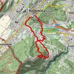
Steg0.8 kmWisli1.3 kmChrüppel (1,706 m)3.8 kmKolm (1,993 m)6.2 kmGoldlochspitz (2,110 m)7.1 kmLawena Obersäss9.3 kmDemmera10.3 kmMazorakopf (2,452 m)13.1 kmFalknis (2,565 m)14.3 kmGuschasattel (2,045 m)16.5 kmDemmera18.1 kmLawena Obersäss19.2 kmGapfahl-Obersäss (1,879 m)22.2 kmWisli28.4 kmSteg28.8 km
- Best season
-
JanFebMarAprMayJunJulAugSepOctNovDec
- Description
-
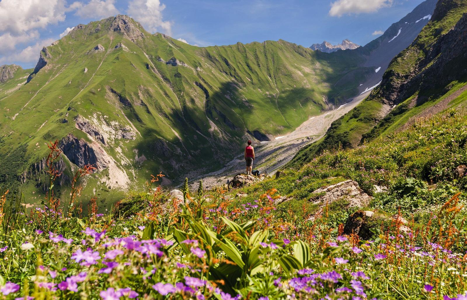
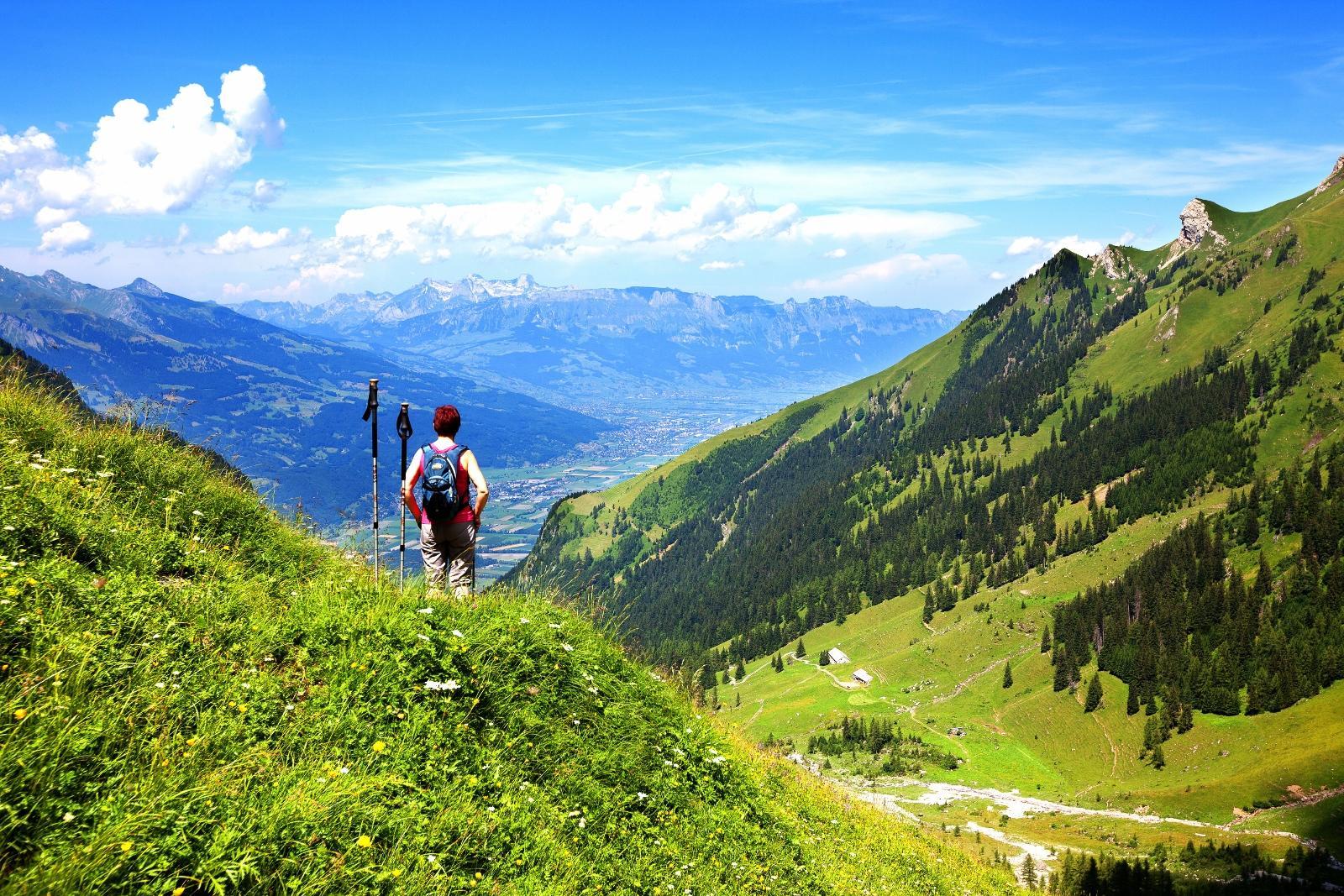
To reach the Falknis mountain, first descend from the Rappenstein ridge towards Mazorahöhe. After reaching Mazorahöhe at around 2000 metres above sea level, a very steep and demanding mountain path climbs over the Guschasattel and the Falknishorn to the summit of the Falknis. There, magnificent views await. On the other side of the Rhine Valley, the peaks of the Glarus Alps as well as the Churfirsten and Säntis peaks in the Alpstein massif. To the north, the view even extends beyond Lake Constance. The way back is again via the Rappenstein ridge, from where a narrow path leads to Alp Gapfahl. The path then turns into a wide dirt road that winds its way down. At the first turn-off, the trail heads left into a hiking trail and follows the Liechtenstein Panorama Trail (trail number 66) to the Berggasthaus Sücka mountain in and from there down to the starting point in Steg.
- Highest point
- 2,540 m
- Endpoint
-
Gänglesee in Steg
- Height profile
-
 © outdooractive.com
 - Safety instructions
-
Trail onto Rappenstein mountain requires surefootedness and a good head for heights. The ascent to the Falknis mountain is an alpine hiking trail.
Going on a tour requires careful planning. We recommend that you discuss the routes and weather conditions with the local information points in advance. Depending on the season and weather conditions, this route may be closed or interrupted.
- Additional information
-
Food & drink:
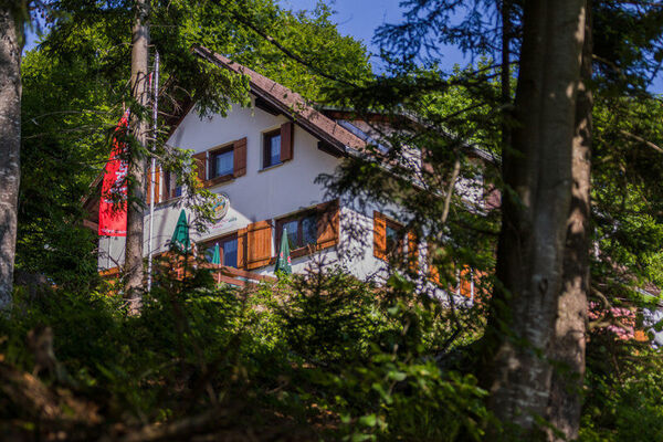
Berggasthaus Sücka mountain in, Alp Valüna, Restaurant Bergstüble and Seeblick in Steg, Alp Lawena
Accommodation:
Berggasthaus Sücka mountain in


-

-
AuthorThe tour Alpine hike to the Falknis mountain is used by outdooractive.com provided.


General info
-
Heidiland
2201
-
Liechtenstein
1289
-
Malbun
308