
- Brief description
- Difficulty
-
difficult
- Rating
-
- Starting point
-
Žerjav
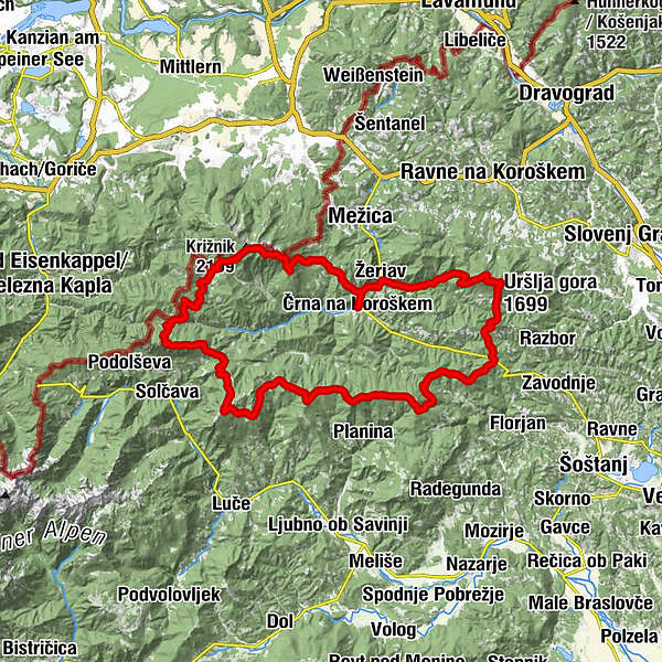
- Route
-
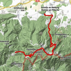
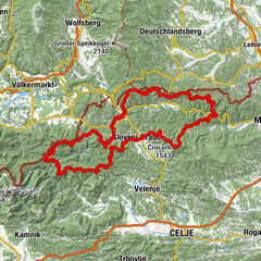
Črna na KoroškemGostilna RešerKoča na Pikovem2.8 kmSveta Helena2.9 kmPlaninski dom na Peci7.9 kmMala Peca (1,731 m)8.1 kmKordeschkopf (2,126 m)9.9 kmRanta (2,065 m)10.8 kmKnieps (2,109 m)11.5 kmVisoka peč (1,850 m)24.9 kmGladki vrh (1,850 m)25.2 kmOdenični hriber (1,863 m)25.6 kmLepi vrh (1,619 m)27.0 kmSpodnje Sleme (1,254 m)29.6 kmIzletniška kmetija Bukovc (Bukovnik)30.8 kmKoča v Grohatu pod Raduho32.4 kmRaduha (2,062 m)34.2 kmMala Raduha (2,029 m)34.7 kmKapela sv. Križa36.1 kmKoča na Loki pod Raduho36.1 kmSnežnica na Raduhi36.7 kmŽarh36.8 kmPlanina Vodol (1,324 m)39.0 kmPrelaz Bela peč (1,353 m)39.6 kmPresečnikov vrh (1,573 m)40.6 kmHlipovec44.9 kmKapelica sv. Cirila in Metoda46.2 kmKrnes (1,613 m)47.7 kmKrumpeška planina50.3 kmDom na Smrekovcu50.9 kmKramarica (1,124 m)54.3 kmOsekani vrh (1,220 m)56.8 kmKozamurški vrh (1,227 m)57.4 kmSv. Vid60.7 kmDom na Uršlji gori67.0 kmCerkev svete Uršule67.0 kmUršlja gora (1,699 m)67.4 kmNaravski vrh (1,178 m)69.5 kmKoča na Naravskih ledinah70.3 kmŽerjav77.6 kmČrna na Koroškem79.9 km
- Best season
-
JanFebMarAprMayJunJulAugSepOctNovDec
- Description
-
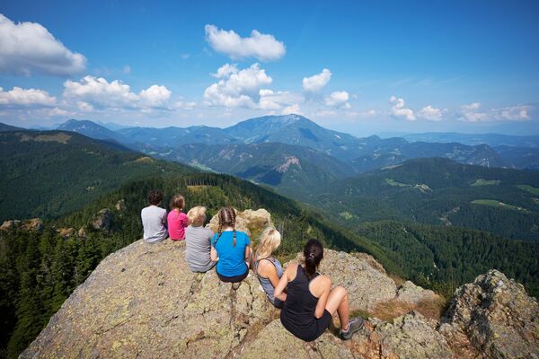
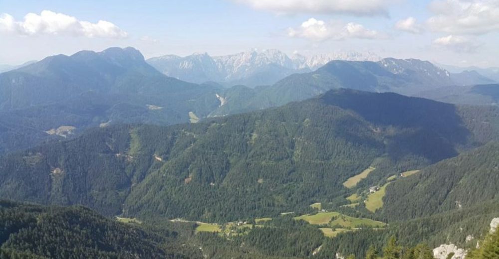
The Koroška mountain challenge is an 80 km long route featuring ascents on the five highest peaks in Koroška – Uršlja gora (1699 m), Smrekovec (1577 m), Raduha (2062 m), Olševa (1930 m) and Peca (2125 m). The most endurable and adventurous mountaineers who complete the trail in less than 24 hours become the members of the Club 24. Even if you are not an extreme athlete, it is worth climbing these peaks. We recommend that you climb and experience them on a several day tour or in the form of individual ascents.
The trail runs through a network of mountain trails marked with red-white "Knafelč" sign. But some shortcuts are required to finnish it in under 24h, which require good preperation in advance, regarding orientation, supplies, etc.
Those who manage to overcome this challenge in under 24h, become members in a honorary club K24 a club with less than 400 members.
- Directions
-
Žerjav
Tomaževa koča
Peca (Kordeževa glava)
Koprivna (potok na koncu spusta)
Kumer
Repija – oskrba z vodo
Lovska koča Forštanca
Olševa (Govca)
Spodnje Sleme
Koča na Grohatu
Velika Raduha
Koča na Loki
Komen
Dom na Smrekovcu
Počitniška hiša TEŠ
Križan
Uršlja gora
Žerjav
- Highest point
- 2,107 m
- Endpoint
-
Žerjav
- Height profile
-
 © outdooractive.com
 - Equipment
-
Good and light hiking shoes, enough food and water, appropriate clothes for temperature variations (night/day), headlight, GPS and a camera.
- Safety instructions
-
Parts of the track are of the beaten path, even some light climbing can be expected (if you wish to make it under 24h)
- Tips
-
You have to study the track carrefully and plan your supplies accordingly. No transportation is allowed, however you can have a support team.
- Additional information
-
Read about experiences of other people on the track. Official starting point is at Kava Bar Urška, Center 117, Črna na Koroškem
- Directions
-
Highway towards Maribor, turn off at Žalec towards Velenje, than continue from Velenje to Črna na Koroškem.
- Public transportation
-
Public transport to Črna na Koroškem with bus or railway connection (from Maribor, but rarely)
- Parking
-
Free parking available


- Author
-
The tour K24- Koroška Hill Challenge is used by outdooractive.com provided.


General info
-
Klopeiner See - Südkärnten
1165
-
Koroška
162
-
Črna na Koroškem
35