© NLW Tourismus Marketing GmbH - Tourismusinfo Nassfeld-Pressegger See
- Brief description
-
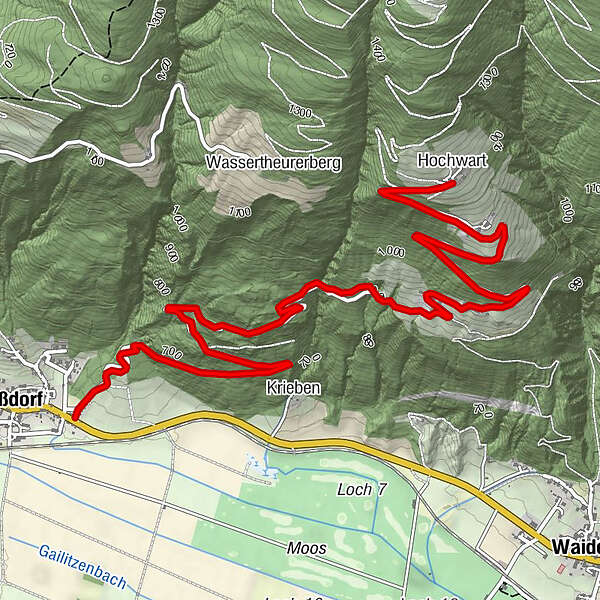
Vom östlichen Ortsbereich in Treßdorf den Güterweg bis nach Staudachberg und Hochwart folgen.
- Difficulty
-
medium
- Rating
-
- Route
-
TreßdorfKrieben1.1 kmStaudachberg3.6 kmHochwart6.2 km
- Best season
-
AugSepOctNovDecJanFebMarAprMayJunJul
- Highest point
- 1,221 m
- Endpoint
-
Hochwart
- Height profile
-


- Author
-
The tour Treßdorf - Staudachberg - Hochwart is used by outdooractive.com provided.
GPS Downloads


General info
Insider tip
A lot of view
Other tours in the regions